BEAR CREEK, TX Campground Reservation, Info, Images, Map, Directions

BEAR CREEK, Texas Campground Images, Info & Reservations

Directions

From Interstate 20 or 820 in southwest Fort Worth, take exit 429A for Highway 377 toward Granbury and go south 5.7 miles (9.2 km); turn left or southeast onto FM Road 1187 and continue for 1.4 miles (2.2 km), then turn left or east onto Ben Day-Murrin Road and continue another 1.6 miles (2.7 km) to the campground entrance.

Phone

817-292-2400

Activities

BOATING, CAMPING, FISHING, WILDLIFE VIEWING

Keywords

BEA3,BENBROOK LAKE,LAKE BENBROOK,BEAR CREEK,MUSTANG BEAR CREEK,BENBROOK LAKE

Related Link(s)

Rec Area Info & Images

Texas State Tourism

Texas State Road Conditions

Overview

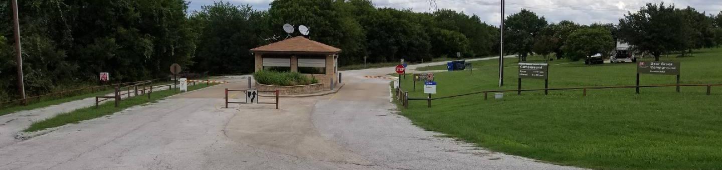
Bear Creek Campground is on the south side of Benbrook Lake in north central Texas, accessible from Ben Day Murrin Road. Individual & group camping, along with boat launching, is available.

Recreation

Both individual & group camping are available in Bear Creek, April thru September, along with boat launching and wildlife viewing. Deer, hawks, owls, roadrunners and woodpeckers can be spotted around the lake.

Facilities

Bear Creek has individual campsites with utility hookups, a large group camping pavilion, restrooms with showers, trailer dump station, and boat launching.

Natural Features

Bear Creek campground lies along the east side Bear Creek on the south side of the lake, with wooded hillsides and prairie above the lake.

Nearby Attractions

Fort Worths renowned Cultural & Museum District, Stockyards National Historic District, Botanical Gardens, Zoo, Bass Performance Hall, and downtown Sundance Square, are all only a short drive from the park. The campground closes at 10:00 p.m. so plan ahead.

Reservation

More from CampingHiking.net:

CAMP 9, California Campground Images, Info & Reservations

Directions From the south, take Highway 99 to Bakersfield. Take the Highway 178 exit and travel east toward the Kern River Canyon. Follow Highway 178 for approximately 40 miles to the town of Lake Isabella. From Lake Isabella, take Highway 155. Continue past the town of Wofford Heights to Kernville.

GONE CREEK, Oregon Campground Images, Info & Reservations

Directions From Sandy, Oregon, travel east on Highway 26 for approximately 40 miles to Skyline Road/Road 42. Turn right on Skyline Road and continue south for about 9 miles. Turn right on Forest Service Road 57 and travel west for 1 mile, then turn right again at the Gone Creek

BROOKEN COVE, Oklahoma Campground Images, Info & Reservations

Directions From Enterprise, Oklahoma, take Highway 71 north for 5 miles and follow signs to the campground. Phone 918-799-5843 Activities BOATING, CAMPING, FISHING, HIKING, SWIMMING SITE Keywords BRCO,EUFAULA LAKE,EUFAULA LAKE Related Link(s) Rec Area Info & Images Oklahoma State Tourism Oklahoma State Road Conditions Overview Brooken Cove Campground sits along

CHEMEKETAN CAMPGROUND, Idaho Campground Images, Info & Reservations

Directions From Stanley, Idaho, take Highway 75 south. Turn southwest off highway onto a dirt road located between mile markers 163 and 162. The campground is located 4 miles beyond the turnoff. Fording a stream is necessary to access the campground. Phone 928-537-8888 Activities BIKING, CAMPING, FISHING, HIKING Keywords CHEM,SALMON