

Directions
Access to the cabin is by float plane. It is about a 20-minute flight from Juneau. This cabin is in a designated Wilderness area, and access by helicopter is illegal. In fall, winter and early spring the cabin may be inaccessible due to frozen lake surface (float planes cannot land). The lake is normally ice-free from mid-May through November. Refer to USGS topographic map Juneau A-2. Click here for information about reaching Forest Service Cabins.
Inclement weather conditions may cause an extension of your trip during any time of the year and winter access can be difficult due to snow and ice conditions. Visitors should bring extra supplies to last 2-5 days. Please contact the Admiralty Island National Monument at 907-586-8800 prior to arrival for more detailed information about safety precautions.
Phone
907-586-8800
Activities
BOATING, CAMPING, FISHING, HIKING, WILDLIFE VIEWING
Keywords
NYLE,YOUNG LAKE NORTH CABIN,TONGASS NF – FS
Related Link(s)
Overview
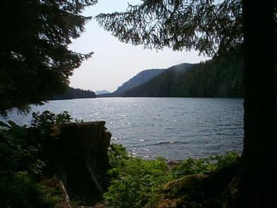
North Young Lake Cabin offers guests recreation, relaxation and a unique wilderness lodging experience on the northern tip of Admiralty Island in the Tongass National Forest. The remote site offers a scenic setting for hiking, fishing, boating, berry picking and wildlife viewing, all within the vicinity of the cabin.
Young Lake North Cabin is one of two cabins on the lake. The other is the South Young Lake Cabin.
Access to the cabin is float plane only. Visitors are responsible for their own travel arrangements and safety and must bring several of their own amenities.
Recreation
Anglers enjoy Young Lake for catching cutthroat trout, dolly varden and coho salmon. Visitors are welcome to use the skiff with oars available at the cabin and may choose to bring a small outboard motor. The motor must be less than 10 horsepower due to wilderness regulations, and visitors are responsible for bringing and using personal floatation devices. The lake is normally ice-free from mid May through November.
Several primitive trails extend from the cabin into the forest. The Admiralty Cove-Young Lake trailhead is at the cabin’s doorstep. The trail is 4.5 miles departing from the cabin and ending at Admiralty cabin and cove. It is a relatively flat trail and follows the creek at each end of the trail. The round-trip hike can be fairly strenuous when conditions are rainy and wet.
Facilities
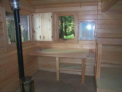
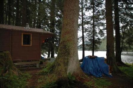
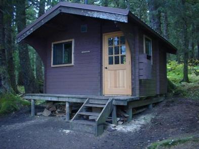
The cabin is a primitive, pre-cut cedar log cabin in pan- abode style, furnished with wooden bunkbeds without mattresses that sleep up to six guests. The cabin is equipped with a table, benches, an oil stove for heat and an outside toilet. Other amenities include cooking counters, shelves, cupboard space and a broom.
The cabin does not have running water or electricity, and visitors must bring their own food, water, sleeping bags, sleeping pads, cook stoves, matches, cooking gear/utensils, light source, toilet paper, first aid kit and garbage bags.
Guests should bring #1 heating oil (kerosene) to fuel the stove. The stove will burn half a gallon in eight hours at the lowest setting, and up to 1.2 gallons during eight hours at the highest setting. A flash light is handy for looking into the burn chamber when lighting the stove. Matches or a lighter are needed to light a small piece of paper to drop in to the burn chamber when lighting the stove. Detailed directions with photos on how to light the stove are provided in the cabin.
Click here for more cabin details.
Natural Features
The cabin is situated under a canopy of old growth forest at an elevation of 320 feet, set back 50 feet from the north end of Young Lake.
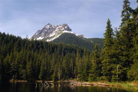
The Kootznoowoo Wilderness encompasses nearly a million acres. Dense spruce and hemlock forests, glacier-fed streams, lakes and muskeg openings define the landscape. Peaks rise from the horizon in the distance.
Wildlife in the area abounds. Sitka black-tailed deer stay well hidden in the dense forest and bald eagles are easily found in treetops along most beaches. Bears frequent the area near the cabin and trails, particularly during salmon runs July through August. Learn more about bear safety in the Tongass National Forest.