Directions
Located 23 miles northwest of Juneau. Access by the Amalga trail, 5.5 miles to the cabin from mile marker 27.3 on the Glacier Highway. The trailhead is on the north end of Eagle River Bridge and follows upstream on north side of Eagle River. The cabin is also accessible by helicopter.
Phone
907-586-8800
Activities
CAMPING, HIKING, WILDLIFE VIEWING, BERRY PICKING, BACKPACKING, SKIING
Keywords
EAAC,TONGASS NF – FS
Related Link(s)
Overview
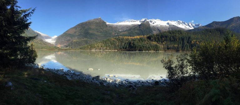
Eagle Glacier Cabin is open year-round for outdoor enthusiasts. This remote retreat is tucked into a peaceful lake setting that offers spectacular mountain views and its very own glacier. The site is accessed by hiking or snowshoeing or cross-country skiing 5.5 miles from the Amalga Trailhead off of Glacier Highway. Visitors are responsible for their own travel arrangements and safety, and must bring several of their own amenities.
Recreation
The Amalga Trail used to access the cabin continues on for another 2 miles to the glacier. Cross-country skis are not advised for this trail in winter due to rough terrain. The Amalga trail can get muddy in the warmer months, so hikers should be sure to wear the proper footwear. The trail is somewhat challenging but with only 300 feet in elevation gain. An additional trail starts at the woodshed and continues about half a mile to a large waterfall. Berries are available for picking in the summer.
Facilities
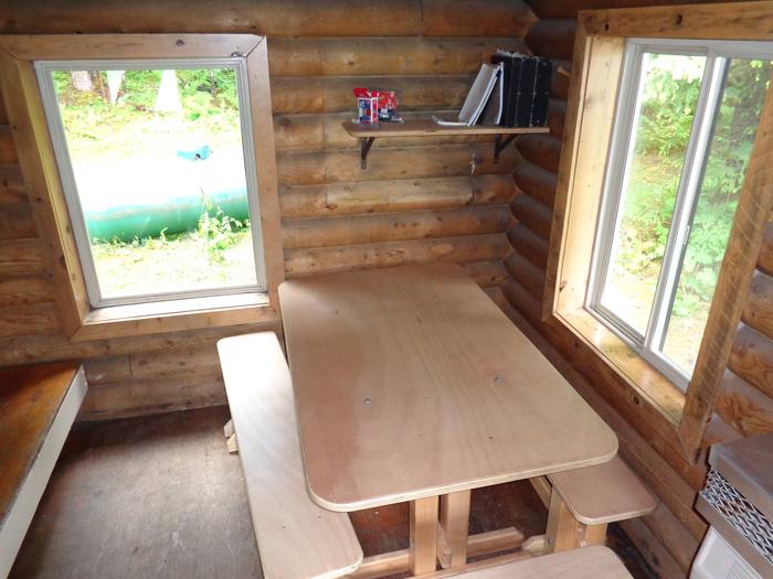
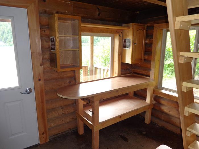
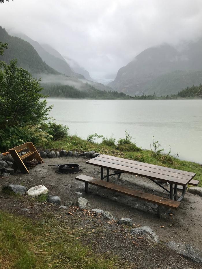
This chalet-style log cabin can accommodate five people and comes equipped with a double bunk, a single bunk and a sleeping loft. Other amenities include a table with benches, propane furnace, wood stove, shovel and bucket, broom, axe, splitting maul and food preparation space. Propane is supplied for the furnace. The cabin has a covered front porch. A picnic table and campfire ring are located in front of the cabin overlooking the lake, and there is also an outhouse. Water, firewood and electricity are not provided. Water is available from a nearby stream, but visitors should be sure to treat water before drinking or cooking with it ( water safety tips ). It is recommended that visitors bring their own water supply. Cooking facilities are not available. Visitors should pack sleeping bags, sleeping pads, a cooking stove, lanterns or flashlights, cookware, plates, utensils, food, toilet paper, garbage bags, a fire extinguisher and fire starter. Visitors are expected to pack out trash and clean the cabin before leaving ( click here for more cabin details).
Natural Features
The cabin offers excellent views of Eagle Glacier Lake, Eagle Glacier and the surrounding mountains. The old-growth forest surrounding the cabin is spruce and hemlock with dense alder and willow patches. This area is home to eagles and black and brown bears ( bear safety information ). The trail leading to the cabin passes several beaver dams where beavers and waterfowl are often seen.


