NORTH OVERLOOK PARK (KS), KS Campground Reservation, Info, Images, Map, Directions

NORTH OVERLOOK PARK (KS), Kansas Campground Images, Info & Reservations

Directions

Take I-70 to exit 295, then 4.5 miles north to Hwy. 57, then east approximately 3.2 miles to park entrance.

Phone

785-238-5714

Activities

CAMPING, WILDLIFE VIEWING, SWIMMING SITE

Keywords

Related Link(s)

Rec Area Info & Images

Kansas State Tourism

Kansas State Road Conditions

Overview

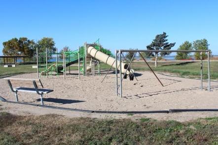
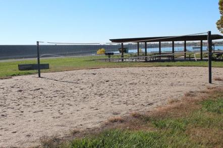
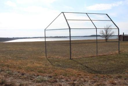
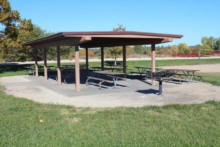
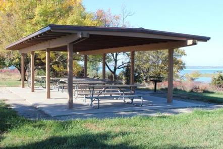
North Overlook Park is a one of the many day use parks at Milford Lake with two shelters available for reservations, great fishing access, and a playground. Also within walking distance of the shelters is a baseball field, horseshoe pits and a volleyball court. With these features offered, North Overlook Park is sure to have something for the whole family.

Click here for the Milford Lake Virtual Tour.

Recreation

Activities at Milford Lake include boating, swimming, fishing, hunting, hiking, wildlife viewing and biking. Milford Lake is known to have great sail boating opportunities as well.

Facilities

Each shelter has picnic tables and grill available for use. Shelter 2 also has a sand volleyball court and horseshoe pits available. And there is a playground, vault toilet and baseball field located between the two shelters.

Natural Features

NATURAL FEATURES: Milford Lake is nestled on the edge of the Kansas Flint Hills and is fed by the Republican River. Milford Lake stands as the largest man-made lake in Kansas, with a surface area of 15,700 acres and 163 miles of shoreline. Milford Lake is also the home of the states third largest wetland and is known to a variety of wildlife.

Nearby Attractions

The Milford Nature Center and Fish Hatchery is nearby just below the dam. There you can find live animal exhibits as well as learn about the ecosystems of Kansas. A golf course is adjacent to the nature center on the north end of the Dam and the town of Junction City is approximately five miles from North Overlook Shelter.

Reservation

More from CampingHiking.net:

COGHILL LAKE CABIN, Alaska Campground Images, Info & Reservations

Directions The cabin is located on the southwest shore of Coghill Lake, on the lagoon just before Coghill River, on the east side of College Fiord in Prince William Sound. Accessible via float plane (50 minutes from Anchorage or 60 minutes from Cordova). The lagoon has enough water to taxi

ANTELOPE FLAT, Utah Campground Images, Info & Reservations

Directions From Vernal, Utah, take U.S. 191 north for 54 miles to Dutch John. Continue north for 8 miles, then turn west onto Forest Road 145 and travel 4 miles to the campground. From Manila, Utah, take Highway 44 for 28 miles. Turn left on U.S. 191 and go north

INDIAN HENRY, Oregon Campground Images, Info & Reservations

Directions From Estacada, Oregon, travel east on Highway 224 for 24 miles to the campground. Phone 503-630-5721 Activities CAMPING, FISHING, HIKING, WATER SPORTS, DAY USE AREA Keywords INDH,MT. HOOD NF – FS Related Link(s) Rec Area Info & Images Oregon State Tourism Forest Service Concessionaire Oregon State Road Conditions Overview

BOY SCOUT, Utah Campground Images, Info & Reservations

Directions From Salt Lake City, head west on I-80 for 36 miles. Take the Stansbury-Tooele/Route 35 exit and travel south 3 miles to Route 138 West. Follow it 10 miles to Grantsville. Go through Grantsville to Cooley Street and turn south; go 5 miles to the South Willow Canyon turnoff.

KATY BRANCH, Tennessee Campground Images, Info & Reservations

Directions From Greeneville travel east to 11E to TN State Road 107. Travel approximately 14.5 miles to the gate at Katy Branch located on the right. (Landmarks will include Clark Creek Road on the right and Jackson Bridge Road on the left.) Unlock the gate and travel about .5 miles