Directions
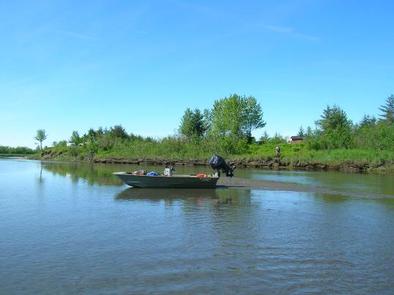
Tiedeman Slough Cabin is on south bank of Tiedeman Slough, just north of Alaganik Slough. It is accessible by boat by traveling to mile 17 on Copper River Highway and turning south on Alaganik Road. The boat ramp is at the end of the road at mile 3. From the boat ramp go 7 miles west on Alaganik Slough to Tiedeman Slough. Travel a quarter-mile north on this slough to the cabin. Travel by boat at high tides only. The delta is subject to high winds that may effect boating on lower Alaganik Slough. The cabin is located on the east bank and may be difficult to access at low tide.
The cabin is also accessible via floatplane at high tide, typically 10 minutes from Cordova. Refer to USGS map, Cordova B4.
Float plane or boat access can only occur at certain stages of the tide. Please check current conditions prior to your trip. Click here for more information.
The best method to travel in the area is by air or jet boat. Smaller motorized or hand powered craft may have difficulty maneuvering in the swift currents and shallow depths of Alaganik Slough. The intertidal beach can be accessed by foot.
Inclement weather conditions may cause an extension of your trip during any time of the year and winter access can be difficult due to snow and ice conditions. Visitors should bring extra supplies to last 2-5 days. Please contact the Contact the Cordova Ranger District at 907-424-7661 prior to arrival for more detailed information about safety precautions.
Phone
1 (907) 424-7661
Activities
BOATING, CAMPING, FISHING, HUNTING, WILDLIFE VIEWING
Keywords
TIE1,CHUGACH NF – FS
Related Link(s)
Overview
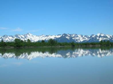
Tiedeman Slough Cabin offers guests recreation, relaxation and a unique lodging experience in the Chugach National Forest. The remote site offers a scenic setting for birding, hunting and wildlife viewing, all within close distance from the cabin.
Access to the cabin is by float plane at high tide or by boat. Visitors are responsible for their own travel arrangements and safety and must bring several of their own amenities.
Recreation
Bird watching is exceptional near this cabin. Anglers will need to travel upstream of the boat launch to Alaganik Slough to find productive fishing waters, as fishing near the cabin is poor because of water turbidity. In Alaganik Slough, however, silver salmon run from August to September, and sockeye salmon are abundant in late June through July.
Hunters can take advantage of waterfowl, bear and deer hunting during designated seasons.
Facilities
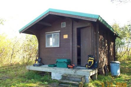
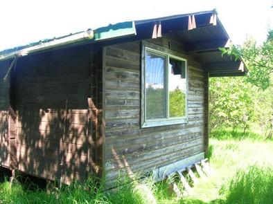
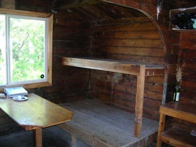
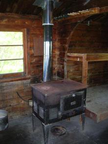
The cabin is a 12 x 14 rustic structure furnished with wooden bunkbeds without mattresses that sleep up to six guests. The cabin is equipped with a table, oil stove, rainwater catchment barrel and an outdoor pit toilet.
The cabin does not have running water or electricity. Visitors must bring their own water, food, sleeping bags, sleeping pads, cook stoves, matches, cooking gear/utensils, light source, #1 stove oil, toilet paper, first aid kit and garbage bags
Click here for more cabin details.
Natural Features
The cabin is located on the east bank of the tidal slough in a low-lying area blanketed with alder and willow. Ponds dot the boggy landscape.
This area offers a diversity of wildlife. Copper River Delta is a major resting and feeding area for 20 million shore birds and waterfowl traveling the Pacific Flyway. Waterfowl in the area include dusky Canada geese, mallard, pintail, green-winged teal, gadwall, widgeon and shoveler.
Land mammals include brown bears, beaver, coyote, moose, wolf and land otters. Bear are most apparent during the spring as they hunt eggs and flightless birds. Sea mammals are not usually present, however, harbor seals will travel up slough following the salmon during their spawning runs.

