Directions
Access is by float plane or boat only. The cabin is located on the mainland in Thomas Bay, south of Cascade Creek and east of Spray Island. From Petersburg the journey is 14 miles by float plane or 19 miles by boat. Refer to USGS topographic map Petersburg D3; Sumdum A3 may also be useful. Maps are available online or by calling the Petersburg Ranger District at (907) 772-3871.
Float plane or boat access can only occur at certain stages of the tide. Please check current conditions before your trip. Click here for more information.
Phone
907-772-3871
Activities
BOATING, CAMPING, FISHING, HIKING, HUNTING, WILDLIFE VIEWING
Keywords
CASK,THOMAS BAY CABIN,TONGASS NF – FS
Related Link(s)
Overview
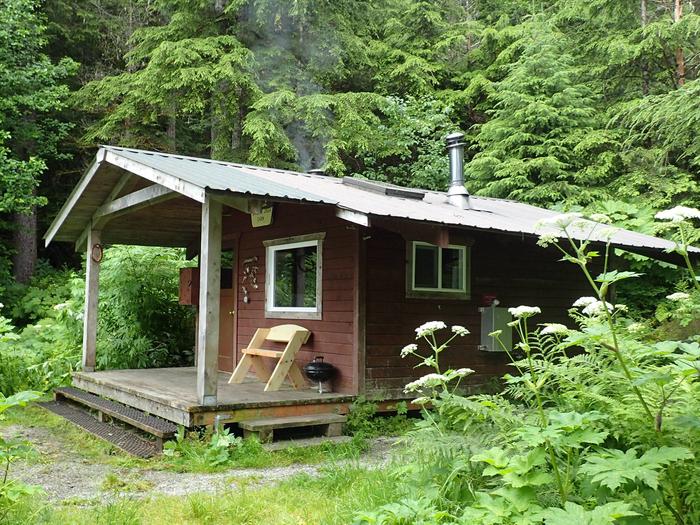
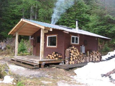
Cascade Creek Cabin is located on the mainland in Thomas Bay, south of Cascade Creek and east of Spray Island. It offers access to a variety of recreational activities, including fishing, boating, hiking, hunting and viewing wildlife.
The cabin can be accessed by either a float plane or boat from Petersburg. Guests are responsible for their own travel arrangements and safety, and must bring several of their own amenities.
Recreation
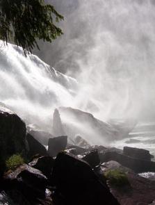
The Cascade Creek Trail begins near the cabin and offers an array of hiking experiences. The trail is moderate for the first mile, then gains elevation and becomes more challenging. The trail provides access to waterfalls, a whitewater canyon, pristine lakes and alpine areas frequented by mountain goats. The trail connects to Falls Lake and Swan Lake, where rowboats with oars are available. Life jackets are not provided. During the summer months cruise ships also take advantage of the hiking opportunities and often anchor near or in front of Cascade Creek Cabin. This increases the amount of traffic in the bay and on the trail during those months.
Facilities
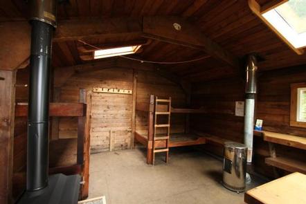
The hunter-style cabin has wooden bunks and can accommodate up to six people. It is equipped with a table, benches and an oil stove and wood stove for heat. An outhouse with a pit toilet is provided.
Water for drinking, cooking and cleaning is not provided at the cabin. It is available from a small stream north of the cabin. Water taken from the stream should be treated or boiled before consumption. Guests are encouraged to bring their own drinking water if possible.
Guests will need to bring their own sleeping bags and pads, cook stove and cooking gear, towels, food and clothing, fire starter and garbage bags, among other necessities. Guests are advised to bring enough kerosene or No. 1 heating oil for the oil heater. It burns at a rate of approximately one gallon per day. Oil is not supplied at the cabin.
A broom, dustpan, axe and splitting maul are generally provided, but may be missing or damaged. Please report damaged items to the Petersburg Ranger District. Firewood is generally provided, but not guaranteed.
Click here for more cabin details and maps.
Natural Features
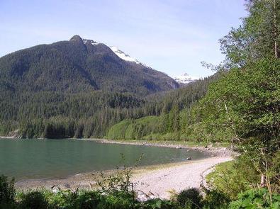
The cabin is located at the edge of a second growth spruce-hemlock forest, along a gravel beach, near the mouth of Cascade Creek. The beach fringe in front of the cabin is flat. Forested slopes directly behind the cabin become steeper with elevation, eventually rising to Cosmos Peak, which is at 5,000 feet.
A variety of wildlife make its home in the area, including deer, moose, mountain goats and black bears (learn about bear safety).

