


Directions
From Petersburg the journey is 15 miles by float plane or 25 miles by boat. Refer to USGS topographic map Petersburg D4. Petersburg D3. Sumdum A4 may also be helpful. Maps are available online or by calling the Petersburg Ranger District at (907) 772-3871.
Float plane or boat access can only occur at certain stages of the tide. Please check current conditions prior to your trip. Click here for more information.
Phone
907-772-3871
Activities
BOATING, CAMPING, FISHING, HIKING, HUNTING, WILDLIFE VIEWING
Keywords
POAY,TONGASS NF – FS
Related Link(s)
Overview
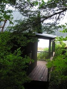
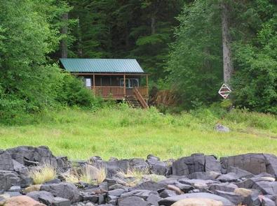
The Portage Bay Cabin is located on the eastern shore of Portage Bay on Kupreanof Island, due east of Stop Island. It provides access to scenic views as well as a variety of recreational opportunities. Visitors to the area enjoy fishing, hiking and wildlife viewing.
It is accessible by boat or float plane only. Guests are responsible for their own travel arrangements and safety, and must bring several of their own amenities.
Recreation
There is excellent halibut fishing in the mouth of Portage Bay. Coho, pink salmon, steelhead and trout fishing are available in the nearby Portage Creek. Hunting for black bears, waterfowl and grouse is also available as per state or federal hunting regulations; click here for more information from the Alaska Department of Fish and Game.
The primitive Portage Mountain Loop Trail connects the cabin with Petersburg Lake Cabin and Salt Chuck East Cabin through Goose Cove, south of the bay. The trail is especially primitive over to Petersburg Lake and is seldom used due to the level of difficulty. Sections of the trail are flooded by beaver ponds.
Facilities
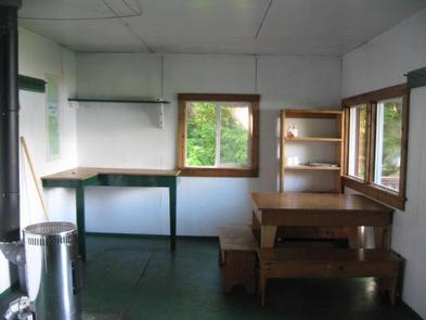
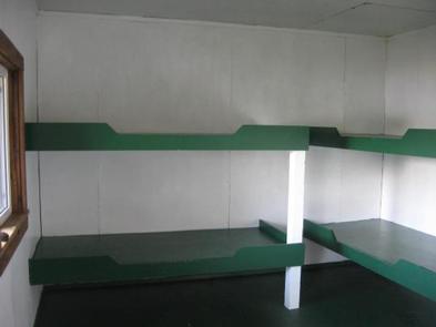
The single-level, hunter-style cabin has four single wooden bunks and can accommodate up to six people. It is equipped with a table, benches and a clean-burning oil heater. An outhouse with a pit toilet is provided.
Water for drinking, cooking and cleaning is not provided at the cabin. The nearest water source is a small creek 100 feet south of the cabin. Water taken from any outdoor source should be treated or boiled before consumption. Guests are encouraged to bring drinking water if possible.
Guests will need to bring their own sleeping bags and pads, cook stove and cooking gear, towels, food, clothing, fire starter and garbage bags, among other necessities. Guests are advised to bring enough kerosene or No. 1 heating oil for the oil heater. It burns at a rate of approximately one gallon per day. Oil is not supplied at the cabin.
Click here for more cabin details and maps.
Natural Features
The cabin was originally built as an administrative site for Forest Service timber layout crews, but was converted to a recreation cabin in 1987. It sits back from the rocky eastern shore of Portage Bay in southeastern Alaska. The surrounding terrain is hilly along the east and flat and rolling south and west of the bay. Portage Mountain rises 3,577 feet in the background.