

Directions
Accessible year round, weather permitting. Located 22 miles southeast of Sitka, north of West Crawfish Inlet, just outside the South Baranof Wilderness Area on the southwest side of Baranof Island. From Sitka, boat access takes about 90 minutes and air access takes about 15 minutes. For geographic features surrounding the cabin refer to USGS topographic map Port Alexander D-4.
Please consult local tide tables before departing for the cabin.
Phone
907-747-6671
Activities
CAMPING, FISHING, HIKING, HUNTING
Keywords
SEFA,TONGASS NF – FS
Related Link(s)
Overview
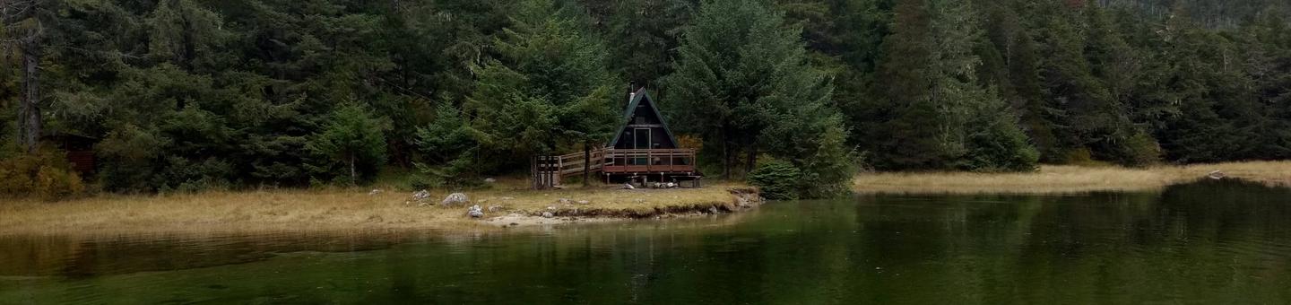
Sevenfathom Bay Cabin is located 22 miles southeast of Sitka, Alaska on Baranof Island. This cabin is generally available year-round, weather permitting, and was built in April 1991 by a group of local Sitka volunteers.
This is a remote site. The cabin can be accessed from Sitka via a 1.5-hour boat ride or a 15-minute floatplane ride. Visitors are responsible for their own travel arrangements and safety, and must bring their own amenities.
Recreation
Many hiking opportunities are available near the cabin, despite a lack of established trails. The South Baranof Wilderness Area can be accessed within five minutes by boat.
Saltwater fishing and deer hunting are popular activities as well. For information about fishing and hunting permits and seasons, visit the Alaska Department of Fish and Game website.
Facilities
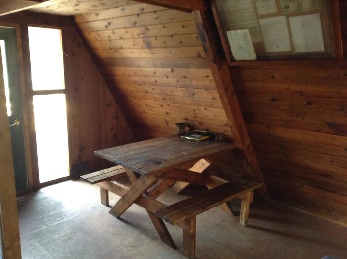
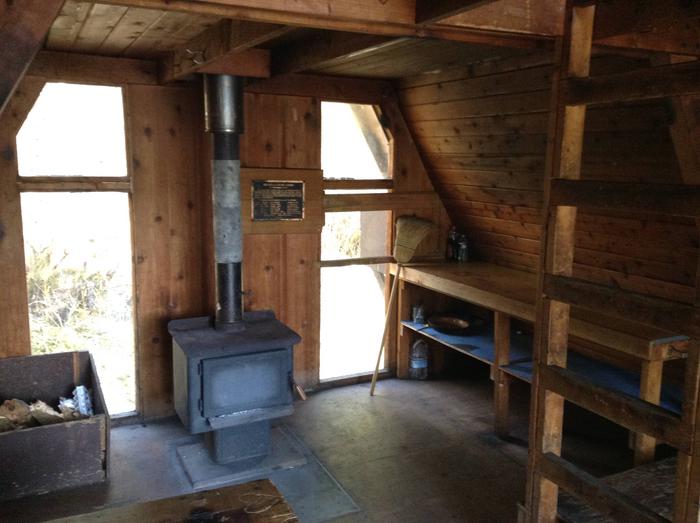
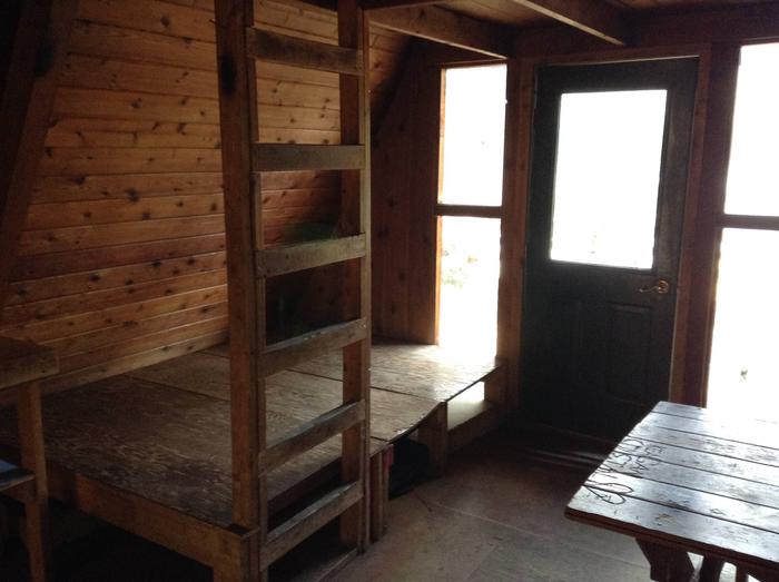
The 16 by 16-ft wood A-frame cabin can accommodate up to eight people. A large deck extends across the front of the cabin. A sleeping loft accessed by vertical ladder, a wooden double bunk, table and benches, wood heating stove, cooking counter, broom, axe and maul are provided. An outhouse toilet is close to the cabin.
A mooring buoy for boat anchorage is available on a first-come, first-served basis. Cabin reservation does not include exclusive use of buoy. Mooring buoys are configured using a 4200-lb concrete block with 90 feet of 7/8th-inch stud link chain. Mariners are responsible for determining how suitable an anchoring system is for the size of their craft.
The cabin does not include mattresses or cooking utensils. Visitors should bring sleeping bags and pads, a cooking stove, pots, pans, plates, utensils, food, toilet paper, a lantern, garbage bags, a fire extinguisher and fire starter. Rain gear and boots are recommended. Firewood can be scarce.
Water is available from a nearby inlet stream but must be treated before using. It’s recommended that visitors bring their own water.
Click here for more cabin information and maps.
Natural Features
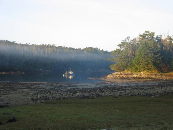
The cabin is located north of West Crawfish Inlet, just outside the South Baranof Wilderness Area on the southwest side of Baranof Island. The cabin is surrounded by nearly flat terrain at the head of Sevenfathom Bay. Brown bear frequent the area.
Nearby Attractions
Popular Goddard Hot Springs is about 20 minutes north of the cabin by boat. Soaking tubs are provided on a first-come, first-served basis by the City and Borough of Sitka.