

Directions
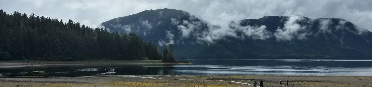
Cabin is located on Halleck Island in upper Nakwasina Sound, 16 miles north of Sitka. It is accessible by floatplane or boat from Sitka year round, weather permitting.
Float plane or boat access can only occur at certain stages of the tide. Please check current conditions prior to your trip. Click here for more information.
Boat operators should use charts to locate dangerous rocks toward the east side of the bay on their approach to the cabin. For geographic features surrounding cabin, refer to USGS topographical maps Sitka A-5, A-4 and B-5.
Phone
907-747-6671
Activities
CAMPING, FISHING, HIKING, HUNTING, WILDLIFE VIEWING
Keywords
ALLN,TONGASS NF – FS
Related Link(s)
Overview
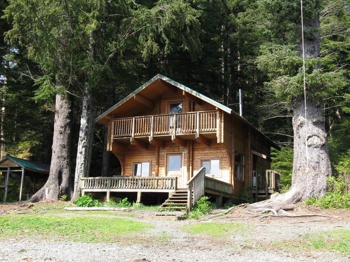
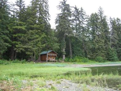
Allan Point Cabin is located on Halleck Island in upper Nakwasina Sound, about 16 miles north of Sitka, Alaska in the Tongass National Forest. The two-story cabin was built in 1993 by volunteers. It has a large front deck that overlooks Nakwasina Sound and is an excellent base for saltwater fishing and deer hunting.
The site can be accessed only by float plane or boat, weather permitting. Travel time from Sitka is 10 minutes by float plane or 30 minutes by boat. Visitors are responsible for their own travel arrangements and safety, and must bring several of their own amenities.
Recreation
Cabin guests enjoy saltwater fishing, deer hunting and viewing wildlife.
For information about fishing and hunting permits and seasons, visit the Alaska Department of Fish and Game website.
Facilities
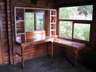
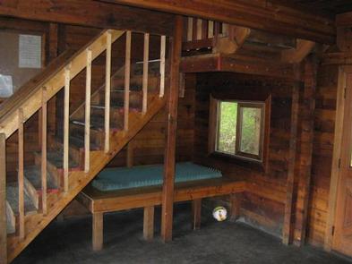
The two-story Pan Abode-style log cabin sleeps 15 people and measures 20 by 20 feet. It has a large front deck and second-floor balconies on both the front and back of the cabin. The main level contains a single bunk bed, a table, benches and cooking counters. The second level, accessed by a stairway, is an open sleeping loft with one single bunk bed and two double bunk beds. An oil heating stove (oil is not supplied) and a broom are provided. An outhouse is located outside. Guests must bring a supply of #1 diesel fuel (10 gallons for a three-day stay, more or less depending on time of year), as well as sleeping bags and pads, a cooking stove, pots, pans, plates, utensils, food, toilet paper, a lantern, garbage bags, a fire extinguisher and fire starter. Rubber boots are recommended. Water is available from small stream 200 feet west of cabin. Treat all water before using. It’s recommended that guests bring their own water. A mooring buoy for boat anchorage is available on first-come, first-served basis to cabin guests and general forest users. Cabin reservation does not include exclusive use of the buoy. Mooring buoys are configured using a 4200-lb concrete block with 90 feet of 7/8th-inch stud link chain. Mariners are responsible for determining how suitable an anchoring system is for the size of their craft. Click here for more cabin details.
Natural Features
The cabin is set at the edge of a tall, dense hemlock-spruce forest on Nakwasina Sound. The cabin faces south, overlooking Nakwasina Sound.
In the early 1960s, several forested areas in Nakwasina Sound were harvested. During the summer, the vegetation pattern in these areas appears more dense and a brighter green, with an overstory of alder and an understory of spruce and hemlock.
Brown bear frequent the area. Learn about bear safety and precautions.