

Directions
This cabin is on the mainland at Anan Bay, across Ernest Sound from the southeast corner of Wrangell Island. The site is 27 miles by air from Wrangell, and is accessible by boat and float plane. There is a 40-foot mooring float anchored in the bay for use by the general public as well as cabin users. Please consult local tide reports to determine the best arrival and departure times.
Phone
907-874-2323
Activities
BOATING, CAMPING, INTERPRETIVE PROGRAMS, FISHING, HIKING, WILDLIFE VIEWING
Keywords
ANAN,TONGASS NF – FS
Related Link(s)
Overview
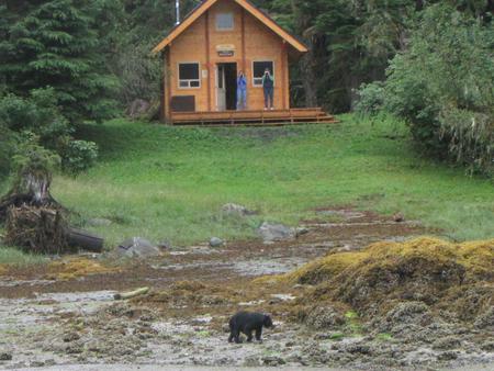
Anan Bay Cabin is popular for wildlife viewing due to its location near Anan Wildlife Observatory, where bears and bald eagles come to fish for salmon in the adjacent creek. The setting in Anan Bay also provides access to saltwater fishing, viewing marine mammals and paddling. The cabin is located about 27 miles southeast of the town of Wrangell, Alaska, and can be accessed by float plane or boat, depending on conditions. Visitors are responsible for their own travel arrangements and safety, and must bring several of their own amenities.
Recreation
The 1-mile Anan Creek Trail leads from the cabin to the Anan Wildlife Observatory. During peak viewing season, the months of July and August, Forest Service interpreters are on-site to provide current information on bear safety, trail conditions and bear activity. There is a high possibility of encountering bears on this trail during this time. Fishing is only permitted from the shore at the trailhead between June 15th and September 15th, due to bear activity. Steelhead is available in April and May, and cutthroat trout, Dolly Varden and pink salmon in July and August. There are opportunities to fish for salmon and halibut in the saltwater.
Facilities
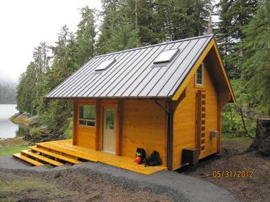
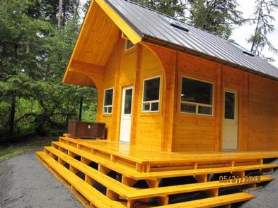
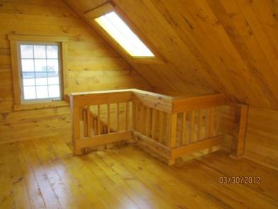
Anan Bay Cabin was originally built in 1964, but a new cabin was constructed in the spring of 2012 using Alaska yellow cedar from the Tongass National Forest. This 15×17-ft two-story cabin sleeps seven people with two single bunks (one with trundle) and a second floor loft. The cabin also has a table with benches, oil stove (#1 oil only), broom, and outhouse toilet. A 40′ mooring float is located in front of the cabin in the bay, but is open to use by the general public as well as cabin users. Vessel limit on the float is a maximum of 36 feet long, with a 30″ draft. Water and electricity are not provided. Water may be available from a seasonal creek behind the cabin, but guests should be sure to treat water before drinking or cooking with it. Visitors are encouraged to bring their own supply of water.
Heating oil is not supplied by the Forest Service. In addition to bringing a supply of #1 stove oil, guests should pack sleeping bags, sleeping pads, a cooking stove, lanterns or flashlights, cookware, plates, utensils, food, toilet paper, garbage bags, a fire extinguisher and fire starter. Guests are expected to pack out trash and clean the cabin before leaving.
Click here for more cabin details.
Natural Features
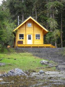
The cabin sits on a gentle slope leading down to the beach, overlooking Anan Bay. The surrounding rainforest is primarily Sitka spruce and western hemlock with some scattered cedar. The slopes around the cabin are gentle to moderate. The nearby lagoon is an intertidal area that often goes dry during low tide. The area provides excellent opportunities to view black and brown bears, harbor seals, bald eagles and various gulls (bear safety information). The high number of salmon in nearby Anan Creek allows visitors the opportunity to view their seasonal spawning in the months of July and August.