
Directions
Access to the cabin is only allowed via the route described in this section. The road that leads to the south of the Guard Station gate crosses private property and is not open for public access to Highway 114.
From Saguache, take Highway 114 west for approximately 22 miles. The turnoff for the Guard Station is 1 mile past County Road NN14. From Gunnison, remain on Highway 114 until approximately 4 miles past the Buffalo Pass Campground entrance. The exit to the station is between mile marker 39 and 40. Look for the Upper Crossing sign on the highway. Turn east for a short distance until the road ends in a "T" Turn right and go .5 mile. The cabin will be on the left.
During the winter guests may need to snowmobile, snow shoe or ski .5 miles from the nearest maintained road in order to access the cabin.
Phone
719-655-2547
Activities
HISTORIC & CULTURAL SITE, CAMPING, FISHING, HIKING, HUNTING, WINTER SPORTS, WILDLIFE VIEWING
Keywords
Upper Crossing Guard Station,UPPER CROSSING GUARD STATION (CO),Upper Crossing,UCGS
Related Link(s)
Colorado State Road Conditions
Overview
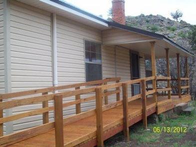
Upper Crossing Guard Station is located at an elevation of 8,400 feet, along a scenic byway near the Continental Divide, offering visitors a comfortable lodging experience in a remote setting in Rio Grande National Forest.
This guard station is the original headquarters of the old Cochetopa National Forest that existed for only a few years during the early part of the last century.
Today, guests to the guard station will find plenty of opportunities for relaxation and recreation in south central Colorado.
Recreation
The area offers many opportunities for hiking in summer, hunting in the fall and cross country skiing and snowmobiling in the winter.
The cabin sits at the confluence of two creeks and offers visitors excellent fishing for rainbow, cutthroat, brown and brook trout right out the front door.
Hiking opportunities are in close proximity to the cabin, extending out to nearby wilderness and other public lands.
Facilities
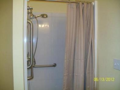
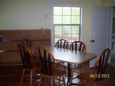
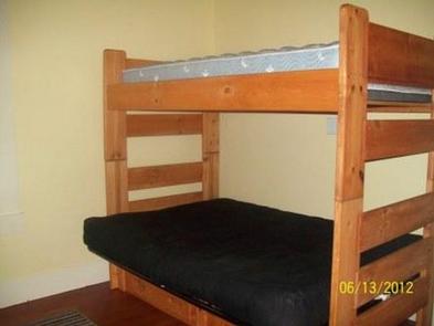
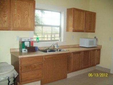
Upper Crossing Guard Station has all the amenities of a standard home, including electricity, heat and inside running water. It is furnished with three bunk beds, with twin beds on the top and fold-out full beds on the bottom, accommodating up to nine people. The cabin has electric lights, propane heater and wood burning stove. The living area has a table and chairs, couch and other furniture. The kitchen is equipped with a refrigerator, stove, hot water, some cooking utensils and some pots and pans. A picnic table, campfire grill and horseshoe pit are also on-site.
Although the cabin has most amenities, guests do need to provide their own food, sleeping bags, linens, towels, dish soap, matches, cooking gear, first aid kit, toilet paper and garbage bags. It is recommended that guests bring an additional light source in case of emergencies.
Natural Features
Upper Crossing Guard Station provides a remote setting that is easily accessible year-round via CO Highway 114. The brief dirt road leading to the cabin is actually the old stagecoach route, complete with historic graffiti that served as billboards advertising goods and services at the stagecoach stops.
Views from the cabin include portions of the Continental Divide and unspoiled surrounding countryside, showcasing high mountain peaks, diverse forests, streams and lakes in addition to some of Colorado’s most scenic working ranches.
Historically, Ute Indians traveled through this area and found it favorable for living in the San Luis Valley.