ALSEK RIVER CABIN, AK Campground Reservation, Info, Images, Map, Directions

ALSEK RIVER CABIN, Alaska Campground Images, Info & Reservations

Directions

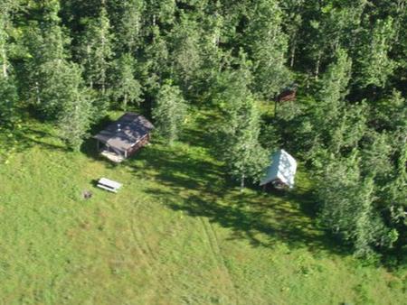
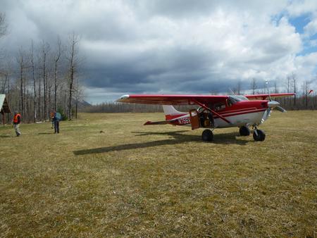
This cabin is located 55 miles southeast of Yakutat, just north of Alsek River. Access is by wheeled plane only, on an 1,800×50-ft. airstrip.

Phone

(907) 784-3359

Activities

CAMPING, HUNTING, WILDLIFE VIEWING

Keywords

ALSE,TONGASS NF – FS

Related Link(s)

Rec Area Info & Images

Alaska State Tourism

Alaska State Road Conditions

Overview

Alsek River Cabin is located on the Yukutat Forelands about a mile from the Alsek River, a large river known for its many glaciers. This cabin is open year-round and offers relaxation as well as excellent hunting opportunites.

The site can be accessed by wheeled plane, depending on conditions. An airstrip is adjacent to the cabin. Guests are responsible for their own travel arrangements and safety, and must bring several of their own amenities.

Recreation

Moose hunting is available in the surrounding area, and mountain goat hunting is excellent in the Brabazon Range 2 miles to the east. Hunters must have the proper licenses and hunt only in designated seasons.

Facilities

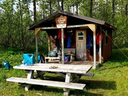
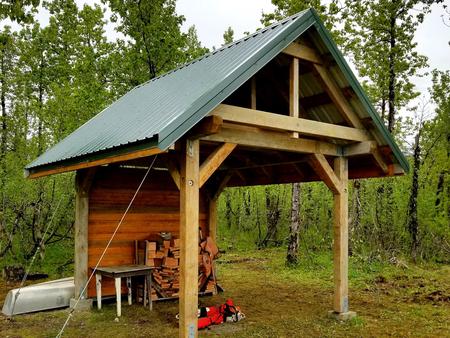
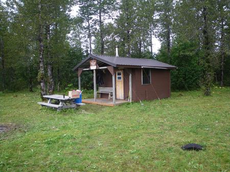
This 14×16-ft. hunter-style cabin sleeps four people with four single wooden bunks. The cabin has a table and benches, broom, an oil heater and food preparation space. An outhouse, picnic table and 12×12-ft. meat shed are located outside. Water, heating oil and electricity are not provided. Visitors must supply their own drinking water as well as #1 diesel oil or kerosene for the heater. One gallon can last 2-10 hours, depending on the heat setting. Other items to bring include sleeping bags, sleeping pads, food, a cooking stove, cookware, plates, utensils, lanterns or flashlights, toilet paper, garbage bags, a fire extinguisher and fire starter. Visitors are expected to pack out trash and clean the cabin before leaving. Click here for more cabin details.

Natural Features

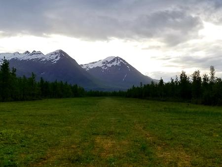
The terrain is flat and very wet, and the cabin sits on predominantly open muskeg with dense patches of alder, cottonwood and willow. The snow-capped peaks of the Brabazon Mountain Range loom over the surrounding area.

Brown and black bears are common here, and moose can often be found in the willow thickets. Sandhill cranes stop in this vicinity during spring and fall migrations. Wild strawberries are available for picking around the airstrip.

Reservation

More from CampingHiking.net:

LINTON, Kentucky Campground Images, Info & Reservations

Directions From Nashville take I-24 west to Cadiz, exit 65. Make a left onto Highway 68 for 8 miles to Highway 139. Make a left on Highway 139 and go 6 miles to Highway 164. Make a right on Highway 164 and the day use area is 8 miles from

HANNA FLAT, California Campground Images, Info & Reservations

Directions Travel east on I10 (Highway 330) to Running Springs. Turn onto Highway 18 and continue to Big Bear Lake Dam but do not cross the dam. Highway 18 becomes Highway 38. Continue to the Fawnskin Fire Station and turn left onto Rim of the World Drive (Forest Route 3N14)

LODGEPOLE AT HEBER, Utah Campground Images, Info & Reservations

Directions From Heber City, Utah, take Highway 40 east for 15 miles. Campground is on the right side of the highway. Phone HEBER RANGER DISTRICT 435-654-0470 OR UTAH RECREATION COMPANY 385-273-1100 Activities CAMPING, FISHING, HIKING, PICNICKING, WILDLIFE VIEWING Keywords LODC,UINTA NF – FS Related Link(s) Rec Area Info & Images

Moonflower Canyon Group Site, Utah Campground Images, Info & Reservations

Directions From the center of Moab (at Center and Main) head south to Kane Creek Road. Turn right (west) on Kane Creek Road and drive 3.5 miles. You will see the Moonflower Campground on the left just past the King’s Bottom Campground. Phone (435)259-2100 Activities BIKING, HISTORIC & CULTURAL SITE,

MARION MOUNTAIN, California Campground Images, Info & Reservations

Directions From Interstate 10 in Banning, take Highway 243 south for about 20 miles to Alandale. Travel east on Stone Creek Campground Road for about 2 miles to Marion Mountain Campground. Phone 909-382-2922 Activities BIKING, CAMPING, FISHING, HIKING, HORSEBACK RIDING, FIRE LOOKOUTS/CABINS OVERNIGHT Keywords MARI,SAN BERNARDINO NF – FS Related

PRINCESS, California Campground Images, Info & Reservations

Directions From Fresno, California, go east on Highway 180 to Grants Grove, continuing approximately 12 miles to Princess Campground on the right. Phone 559-335-2232 Activities CAMPING, HIKING, DAY USE AREA Keywords PRCS,GIANT SEQUOIA NAT. MONUMENT,SEQUOIA NF – FS Related Link(s) Rec Area Info & Images California State Tourism Forest Service