TYEE CAMPGROUND, OR Campground Reservation, Info, Images, Map, Directions

TYEE CAMPGROUND, Oregon Campground Images, Info & Reservations

Directions

From Florence, OR, travel south on Highway 101, six miles to Pacific Avenue. Turn left on Pacific Avenue and travel approximately 100 feet. Campground is located on the right (south) side of Pacific Avenue.

Phone

541-271-6000

Activities

BOATING, CAMPING, FISHING, HIKING, WILDLIFE VIEWING

Keywords

TYEE,OREGON DUNES,SIUSLAW NF – FS

Related Link(s)

Rec Area Info & Images

Oregon State Road Conditions

Oregon State Tourism

Overview

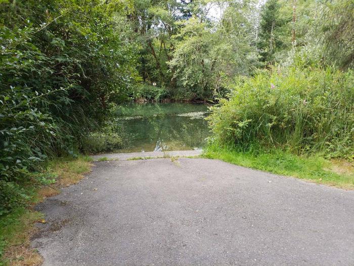
Tyee Campground, located 5 miles south of Florence, is part of the Oregon Dunes National Recreation Area. The small campground sits on the northern banks of the Siltcoos River beside the Siltcoos Lake outlet. Many campers bring kayaks and take pleasure in boating up and down the outlet.

This is a great campground for kids to play and anglers to try their luck from the riverbank.

Recreation

In the area, hikers can enjoy miles of open beach and explore dune formations above the Siltcoos River.

Anglers have a chance to catch coho salmon and bird watchers can sit back and watch a variety of shorebirds and waterfowl.

Facilities

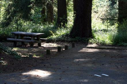
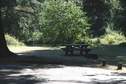
Drinking water, vault toilets and a boat ramp are among the campground amenities. Each campsite has a picnic table and a fire ring with grill. Parking aprons are paved and a dump station is within 4 miles at Honeyman State Park. The campground has 14 sites, 9 are reservable and 5 are available on a first-come first-serve basis.

Natural Features

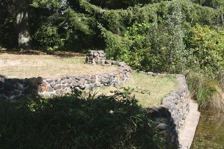
A few sites are secluded by local coastal shrubbery and other sites are located on an open meadow alongside the water. The Siltcoos River flows west from the 3,164-acre Siltcoos Lake and completes its journey in the Pacific Ocean.

Oregon Dunes National Recreation Area boasts the largest coastal dunes in North America.

Roosevelt elk, panfish and bald eagles are just some of the wildlife that live in this area.

Nearby Attractions

Boating is available at Tahkenitch Lake and Siltcoos Lake. Off-road vehicle riding trails weave along the nearby dunes.

Reservation

More from CampingHiking.net:

DEVILS GARDEN CAMPGROUND, Utah Campground Images, Info & Reservations

Directions From I-70, take Exit 182. Travel south for 26 miles to the park entrance. Take the park road 18 miles to Devils Garden. From Moab, take Highway 191 north for 4.5 miles to the park entrance. Take the park road 18 miles to Devils Garden. Phone 435-719-2299 Activities CAMPING,

DAM WEST SPILLWAY, Illinois Campground Images, Info & Reservations

Directions From I-70, take State Route 127 south to Carlyle and turn east on William Road. Continue for 1/2-mile to Lake Road and turn south, following signs to the park. Phone 618-594-5253 Activities BOATING, CAMPING, FISHING Keywords DAWS,CARLYLE LAKE Related Link(s) Rec Area Info & Images Illinois State Tourism Illinois

POTTERS POND, Utah Campground Images, Info & Reservations

Directions From Price, Utah, travel south on Highway 10 for 20 miles, to Huntington. Turn right onto Highway 31 and travel northwest for 30 miles. Turn south onto Miller Flat Road and travel 11 miles. Turn right onto Potter Canyon Road and continue for less than a mile to the

PRIEST RIVER, Idaho Campground Images, Info & Reservations

Directions Priest River Recreation Area is 1 mile east of the town of Priest River on Highway 2. After the river it will be the first road on the right. The park is also known as the "Mudhole." Phone 208-437-3133 Activities BOATING, CAMPING, FISHING, VISITOR CENTER, WILDLIFE VIEWING, DAY USE

RED DIAMOND CAMPGROUND, Oregon Campground Images, Info & Reservations

Directions From Blue River, OR, travel 4 miles east on Highway 126 to Aufderheide Drive (Forest Service Road 19). Turn right and proceed south on Aufderheide Drive, taking the Y and climbing to the top of Cougar Reservoir. Continue south on Aufderheide Drive for 13 miles to Red Diamond Group