BUCK LAKE GROUP CAMPGROUND, FL Campground Reservation, Info, Images, Map, Directions

BUCK LAKE GROUP CAMPGROUND, Florida Campground Images, Info & Reservations

Directions

From I-75 in Ocala, Florida, travel east on State Route 40. Turn onto State Route 19 south, then turn right onto Forest Road 595-2 and travel for approximately 4 miles. Buck Lake Group Camp will be on the left.

Phone

352-625-2520

Activities

BOATING, CAMPING, FISHING, HIKING

Keywords

BLGR,Buck Lake,Buck Lake Group Camp

Related Link(s)

Rec Area Info & Images

Florida State Road Conditions

Florida State Tourism

Overview

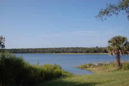
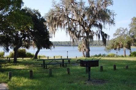
Buck Lake is a group camping facility in the heart of Ocala National Forest in Florida. Great for family reunions and social gatherings, the campground can host a group of up to 50 guests along the shores of Buck Lake.

Activities include fishing, boating, picnicking, hiking and simply relaxing and enjoying the breeze.

Recreation

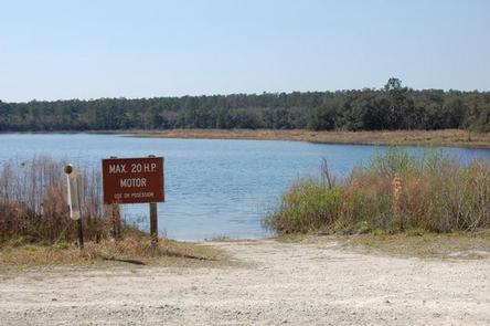
The sandy swimming beach provides a great place to relax and picnic. Campers have access to Buck Lake to enjoy fishing for panfish, bass and crappie, as well as boating.

Hikers can access a segment of the 1,400-mile Florida Trail via a scenic trail that loops around the lake for 1.7 miles.

Facilities

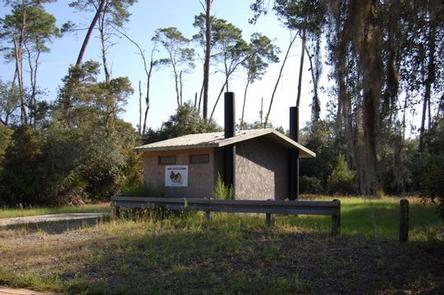
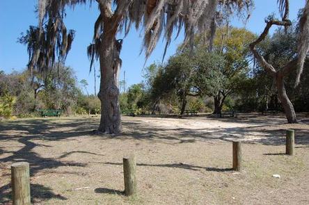
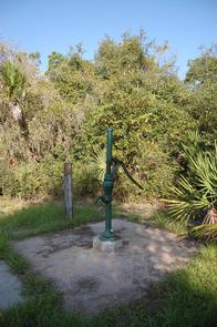
This campground provides primitive camping for groups. Amenities include a vault toilet, a hand pump for drinking water, six picnic tables and a group campfire ring. Group get exclusive use of the facility during the reservation.

Natural Features

Located in north central Florida, the Ocala National Forest spans four counties and 383,000 acres. It is the southernmost and oldest national forest east of the Mississippi River and protects the world’s largest contiguous sand pine scrub forest.

The forest is also rich in water resources with more than 600 lakes, rivers and springs, several of which are near Buck Lake.

Nearby Attractions

Buck Lake is near the beautiful, turquoise waters of Alexander Springs Recreation Area, where visitors can swim, dive and snorkel in a warm, spring-fed lake and canoe on a 7-mile run.

Reservation

More from CampingHiking.net:

DORIS CREEK CAMPGROUND, Montana Campground Images, Info & Reservations

Directions Turn off U.S. Highway 2 at milepost 144 and follow the West Side Hungry Horse Reservoir (Forest Road #895) across the Hungry Horse Dam. The campground is 3 miles south of the Dam. The road is paved to the campground. Phone 406-752-7924 FOR RESERVATIONS CALL: 1-877-444-6777 Activities BOATING, CAMPING,

SIERRA, California Campground Images, Info & Reservations

Directions From Sierra City travel north on Highway 49, in about 7 miles turn right into the campground. Phone (530)478-6253 Activities CAMPING, FISHING, HIKING, HUNTING, WATER ACCESS, SCENIC DRIVE, GOLD PANNING Keywords SRRA,TAHOE NF – FS Related Link(s) Rec Area Info & Images California State Road Conditions California State Tourism

MILL DAM GROUP CAMP, Florida Campground Images, Info & Reservations

Directions Mill Dam is located just off of Highway 40, approximately 15 miles east of Silver Springs, Florida, and 50 miles west of Ormond Beach. From 40, look for the Mill Dam/Half Moon signs about a quarter-mile from the recreational area turnoffs. Phone 352-625-2520 Activities CAMPING, HIKING, WATER SPORTS, SWIMMING

LIMBER PINE, Montana Campground Images, Info & Reservations

Directions From U.S. Highway 212, turn off at Rock Creek Road (Forest Road 2421). Go just over a mile to the campground entrance, which should be on the left. Phone 406-587-9054 Activities FISHING, HIKING, OFF ROAD VEHICLE TRAILS, KAYAKING, CANOEING Keywords LIMB,CUSTER NF – FS Related Link(s) Rec Area Info