SPEEGLEVILLE PARK, TX Campground Reservation, Info, Images, Map, Directions

SPEEGLEVILLE PARK, Texas Campground Images, Info & Reservations

Directions

From I-35, take exit 330B Hwy 6 N toward Meridian for about 6 miles. After passing over the Lake on the Twin Bridges, take the first exit toward Lake Waco/Speegleville Park. Take a left on the access road. You will continue past the Twin Bridges Park about a quarter of a mile until you reach Overflow Road. Turn right on Overflow Road and drive for about 1.5 miles until you reach the entrance on the left.

Phone

254-756-5359

Activities

BOATING, CAMPING, FISHING

Keywords

SPGV,Speegleville Park

Related Link(s)

Rec Area Info & Images

Texas State Road Conditions

Texas State Tourism

Overview

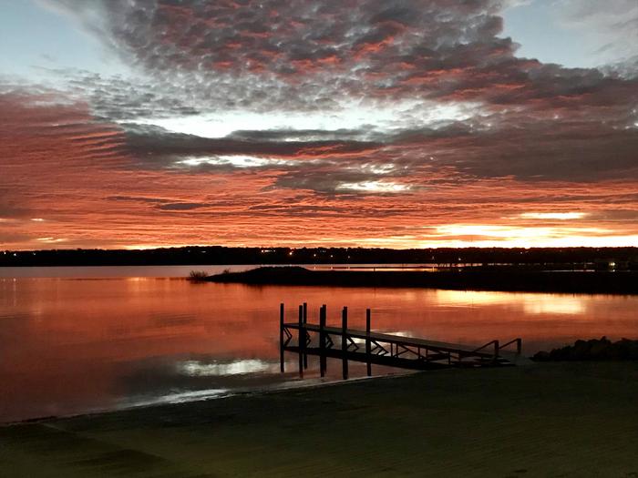
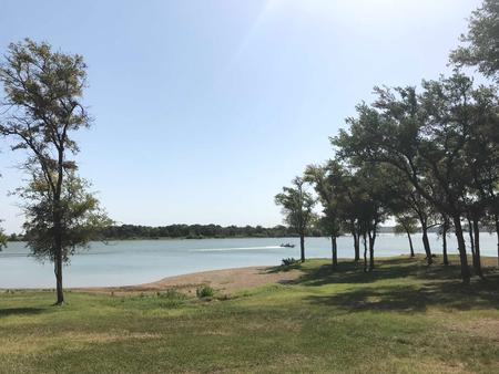
Speegleville Park is perched on the south end of a scenic cove of Waco Lake. The park provides outdoor recreation options like boating, jet skiing, fishing, swimming and bird watching.

Recreation

The main lake shoreline has a large amount of submerged timber, which typically holds fish year-round. Anglers will find plenty of catfish, crappie, large and smallmouth bass as well as sunfish. At least 51 species of fish inhabit the lake’s waters, and a record flathead catfish weighed in at a whopping 59.5 pounds.

A four-lane boat ramp helps visitors enjoy the lake.

Facilities

The park includes two screened shelters along with 30 campsites with water and electric hookups.

Natural Features

Waco Lake, located in central Texas within Waco city limits, boasts 79,000 acre-feet of water, providing irrigation and drinking water to residents of the Waco area. The lake is primarily fed by the Bosque River, which runs for 115 miles through central Texas.

Nearby Attractions

Horseback riding, hiking and biking can be done on the 20-mile Lacy Point Hiking and Biking Trail. The trail is accessible from the Lacy Point boat ramp, which is a short drive around the cove.

Reservation

More from CampingHiking.net:

Little Naches Campground, Washington Campground Images, Info & Reservations

Directions From Naches, take Highway 410 northwest 30 miles to Forest Road 107. Turn onto 107 and follow to the campground. Phone 541-338-7869 Activities BIKING, CAMPING, FISHING, HIKING, WATER SPORTS Keywords LILN,NACHES,OKANOGAN – WENATCHEE NF -FS,LITTLE NACHES,LITTLE NACHES CAMPGROUND,NATCHES Related Link(s) Rec Area Info & Images Washington State Tourism Washington

KELLY FORKS CABIN, Idaho Campground Images, Info & Reservations

Directions The cabin is approximately 48 miles northeast of the community of Pierce, Idaho. The last 31 miles to the cabin from Pierce are narrow, have a gravel surface and may be peppered with large potholes and rocks, so travel can be slow-going. Kelly Forks Cabin is also situated about

LOLETA RECREATION, Pennsylvania Campground Images, Info & Reservations

Directions From the west, take I-80 east to Clarion, Pennsylvania. Turn left onto State Route 66 and continue northeast to Marienville. Turn right on South Forest Street and go south 6 miles to the Loleta Campground entrance sign. From the north, take State Route 66 to Marienville, turn left on

EAST FORK (TX), Texas Campground Images, Info & Reservations

Directions From Wylie, TX, take State Highway 78 North to Eubanks Lane. Turn left onto Eubanks, stay to the right at the fork in the road (onto Forrest Ross Road) and continue to the stop sign at the intersection of Forrest Ross Road and Skyview Drive. Continue straight into East

GRIZZLY, California Campground Images, Info & Reservations

Directions From Reno, travel north on Highway 395 to Highway 70 and turn west to Portola. From Portola, take County Road 126 north for 7 miles, then County Road 112 to the east side of Lake Davis. Continue approximately 1 mile to the campground, which is on the left. Phone