BELLAIRE LAKE CAMPGROUND, CO Campground Reservation, Info, Images, Map, Directions

BELLAIRE LAKE CAMPGROUND, Colorado Campground Images, Info & Reservations

Directions

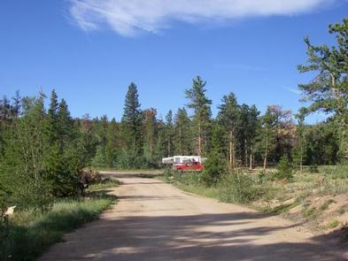
From Fort Collins, travel north on Highway 287 for 21 miles, to Livermore. Turn left onto Red Feather Lakes Road (County Road 74E) and travel 25 miles, just beyond the south side of Red Feather Lakes. Turn south onto County Road 69 and continue approximately 3 miles. The campground is located on the right.

Phone

970-295-6700

Activities

BIKING, CAMPING, FISHING, HIKING, WILDLIFE VIEWING, CANOEING, NON-MOTORIZED BOATING

Keywords

BELC,Bellaire,Red Feather Lakes,Red Feathers,Redfeather Lakes,Bellare

Related Link(s)

Rec Area Info & Images

Forest Service Concessionaire

Colorado State Tourism

Colorado State Road Conditions

Overview

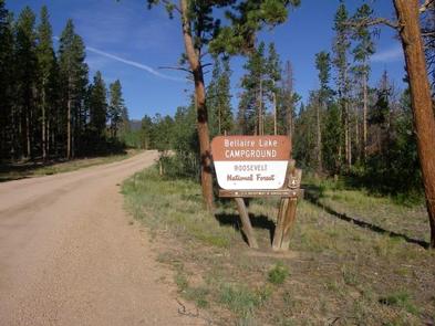
Bellaire Campground is located 47 miles northwest of Fort Collins, Colo., near the Red Feather Lakes village. Visitors enjoy the area for its canoeing, fishing and trail opportunities.

Recreation

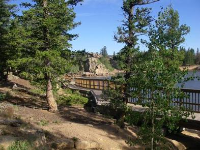
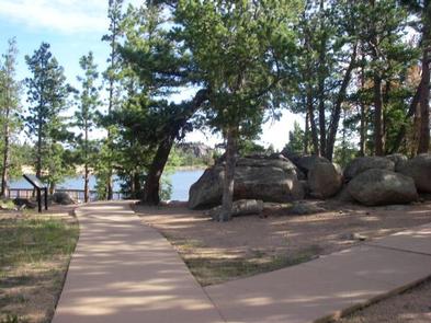
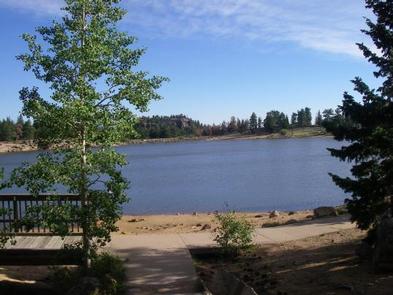
Canoeing and fishing are popular activities on 10-acre, no-wake Bellaire Lake. Anglers cast for rainbow and brook trout, among other species. The campground is within walking distance of the lake via an accessible boardwalk. Several additional lakes are in the vicinity.

Many hiking, biking and horseback riding trails are in the surrounding area, including the 1.25-mile Molly Lake Trail and 4-mile Mount Margaret Trail. Several off-road vehicle trails are located within five miles of the campground.

Other popular activities include viewing wildlife and visiting nearby Redfeather Visitor Center.

Facilities

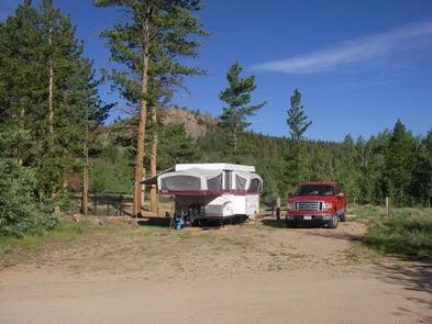
The campground offers accessible single, double and triple family sites with electric hookups. Five additional sites are designated for tent camping and do not have hookups. Each site contains a tent pad, picnic table and campfire ring with grill.

Flush toilets, vault toilets and drinking water are provided. Dead and downed firewood may be gathered in the forest or purchased from the campground host.

Natural Features

The campground is comprised of rolling hills, pine forests and unique rock formations. It sits near Bellaire Lake at an elevation of 8,600 feet. Afternoon thunderstorms can be expected during spring and summer months.

Due to the mountain pine beetle infestation and the removal of hazardous trees, there may be little to no shade in the campground.

Nearby Attractions

The small village of Red Feather Lakes is nearby, offering limited dining options, gift shops, general stores, a library, post office and a golf course.

Charges & Cancellations

A $10.00 service fee will apply if you change or cancel your reservation. Late cancellations are subject to additional fees. For full details see NRRS Reservation Policy.

Reservation

More from CampingHiking.net:

LOWER PENSTEMON, Idaho Campground Images, Info & Reservations

Directions Travel south on Twin Falls County Road G3 which becomes Forest Road 515, commonly known as Rock Creek Road, for approximately 27 miles from Hansen. Phone 208-678-0430 Activities BIKING, CAMPING, HIKING, HORSEBACK RIDING, HUNTING, WILDLIFE VIEWING Keywords LOWP,SAWTOOTH NF – FS Related Link(s) Rec Area Info & Images Idaho

SUNNYSIDE CAMPGROUND, Oregon Campground Images, Info & Reservations

Directions From Blue River, travel 4 miles east on Hwy 126 to Aufderheide Drive (FS road 19). Continue on Aufderheide Drive for 9.5 miles; turn left on FS road 1900-500 for .25 miles. Phone 801-226-3564 Activities WILDLIFE VIEWING, BIRDING Keywords SUNNYSIDE CAMPGROUND,COUGAR RESERVOIR,BLUE RIVER Related Link(s) Rec Area Info &

SPRINGFIELD, Georgia Campground Images, Info & Reservations

Directions From Interstate 85 in South Carolina, take exit 11 onto Highway 187 south. Turn on Providence Church Road and follow signs to the park. 1915 PROVIDENCE CHURCH ROAD Anderson, SC 29625 Phone 888-893-0678 Activities BOATING, CAMPING, FISHING, SWIMMING SITE Keywords SPRF,HARTWELL LAKE PROJECT Related Link(s) Rec Area Info &

MOSER ISLAND CABIN, Alaska Campground Images, Info & Reservations

Directions Accessible year round, weather permitting. Located 48 air miles north of Sitka, within Hoonah Sound on the north end of Moser Island, north of Peril Strait. Access from Sitka is 30 minutes by floatplane, or 2 hours by boat. For geographic features surrounding the cabin, refer to USGS topographic

SEELY CREEK GUARD STATION, Utah Campground Images, Info & Reservations

Directions From Orangeville, travel west on State Highway 29 to Joe’s Valley Reservoir. At the reservoir, turn right and follow the road around to the other side. When you start heading away from the reservoir and toward the plateau, you’ll pass Orange Olsen Administrative Site on the right and then

CANAL CREEK, Oregon Campground Images, Info & Reservations

Directions From Waldport, Oregon, take State Route 34 east 7 miles to the campground sign at Canal Creek Rd../Forest Service Rd. 3462. Turn right onto Canal Creek Rd./FSR 3462 and go 4 miles to another campground sign and turn left into the campground. Phone 541-528-7725 Activities FISHING, HIKING, BERRY PICKING,