WINNIE CAMPGROUND, MN Campground Reservation, Info, Images, Map, Directions

WINNIE CAMPGROUND, Minnesota Campground Images, Info & Reservations

Directions

Take Highway 2 six miles east of Cass Lake. Turn north on County Road 10 and drive two miles to County Road 91. Turn right onto County Road 91 and continue for just over three miles, to Forest Road 2171. Drive six miles northeast on Forest Road 2171 to Forest Road 2168, then four miles south to the campground.

Phone

218-835-4291

Activities

BOATING, CAMPING, FISHING, HIKING, WATER SPORTS

Keywords

WICA,West Winnie Campground

Related Link(s)

Rec Area Info & Images

Minnesota State Tourism

Minnesota State Road Conditions

Overview

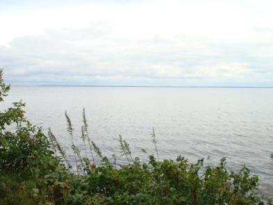
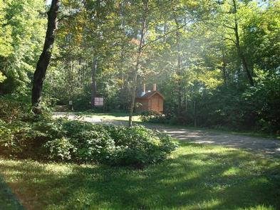
Winnie Campground is remotely located on the west side of Lake Winnibigoshish in the heart of the Chippewa National Forest. Visitors come to the area to enjoy boating, trophy muskie fishing and beautiful scenery.

Recreation

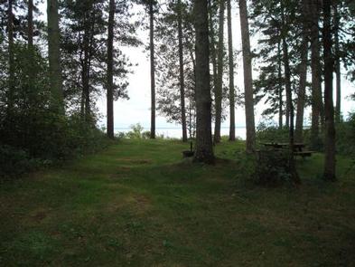
Lake Winnie offers excellent fishing opportunities for walleye, perch and muskie. It is one of Minnesota’s premier fisheries. Boating on this 67,000-acre lake is also very popular. A boat ramp and harbor are located next to the campground.

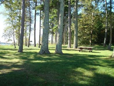
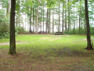
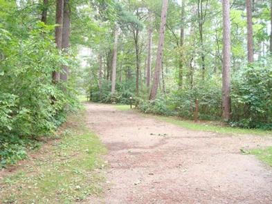
Many hiking and biking trails meander around the lake and its 141 miles of shoreline. A picnic area is adjacent to the campground. Hunting areas can be found in the surrounding forest.

Facilities

The campground offers 33 reservable sites, some of which are very large and suitable for groups. Each site is equipped with a picnic table and campfire ring. Vault toilets, hand-pumped drinking water and recycling services are provided. Firewood may be purchased when the host is available.

Natural Features

The campground is situated on the western shore of the lake in a scenic forest of mature red and white pine. Some sites have lake views.

Nearby Attractions

The town of Cass Lake, Minnesota is 25 miles west of the campground, offering restaurants, a bank, grocery and hardware stores, a movie theater and museum.

Reservation

More from CampingHiking.net:

CIRCLE PARK CAMPGROUND, Wyoming Campground Images, Info & Reservations

Directions From Buffalo, WY, take US Hwy 16 west for 13.4 miles to FS Road 20 (Circle Park Road), turn right, go 2.1 miles. Phone 406-587-9054 Activities BIKING, BOATING, FISHING, HIKING, MOUNTAIN BIKING, WATER ACTIVITIES, CANOEING, STAR GAZING, BIRDING, WATER ACCESS, SCENIC DRIVE, BACKPACKING Keywords Related Link(s) Rec Area Info

COLES CREEK DAY USE, Illinois Campground Images, Info & Reservations

Directions From I-57, take Old U.S. Highway 50 west for 19 miles, through Salem, Odin and Sandoval. Turn north on Boulder Road/2400E and continue for 4 miles, then turn east on 1700N and continue until the road connects with 2400E. Continue south to the Coles Creek entrance. Phone 618-226-3211 Activities

HAT CREEK, California Campground Images, Info & Reservations

Directions From Highways 44 and 89, go through Old Station and continue 1.5 miles west to the campground. Phone 530-336-5521 Activities CAMPING, FISHING Keywords HATC,LASSEN NF – FS Related Link(s) Rec Area Info & Images California State Tourism California State Road Conditions Overview Hat Creek is one of six campgrounds

JUDITH GUARD STATION, Montana Campground Images, Info & Reservations

Directions From Great Falls, travel east on U.S. Highway 87 for about 63 miles to Windham, Montana, from Windham turn right off HWY 200/87 and head south for approximately 10 miles until the town of Utica. Turn right at Utica, continue south for approximately 13 miles on the county road.

SITTING BULL, Wyoming Campground Images, Info & Reservations

Directions From Ten Sleep, Wyoming: Take Hwy 16 east for approximately 20 miles to Forest Service Road 432. Turn left on FSR 432 and continue about a mile to campground. Phone 406-587-9054 Activities BIKING, CAMPING, FISHING, HIKING, WILDLIFE VIEWING Keywords SITT,BIGHORN NF – FS Related Link(s) Rec Area Info &