MILLPOND PAVILION, OR Campground Reservation, Info, Images, Map, Directions

MILLPOND PAVILION, Oregon Campground Images, Info & Reservations

Directions

From Roseburg, travel east on Highway 138 for 22 miles. Turn left (north) on Rock Creek Road and proceed 5 miles. Campground is on the right.

Phone

541-440-4930

Activities

BIKING, CAMPING, WATER SPORTS, FISH HATCHERY, SWIMMING SITE

Keywords

MIPA,Mill Pond Pavilion

Related Link(s)

Rec Area Info & Images

Oregon State Tourism

Oregon State Road Conditions

Overview

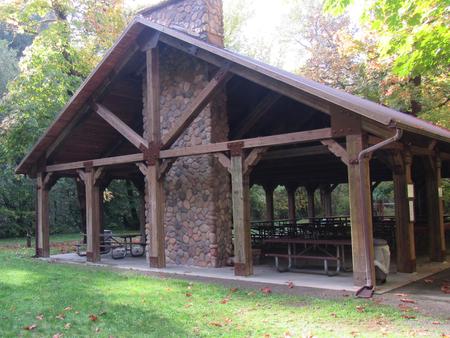
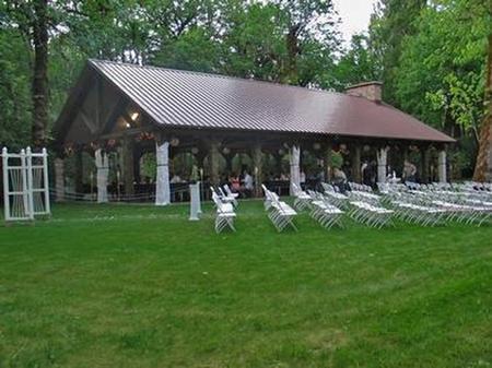
Millpond Pavilion is beautifully set along Rock Creek, which flows into the Wild and Scenic North Umpqua River. The pavilion boasts a large picnic shelter that holds up to 200 people with modern conveniences like drinking water, a sink, large grills, electrical outlets and a fireplace.

The flat grassy area is perfect for a casual game of soccer or a more special occasion, like an outdoor wedding.

In 1988 congress designated the North Umpqua River as a National Wild and Scenic River, preserving and protecting it for outdoor enthusiasts. The river is a tributary of the Umpqua River, which runs for over 200 miles from the Cascade Range of southwestern Oregon to the Pacific Ocean.

Recreation

Guests can play kickball, softball or other sports in the field that’s included in the pavilion reservation.

Adjacent to the pavilion are horseshoe pits and a playground to entertain young ones. From the pavilion, visitors can follow a 1-mile interpretive trail that passes through the site of an old lumber mill.

Facilities

Weddings and family reunions are very popular at this scenic destination. The long serving counter, stone fireplace, sink, two barbecue grills and multiple electric outlets create an ideal location for many festive occasions.

If groups choose to camp overnight, they can do so at the nearby first-come, first served Millpond Campground or the reservable Lone Pine Group Campground located across the road.

Natural Features

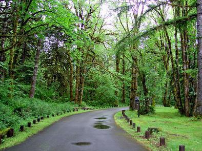
Millpond is just west of the Umpqua National Forest, in a lush region full of Douglas fir trees, western red cedar and sugar pines. The pavilion is in the foothills of the Cascade Mountains at an elevation of 1,170 feet.

Nearby Attractions

Visitors can get their adventure fix with kayaking and whitewater rafting and fishing in the North Umpqua River, just five miles away.

The incredibly scenic 79-mile North Umpqua Trail is ideal for mountain biking and hiking. And for a family-friendly destination, the nearby Rock Creek Fish Hatchery allows visitors to view salmon and steelhead.

Reservation

More from CampingHiking.net:

SPILLWAY (AZ), Arizona Campground Images, Info & Reservations

Directions From Payson, Arizona, take Highway 260 northeast toward Heber. Turn left (west) onto Forest Road 300 directly across from the Rim Visitor Information Station and follow for 5 miles. Turn right at Woods Canyon Lake Road. Spillway is on the right, another 0.75 miles further. Phone 928-535-9859 Activities BOATING,

TIMBERLINE CAMPGROUND, Colorado Campground Images, Info & Reservations

Directions From Denver, Colorado, take Highway 285 southwest to Park County Rd. 58. Turn right at County Rd. 58 and follow road to Forest Road 125. Turn right and follow road about 0.5 miles to the campground entrance. Phone 303-275-5610 Activities BIKING, CAMPING, FISHING, HIKING, HUNTING, WILDLIFE VIEWING Keywords Timberline

WEST POINT CABIN, Alaska Campground Images, Info & Reservations

Directions The West Point Cabin is located near the mouth of Portage Bay on Kupreanof Island. It is situated west of West Point, just around the point from Fredrick Sound. It is 18 miles by float plane or 24 miles by boat from Petersburg. The cabin can be found on

SANTA CRUZ SCORPION, California Campground Images, Info & Reservations

Directions Boat transportation can be arranged with Island Packers from Ventura Harbor. To park headquarters in Ventura, Ca: exit Highway 101, at Victoria or Seaward to Ventura Harbor. Phone 805-658-5730 Activities BOATING, HISTORIC & CULTURAL SITE, CAMPING, INTERPRETIVE PROGRAMS, FISHING, HIKING, PICNICKING, VISITOR CENTER, WATER SPORTS, WILDLIFE VIEWING, WILDERNESS, INFORMATION

LAVONIA, Texas Campground Images, Info & Reservations

Directions From Wylie, Texas take State Highway 78 North to Lake Road (County Road 486) located in the city of Lavon. Take a left on Lake Road. Follow signs into the campground by taking a left over the railroad tracks bridge. Phone 972-442-3141 Activities BOATING, CAMPING, FISHING, SWIMMING SITE Keywords

JOHNSON CREEK DAY USE, Texas Campground Images, Info & Reservations

Directions From Jefferson, Texas, travel 3.8 miles northwest on Highway 49. Turn left onto FM 729 and continue for just over 8.5 miles. Park entrance will be on the left. Phone 903-665-2336 Activities BOATING, FISHING, PICNICKING, WATER SPORTS, WILDLIFE VIEWING, DAY USE AREA, SWIMMING Keywords None Related Link(s) Rec Area