
Directions
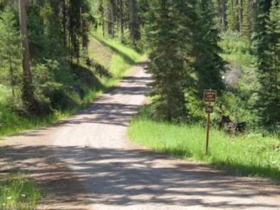
From the junction of Montana Highways 200 and 83 (locally referred to as Clearwater Junction), travel north on Highway 83 for approximately 15 miles to the town of Seeley Lake. Continue north on Highway 83 for 9.9 miles. The campground the entrance is on the west side of the highway.
Phone
406-677-2233
Activities
BIKING, BOATING, CAMPING, FISHING, HIKING, WATER SPORTS, WILDLIFE VIEWING, KAYAKING, CANOEING, BERRY PICKING, BIRDING, JET SKIING
Keywords
Old Alva,South end of Lake Alva,LSID,LAKESIDE 3 (GROUP CAMPSITE) (MT)
Related Link(s)
Overview
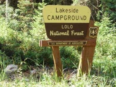
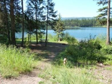
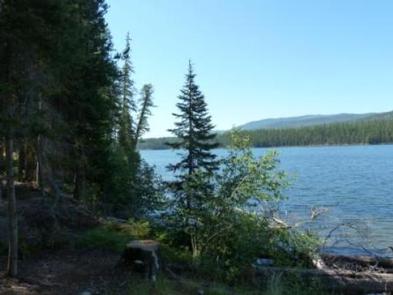
Lakeside Campground is located at the south end of Lake Alva, in Montana’s Lolo National Forest. The campground offers a chance to camp and enjoy recreational activities such as swimming, fishing and boating. The beautiful Mission Mountain Wilderness Area is 15 miles away.
Recreation
Lake Alva is in a great spot for boating and fishing. Anglers will find a variety of freshwater fish, including Kokanee salmon, suckers, whitefish, pike, trout and perch, among other species. A boat ramp is available at nearby Lake Alva Campground. Motorized boating is allowed with the “No-Wake” regulation. Many non-motorized boaters find solace during early/evening morning hours on the lake. Swimming is also a popular activity.
Facilities
One large, accessible group campsite is available for reservations at Lakeside Campground. Individual sites are available on a first-come, first-served basis. The group site can accommodate up to 25 people and up to four RVs and six vehicles.
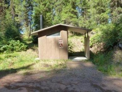
The site is equipped with tables and a campfire ring with grill. Accessible vault toilets are provided, but there is no drinking water available at the campground. Trash collection is not available. Lakeside Group is located on Lake Alva. Lake Alva is a NO-WAKE lake.
Natural Features
The campground is situated at the south end of Lake Alva, and offers shade and lake access. At an elevation of approximately 4,100 feet, temperatures are relatively cool on summer days.
The lake is home to a loon population, and has protected nesting areas during May and June. The birds’ mesmerizing calls can often be heard in the campground.
Nearby Attractions
Seeley Lake is about 10 miles south of the campground, with boating, water skiing and fishing opportunities. The town of Seeley Lake lies on the southeastern tip of the lake. A variety of services are offered there, including boat, canoe, kayak and row boat rentals.
The Mission Mountain Wilderness Area is about 15 miles northwest of the campground. The area is popular for its scenic views and abundant wildlife. Active glaciers, alpine lakes, meadows and clear, icy streams, along with vertical cliffs and jagged peaks, make up the area.