
Directions
From I- 81 North, take Exit 175 just south of Natural Bridge, Virginia. Go north on U.S. Highway 11 toward Natural Bridge (left turn facing the Exxon station). From Natural Bridge, follow Route 130 East at the intersection with U.S. Highway 11 (right turn at the Natural Bridge parking lot). Continue on Route 130 East for approximately 4 miles to Natural Bridge Station. Turn right onto State Route 759 and continue for approximately 3 miles. Turn right onto State Route 781. The entrance for Cave Mountain Lake Recreation Area is approximately 1.6 miles ahead. Turn left into the recreation area and continue to the beach area parking. The group picnic shelter is across the foot bridge to the right of the main path to the lake. From I-81 South, take Exit 180 and continue south on U.S. Highway 11 to Natural Bridge. In Natural Bridge, take a left onto Route 130 East and continue 4 miles to Natural Bridge Station and continue following the directions above.
Phone
540-291-2188
Activities
BIKING, CAMPING, FISHING, HIKING, PICNICKING, DAY USE AREA, SWIMMING SITE
Keywords
Cave Mountain,Cave Mountain Lake Recreation Area,CAVE MOUNTAIN LAKE GROUP PICNIC SHELTER (VA)
Related Link(s)
Virginia State Road Conditions
Overview
Cave Mountain Lake Group Picnic Shelter is nestled in the Blue Ridge Mountains of Virginia, and welcomes visitors to enjoy the rustic beauty and peacefulness of the area. Easy access from the interstate and close proximity to historic Lexington and Natural Bridge State Park make Cave Mountain Lake an ideal destination.
Recreation
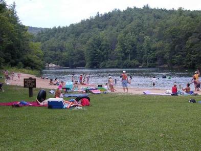
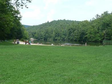
The 7 acre lake offers opportunities for swimming in a designated area which includes a sand beach. Fishing for youth only (ages 15 and under) is open April 1st through June 15th, then fishing is open to anglers of all ages with a valid Virginia fishing license for the remainder of the season. There are several piers around the lake for better fishing access. A number of opportunities for photography, birding and wildlife viewing are available along the trails and water’s edge. Hiking trails surround the area, offering everything from a short walk around the lake to an all-day hike along the nearby ridges. The Panther Knob Trail starts beside the group picnic shelter and skirts the edge of the lake to the dam. Visitors may also enjoy a day hike or backpacking trip on the Appalachian National Scenic Trail, the James River Face Wilderness or the Thunder Ridge Wilderness.
Facilities
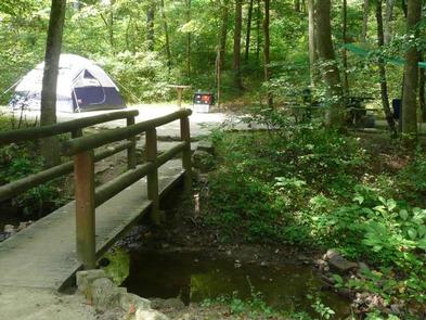
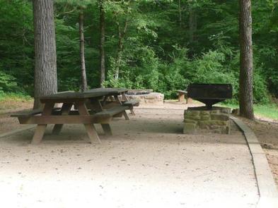
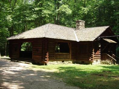
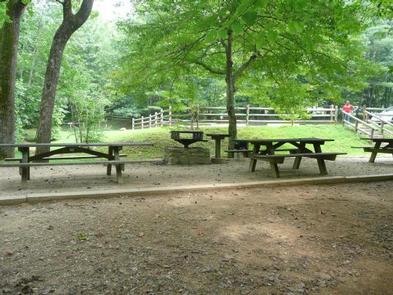
The picnic shelter is a historic structure that does not support accessibility standards. Parking is available in the day-use parking area and the shelter is reached via a foot bridge and along a gravel path. The shelter can accommodate up to 50 people. Amenities include electricity for lights and small appliances, a fireplace, eight picnic tables under the shelter with more nearby, a double pedestal grill, trash cans and a drinking fountain with a spigot. Flush toilets and showers are available at the beach bathhouse which include showers and changing areas. The beach area is within walking distance of the group picnic shelter. The day use area, including the picnic shelter, closes at 9 pm or dark, whichever comes first. The main gate on State Route 781 closes at 10 pm and visitors not camping need to exit the area before the gate closes. Guests attending events scheduled for the group picnic shelter are still responsible for the appropriate day use fee.
Natural Features
Cave Mountain Lake covers seven acres and was built in the late 1930s by the Civilian Conservation Corps, using existing natural rock buttresses to form the 35-foot dam. A grassy field extends from the lake’s sandy beach to forested hills that paint a scenic backdrop.
Nearby Attractions
Lexington, Virginia, just 20 minutes away, is home to several historic sites including the Stonewall Jackson House, George C. Marshall Museum and the Virignia Military Institute Museum. It’s a charming town with horse drawn carriage rides through the streets. Ice and other sundries can be found at small stores along State Route 759. Natural Bridge State Park is a short 8 mile drive and offers visitors views of a 215 foot tall Natural Bridge and limestone gorge, 6 miles of hiking trails, a Monacan Indian village, and the 30 foot cascade of Lace Falls.