COOKSON LAKE DISPERSED CAMPSITE, MI Campground Reservation, Info, Images, Map, Directions

COOKSON LAKE DISPERSED CAMPSITE, Michigan Campground Images, Info & Reservations

Listen

Directions

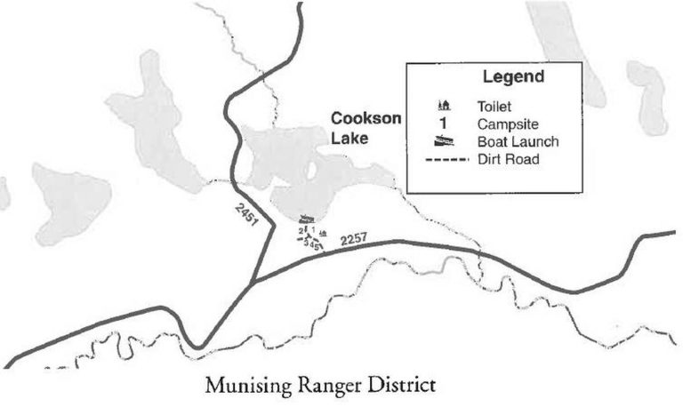
From Munising, Michigan, take State Route 28 east towards Shingleton. Turn south on Highway 13 at Wetmore. Turn left onto Forest Service Road 2258 and continue for about 5 miles. Just before reaching the bridge over the Indian River, turn east on Forest Service Road 2257. Travel about a mile and a half east to the campground.

Phone

906-387-2512

Activities

BIKING, BOATING, CAMPING, FISHING, SWIMMING SITE

Keywords

C114

Related Link(s)

Rec Area Info & Images

Michigan State Tourism

Michigan State Road Conditions

Overview

Cookson Lake Campsite offers a primitive place to stay in the thick of Michigan’s wilderness. Beautiful forests surround several lakes in the area, providing ample opportunity to enjoy nature in all its forms.

Recreation

Visitors enjoy swimming and fishing in the 35-acre adjacent lake. Largemouth bass, northern pike, bluegill and bullhead are among the typical catch. Licenses are required for fishing in Michigan waters.

Boating the lake is also a popular pastime, and a boat ramp is located near the campsite.

Facilities

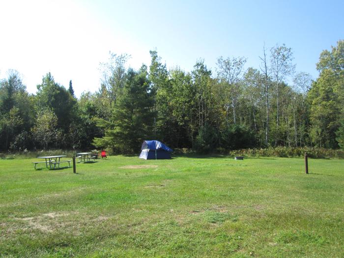
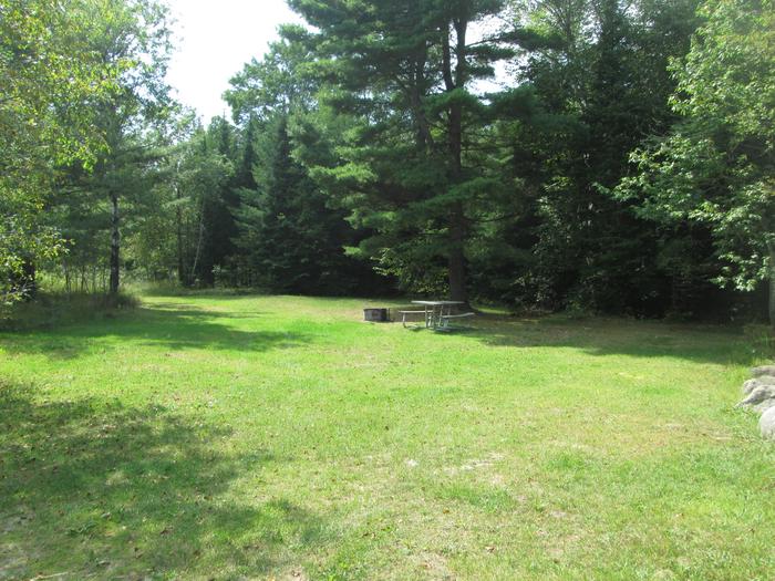
The campground offers five primitive campsites for tent and RV camping. Each offers tables and campfire rings. A pit toilet is located near one of the sites, but toilet paper is not provided.

Natural Features

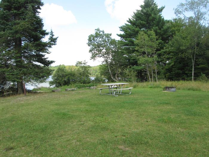
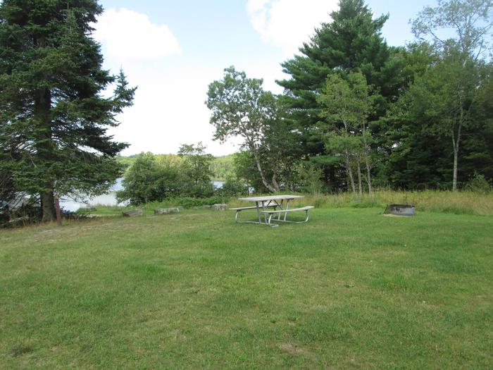
The campsite is located in a large open field on the shores of Cookson Lake. The lake boasts two small islands, and a variety of wildflowers abound in the area during warmer months.

Nearby Attractions

Cookson Lake is near the Indian Wild and Scenic rivers and the Big Island Lake Wilderness Area.

Reservation

More from CampingHiking.net:

OAK PARK DAY USE, Texas Campground Images, Info & Reservations

Listen Directions From Waco or Corsicana, Texas, take State Highway 31 to the intersection with FM 667. Turn north on FM 667 and travel about 1.5 miles to the park entrance on the left side of the road. Phone 254-578-1431 Activities SWIMMING Keywords Oak park Related Link(s) Rec Area Info

LOST CLAIM, California Campground Images, Info & Reservations

Listen Directions From Groveland, Take State Highway 120 east for 12 miles. The campground is just east of the Groveland Ranger District Office. Phone 209-379-2258 Activities BIKING, CAMPING, FISHING, HIKING, WILDLIFE VIEWING, STAR GAZING Keywords LOST CLAIM Related Link(s) Rec Area Info & Images California State Road Conditions Forest Service

VETERANS LAKE PAVILION, Oklahoma Campground Images, Info & Reservations

Listen Directions From I-35, take Exit #55 or #51 and drive towards the city of Davis, OK. Once in Davis, go east towards Sulphur on Highway 7 Watch for the Chickasaw National Recreation Area signs to direct you to your selected area: Campgrounds, Boat Ramps, Pavilion, and Picnic Area.- Drive

NORTH SHORE, Texas Campground Images, Info & Reservations

Listen Directions From Texarkana, take U.S. Highway 59 south approximately 10 miles. Turn right on Farm-to-Market (FM) Road 2148 and travel approximately 1.5 miles to the Wright Patman Lake sign. Turn left and follow park signs to the entrance. Phone 903-838-8781 Activities BOATING, INTERPRETIVE PROGRAMS, FISHING, WATER SPORTS, SWIMMING SITE,

Lodgepole Campground (MT), Montana Campground Images, Info & Reservations

Listen Directions From Philipsburg travel 10.75 miles south on State Highway 1. The campground is directly across the highway from Georgetown Lake and Red Bridge Boat Launch. Phone 406-210-8199 Activities BIKING, BOATING, CAMPING, FISHING, HIKING, HUNTING, WATER SPORTS, WILDLIFE VIEWING, SWIMMING SITE Keywords LODB,BEAVERHEAD-DEERLODGE NF -FS Related Link(s) Rec Area

Toto Creek Campground, Georgia Campground Images, Info & Reservations

Listen Directions Physical address is 154 Toto Creek Park Rd., Dawsonville, GA 30506 From Georgia Highway 400 North, exit left for Harmony Church Rd. heading east; stay straight onto Price Rd.; turn right on Toto Creek Park Rd.; turn right to continue on Toto Creek Park Rd.; road dead ends