FISH CREEK PAVILION, ID Campground Reservation, Info, Images, Map, Directions

FISH CREEK PAVILION, Idaho Campground Images, Info & Reservations

Directions

From Grangeville, head south on Grangeville-Salmon Road for approximately 7 miles to the Fish Creek Meadows area. Turn right onto Forest Road 4600. The entrance to Fish Creek Pavilion is located 300 feet ahead on the left.

Phone

208-983-1950

Activities

CAMPING, HIKING, HORSEBACK RIDING

Keywords

None

Related Link(s)

Rec Area Info & Images

Idaho State Tourism

Idaho State Road Conditions

Overview

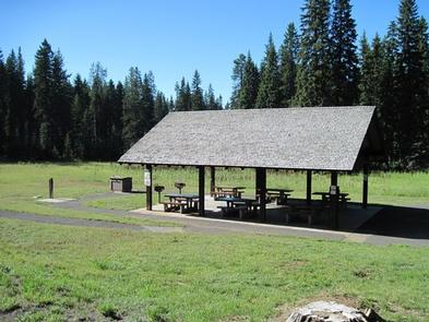
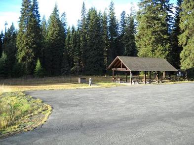
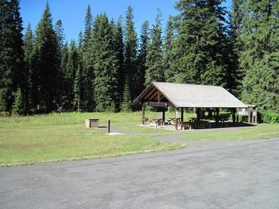
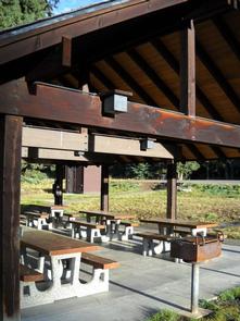
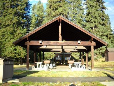
Fish Creek Pavilion is a day-use picnic area adjacent to Fish Creek Campground. It’s situated in a meadow surrounded by conifers and near a variety of recreational activities.

Recreation

The Fish Creek Cross Country Trail begins within the adjacent campground. This 7-mile multi-use loop is open to hikers, mountain bikers, horseback riders and off-road vehicle enthusiasts. Hikers will find additional foot trails as well.

Visitors who wish to camp can stay at Fish Creek Campground, which has first-come, first-served sites. Groups can reserve the Fish Creek Group Site about 2 miles down the road.

Facilities

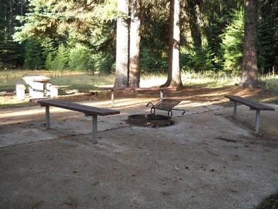
The accessible pavilion can accommodate up to 75 people. Eight picnic tables, two barbecue grills, electricity and lights are provided. Drinking water is available from June 15 to September 15. A short paved path leads to additional picnic tables and campfire circle with benches.

Natural Features

In the heart of north central Idaho, rugged peaks, deep canyons, dense forests and remote wilderness comprise the Nez Perce National Forest. Due in large part to dramatic elevational differences, the forest supports a wide variety of vegetation, from cedar groves to desert ecosystems.

Fish Creek Pavilion is located in the Salmon River/Highway 95 Corridor. The landscape here varies from the emerald Salmon River pouring through steep canyon walls to sapphire Moore’s Lake in the remote Gospel-Hump Wilderness.

Nearby Attractions

Grangeville is the nearest town. It offers camping supplies and a historical museum.

Reservation

More from CampingHiking.net:

KIRBY COVE CAMPGROUND, California Campground Images, Info & Reservations

Directions From San Francisco (travelling north):  Cross the Golden Gate Bridge and take exit 442 onto Alexander Avenue. This will be the exit after the Vista Point. Continue straight for about a mile, and then turn left onto Bunker Road. Travel through the Baker-Barry Tunnel and continue straight until you

CALABASAS, Arizona Campground Images, Info & Reservations

Directions From Tucson, Arizona, take I-19 south for about 56 miles. Exit onto AZ 289 (Exit 12). Turn right (west) onto AZ Highway 289 (Ruby Road) and continue to the Pe Blanca Recreational Area. From Nogales, Arizona, take I-19 north for about 4.4 miles. Exit onto AZ 289 (Exit 12).

KATY BRANCH, Tennessee Campground Images, Info & Reservations

Directions From Greeneville travel east to 11E to TN State Road 107. Travel approximately 14.5 miles to the gate at Katy Branch located on the right. (Landmarks will include Clark Creek Road on the right and Jackson Bridge Road on the left.) Unlock the gate and travel about .5 miles

OHAVER LAKE, Colorado Campground Images, Info & Reservations

Directions From Salida, Colorado: Travel west on Highway 50 to Poncha Springs. Turn south on Hwy 285 and travel for 5 miles. Turn right onto County Road 200 and continue for 2.3 miles. Turn west on County Road 202 and proceed 2.5 miles. Phone CAMPGROUNDS DO NOT HAVE PHONE SERVICE,

SLIDE CREEK, Oregon Campground Images, Info & Reservations

Directions From Blue River, travel 4 miles east on Hwy 126 to Aufderheide Drive (FS road 19). Proceed on Aufderheide Drive for 9.5 miles to FS road 1900-500 and continue for 1.5 miles to Slide Creek Campground. Phone 801-226-3564 Activities BOATING, FISHING, WATER SPORTS, WILDLIFE VIEWING, SWIMMING, BIRDING Keywords Slide