MOKINS BAY CAMPGROUND, ID Campground Reservation, Info, Images, Map, Directions

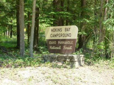
MOKINS BAY CAMPGROUND, Idaho Campground Images, Info & Reservations

Directions

From Coeur d’Alene, Idaho, take Route 95 north for 6.1 miles to Lancaster Road. Turn right and continue 6.3 miles to a ‘Y’ intersection. Bear right and continue to Mokins Road, turn left go 0.1 mile to campground entrance.

Phone

435-245-6521

Activities

BIKING, BOATING, CAMPING, FISHING, HIKING, WATER SPORTS, WILDLIFE VIEWING, SWIMMING SITE, MOUNTAIN BIKING, KAYAKING, CANOEING, JET SKIING

Keywords

Mokins Bay Campground,Mokins,Mokins Bay

Related Link(s)

Rec Area Info & Images

Idaho State Tourism

Forest Service Concessionaire

Idaho State Road Conditions

Overview

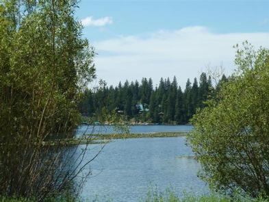
Mokins Bay Campground is located near the eastern shore of Hayden Lake in northwest Idaho. Its picturesque setting in the northwest portion of the Bitterroot Mountain range, known as the Coeur d’Alene mountains, creates solitude in a forested setting at this campground. The lake is a 10 minute walk from the campground.

Recreation

Fishing is popular in the surrounding lakes and streams, and cutthroat trout and large and small-mouth bass are the most common catches. Power boating and other water sports are also popular activities.

Facilities

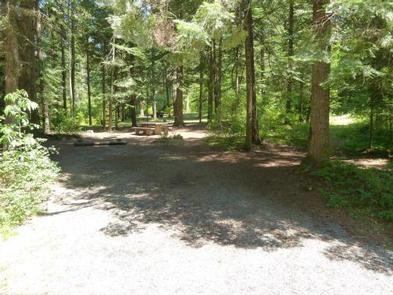
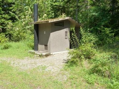
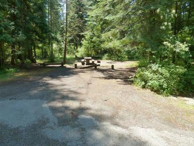
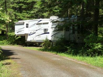
Drinking water, grills, paved parking spurs and vault toilets are among the amenities at Mokins. A horseshoe pit is also onsite. Access to campground is on a gravel road.

Natural Features

The small campground is surrounded by a heavy canopy of pines. Wildflowers like trillium and buttercups thrive in the springtime, creating a stunning backdrop for campers.

Hayden Lake boasts a 40-mile shoreline with a surface area of 3,800 acres. The lake was formed by the Missoula Floods that occurred nearly 15,000 years ago, at the end of the last ice age.

Nearby Attractions

The town of Coeur d’Alene, Idaho is 21 miles away, and offers several tourist attractions, as well as restaurants, gas and groceries.

Reservation

More from CampingHiking.net:

CARP RIVER CAMPGROUND, Michigan Campground Images, Info & Reservations

Directions 4664 Mackinac Trail, St Ignace Michigan 49781 From the intersection of US-2 and I-75, drive north on I-75 to exit 352. Turn right on County Road 123, then turn left on Mackinac Trail/Highway 63. Drive north approximately five miles, turn left onto FR 3445 and drive a quarter mile

OUTLET AT PRIEST LAKE, Idaho Campground Images, Info & Reservations

Directions Physical Address: Priest River, ID 83856 From I-90; Turn at Post Falls Highway 41 north to Newport, WA. Take Highway 2 east to Priest River. At the junction of Highway 57 and Highway 2, turn left. Drive 26 miles to Outlet Bay Road. Turn right for approximately 0.5 mile.

PLAYGROUND GROUP, Arizona Campground Images, Info & Reservations

Directions Take State Highway 89A (seven miles southwest of Jerome or 13 miles east of Prescott Valley) to Forest Road 104. Travel on Forest Road 104 for two miles to Playground Group Campground. Phone 928-567-4121 DURING OFFICE HOURS 0800-0430 M-F Activities CAMPING, PICNICKING Keywords PLAY,PRESCOTT NF – FS Related Link(s)

SQUAW LAKES, Oregon Campground Images, Info & Reservations

Directions From Jacksonville, Oregon, take Highway 238 west 7 miles and turn left at Ruch on Road 859. Go 14 miles to Applegate Dam, cross over the dam (Road 1075) and continue on pavement 2 miles. When pavement ends, continue 7 miles to the campground. Phone (541) 899-9220 Activities BIKING,