Directions
From Estacada, drive south on Highway 224 for 45 miles. The road becomes Forest Service Road 46. From Road 46, turn east onto Forest Service Road 4690 and drive 6 miles on pavement, then about 3 miles on gravel, to a junction with Forest Road 4220. Turn south and continue 4 miles to Olallie Lake Resort. The road continues south from the resort for 13 miles. The roads are closed in the winter.
Phone
503-630-6861
Activities
BOATING, CAMPING, FISHING, WILDLIFE VIEWING
Keywords
Olallie Lake Cabin,Olallie Forest Service Cabin
Related Link(s)
Overview
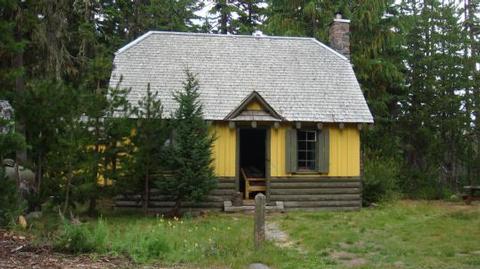
Olallie Lake Guard Station Cabin gives campers an old-fashioned cabin experience with its well-preserved features, including a massive rock chimney, interior wood and hand-wrought iron work. It provides access to a number of outdoor recreation opportunities as well as its namesake lake. The cabin is at nearly 5,000 feet so the season can be delayed by late snows which restricts cabin access.
Recreation
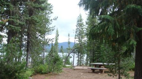
The Olallie Lake Guard Station Cabin is located in the heart of the Olallie Lake Scenic Area which has hundreds of lakes and miles of trails including the Pacific Crest Trail located adjacent to the cabin. Olallie Lake has non-motorized boating and excellent fishing. Rental row boats are available at the nearby Olallie Resort. The lake is stocked with rainbow and brook trout. Swimming in the lakes around the cabin can be very cold. Some of the trails and most of the graveled roads are open for mountain biking.
Facilities
The four-room guard station has a kitchen, living room with two futon couches, a bunk bedroom and a loft with a queen bed. The cabin sleeps up to eight people. It has propane lights, a propane refrigerator, stove and oven and basic cooking pots, pans and dishes and eating utensils. A table and chairs is provided. A wood stove is available for heat. Firewood is provided. The cabin has a limited water supply. The cabin has a 50 gallon water tank that the Forest Service will strive to refill as needed. However, excessive water use can drain the tank and depending on work schedules, a full tank is not assured. Cabin users can bring potable drinking water as a backup, boil lake water or buy water from the nearby resort. A vault toilet is located about 75 feet from the cabin and is used by others. Cell phone coverage is not available at the cabin and very spotty in the entire Olallie Lake Scenic Area.
Guests will need to bring sleeping bags or bedding, towels and wash cloths, paper towels, food and personal gear, as well as a flashlight or lantern for emergencies, a first aid kit, insect repellent (a must!), sunscreen and dish soap, among other necessities. Please bring garbage bags and clean the facility before leaving. This is a "Pack it in, Pack it out" site. There is no on site host or manager for the cabin. Forest Service personnel will be in the area periodically.
Guests can access the cabin by vehicle. Higher clearance or 4wd is preferable, but the cabin is accessible to 2wd passenger cars if they drive slow. Road conditions can be hampered by early or late snows. Guests are responsible for their own travel arrangements and safety..
Natural Features
This historically significant, two-story cabin was built by the Civilian Conservation Corps in the 1930’s for the Forest Ranger that patrolled the area. It is a classic example of the Forest Service rustic architectural style of Depression Era administration buildings. The cabin is located on the far south end of the Mt. Hood National Forest. It’s location near the shore of Olallie Lake affords visitors views of the north face of 10,497-foot Mt. Jefferson and 7,215-foot Olallie Butte, in the Cascade Mountains. The facility was listed on the National Register of Historic Places in 1991. Olallie is Chinook jargon for "berry."
Nearby Attractions
The Olallie Lake Resort is near the cabin. There is a store there that sells some food, bait, etc. The nearest town is Detroit which is 36 miles south. CJ’s Chevron is the north 40 miles on Hwy 26. The nearest water is Clackamas Lake Guard Station which is north on Road 42.


