


Directions
Public Transportation: Take the Q35 bus to the Flatbush Avenue/Ryan Visitor Center stop. Enter the park through the pedestrian gate and walk around the right side of the Visitor Center. Keep walking east for approximately 1 mile to the camp grounds. Passenger vehicles: Take the Belt Parkway to exit 11S, Flatbush Avenue South. Proceed approximately one mile south to the main entrance of Floyd Bennett Field on the left (the last traffic light before the Gil Hodges Memorial Toll Bridge.) Make a LEFT turn at the light. Follow directions below. RV Campers/Commerical vehicles: From Eastern Long Island (North Shore): Take I-495 West (Long Island Expressway) to I-278 West (Brooklyn Queens Expressway). Exit at Tillary Street (Exit 29). Make left at second traffic light onto Flatbush Avenue South. Stay on Flatbush Avenue approximately 10 miles until just before the Gil Hodges Memorial Bridge. Make a left turn at the last traffic light before the bridge to enter Floyd Bennett Field. After turning into Floyd Bennett Field make the first left turn and then the next right turn. Campground check-in is 1 mile ahead on the right. From Central New Jersey: Take I-95 to Exit 13 (Goethels Bridge – toll). Cross bridge to I-278 East (Brooklyn Queens Expressway). Exit at Atlantic Avenuue (Exit 27). Stay right onto Atlantic Avenue. Take Atlantic Avenue to Flatbush Avenue. Make a right onto Flatbush Avenue southbound. Stay on Flatbush Avenue approximately 10 miles until just before the Gil Hodges Memorial Bridge. Make left at last traffic light before bridge to enter Floyd Bennett Field. After turning into Floyd Bennett Field make the first left turn and then the next right turn. Campground check-in is 1 mile ahead on the right.
Phone
718-338-3799
Activities
BIKING, CAMPING, INTERPRETIVE PROGRAMS, FISHING, HIKING, HORSEBACK RIDING, WINTER SPORTS, VISITOR CENTER, STAR GAZING, RECREATION PROGRAMS, ARCHERY
Keywords
CAMP GATEWAY BROOKLYN NY,Gateway National Recreation Area,Floyd Bennett Field,Barren Island,Goldenrod,Jamaica Bay,Tamarack,Wiley Post
Related Link(s)
New York State Road Conditions
Overview
There’s no other campground in the world where a family can sleep under the stars, tour the Statue of Liberty, watch a Broadway musical and kayak in one of the world’s premier bird migration sanctuaries-all in one trip. Camp Gateway provides a tranquil outdoor experience right outside the nation’s most lively and iconic metropolis- New York City.
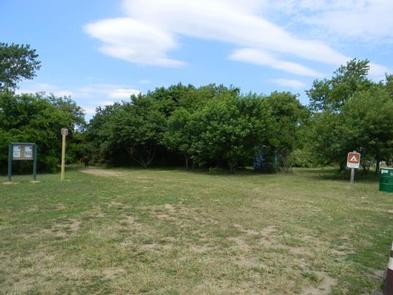
Located in Floyd Bennet Field in Brooklyn, New York, the campground offers an outdoor escape for hiking, biking, birding and historic tours of airports and forts.Ranger-led programs are available all summer.
Recreation
History buffs can visit Civil War-era forts, restored historic aircraft or Nike missile sites. Nature lovers can stroll wooded paths, watch for birds and horseshoe crabs or simply relax. Horseback riding, kayaking and archery are also options.
Facilities
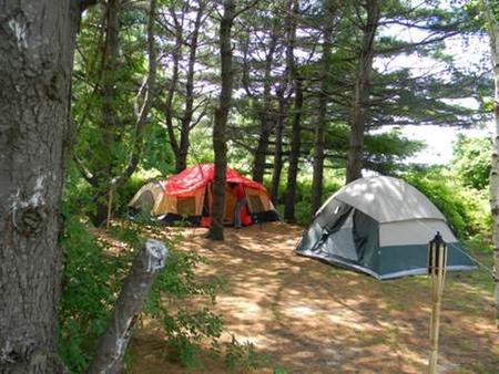
Public bus transportation takes campers to a subway station for easy access around the New York City metro area. Camp Gateway is open April – October and offers tent and RV camping. Generators are permitted during limited hours at RV sites only. Dump Station is available.
Natural Features
Gateway National Recreation Area exists within one of the most urbanized areas of the country, covering 26,000 acres of New Jersey and three New York City boroughs. Among the urban environment, the park boasts grasslands, woodlands, sand dunes, beaches, ponds, salt marshes and forests. Camp Gateway is in the woodland habitat of Floyd Bennet Field.
Nearby Attractions
Biking trails weave through Fort Tilden, with a military history that dates back to the War of 1812.
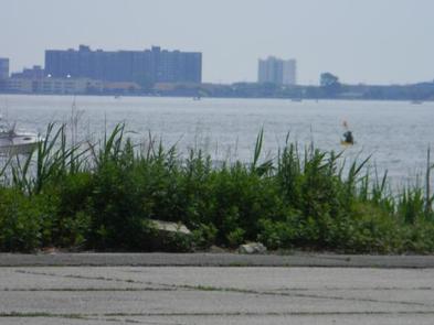
Birders should try the Jamaica Bay Wildlife Refuge with 300 species of migratory birds, with willets and green herons in spring and summer, or osprey and black crowned night herons year-round.
If the big city beckons, head to Riis Landing for seasonal ferry rides to Manhattan. Call for information.