DELTA, OR Campground Reservation, Info, Images, Map, Directions

DELTA, Oregon Campground Images, Info & Reservations

Directions

Located 51 miles from Eugene OR on HWY 126 to the Cougar Reservoir turn off. Take a right turn (south) on Aufderheide Drive and cross the McKenzie River, turn right on to the campground entrance road Forest Road 400. Follow the road approximately 1 mile to the campground.

Phone

801-226-3564

Activities

FISHING, PICNICKING, DAY USE AREA, RAFTING

Keywords

Delta,Delta Campground

Related Link(s)

Rec Area Info & Images

Oregon State Road Conditions

Oregon State Tourism

Forest Service Concessionaire

Overview

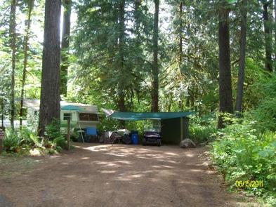
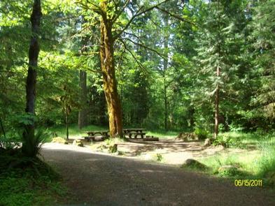
Known for its access to rafting and drift boat fishing on the McKenzie River, Delta campground, located along a portion of the West Cascades National Scenic Byway, is one of the largest and most scenic campgrounds on the McKenzie District. Access to the river, hiking and mountain biking trails are nearby. Reservations are available May through Mid-September, they can be made at least six months in advance, but must be made at least 4 days prior to your intended arrival date.

Recreation

Cougar Reservoir and Terwilliger Hot Springs make this campground a great spot for camping and exploring the area. Visitors can also enjoy a short botanical walk on the Delta Old Growth Nature Trail. A Day Use area and amphitheater are also available at the campground.

Nearby Attractions

There is a non-motorized boat launch within one mile. Within ten miles there is a motorized boat launch and access to flat water. Hiking and biking trails and Terwilliger Hot Springs are also within ten miles.

Reservation

More from CampingHiking.net:

BOGAN FLATS CAMPGROUND GRP S, Colorado Campground Images, Info & Reservations

Directions Take I-70 west of Denver, Colorado, to Glenwood Spring exit 116, Highway 82, south to Carbondale. Take Highway 133 south for 20 miles. Turn left on Gunnison County Road 3 toward Marble. Campground located another 1.5 miles near the river. Phone 970-927-0107 Activities BIKING, HISTORIC & CULTURAL SITE, CAMPING,

TEJAS PARK, Texas Campground Images, Info & Reservations

Directions From I-35, take Williams Drive west, then turn south on Farm to Market Rd 3405. Turn east on County Rd 258 and continue across the North San Gabriel River. Turn left into Tejas Park. Phone 512-930-5253 Activities CAMPING, FISHING, HIKING, HUNTING, WILDLIFE VIEWING, PADDLING, MOUNTAIN BIKING, WATER ACTIVITIES Keywords

HURRICANE CAMPGROUND, Virginia Campground Images, Info & Reservations

Directions From I-81: Take Marion exit 45 onto Virginia State Route 16 South. Follow SR 16 for 15 miles to SR 650 (5 miles south of Sugar Grove). Turn right on gravel SR 650, and follow for 2 miles to the paved campground entrance road. Phone 276-783-5196 Activities BIKING, CAMPING,