
Directions
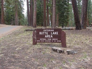
From Redding, California, drive 63 miles east on state Highway 44 to Old Station. From the intersection of Highway 44 and State Highway 89 , continue east on Highway 44 for 11 miles. Watch for sign to Butte Lake Campground. Turn right and continue for six miles on a rough gravel road. The stock corral road is located directly left of the Butte Lake self-registration entrance station. Turn left up the hill and take the immediate road to the right. Continue up the hill to the campsite and the corrals.
Phone
530-595-6121
Activities
BOATING, CAMPING, FISHING, HIKING, VISITOR CENTER, SWIMMING SITE
Keywords
Lassen Volcanic National Park
Related Link(s)
California State Road Conditions
Overview
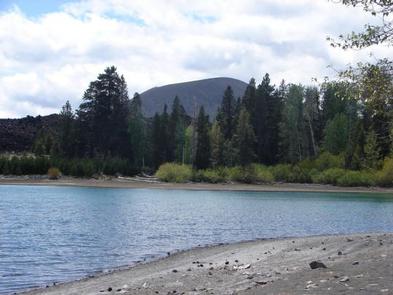
Butte Lake Stock Corral (elevation 6,100 ft.) is located in the northeastern section of Lassen Volcanic National Park in northern California. It is fairly remote and within walking distance of Butte Lake, which is popular for fishing, canoeing, kayaking and swimming. Several trails are located nearby. The facility is 45 minutes from the main park road.
Recreation
Outdoor enthusiasts stay at Butte Lake Stock Corral for its many recreation opportunities. The lake is popular for trout fishing, as well as non-motorized boating. Trailheads within the facility include the hike to Snag Lake, trails leading to the interior of the park, and the Cluster Lakes loop. Longer trails nearby will take you to Juniper Lake and Summit Lake. The Pacific Crest Trail can also be accessed from Butte Lake and runs through the park.
Facilities
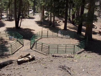
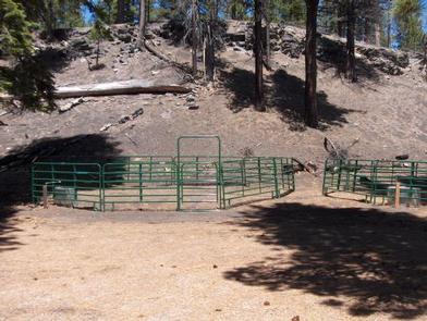
The stock corral area has two adjacent metal corrals with water troughs and spigots. A vault toilet is located next to the facility for the use of those reserving the corral. This facility is remote and you must travel on a six-mile gravel road to access the facility.
Natural Features
The area is dominated by Ponderosa pines and surrounded by soft volcanic soils. Extending into Butte Lake is a large black lava flow, creating rocky shores and interesting views for visitors in kayaks and canoes to explore. Trails suitable for horses are easily accessed from the corral and numerous forest roads just outside the park boundary.
The national park is known for its volcanic history, as well as its diversity of plants and animals. It contains 300 active volcanic domes and many hydrothermal features, such as mud pots and steam vents. Lassen Peak is the southernmost active volcano in the Cascades, and the second most recent volcano to erupt in the lower 48 of the United States before Mount Saint Helens.
Lassen Volcanic National Park boasts over 700 species of flowering plants and 250 species of vertebrates, including birds, mammals, reptiles and fish. The park is at the junction of the Cascade Mountains, the Sierra Nevada Mountains and the Great Basin, thus providing many unique habitats.
Nearby Attractions
The Caribou Wilderness area is managed by the Forest Service has numerous trails that are suitable for stock use and can be accessed directly from the park via the Widow Lake trail.