Directions
Point Reyes is located approximately 50 miles north of San Francisco and can be approached either northbound or southbound via Highway 101 and Exit 450A/B Sir Francis Drake Highway. Visitors can also reach the park via the longer and winding scenic Highway 1 or the Point Reyes Petaluma Road.
Public transportation to the Bear Valley Visitor Center from San Rafael along Sir Francis Drake Boulevard is available through the West Marin Stagecoach.
Directions http://www.nps.gov/pore/planyourvisit/directions.htm for the quickest routes to Point Reyes National Seashore’s Bear Valley Visitor Center.
Bear Valley Visitor Center GPS:
Latitude: North 38 degrees, 2 minutes and 27 seconds. Longitude: West 122 degrees, 48 Minutes and 1 second.
Phone
415-464-5100 X2 X5
Activities
BIKING, BOATING, HISTORIC & CULTURAL SITE, CAMPING, FISHING, HIKING, VISITOR CENTER, SWIMMING SITE
Keywords
Coast Camp,Glen Camp,Sky Camp,Wild Cat Camp,Tomales Bay
Related Link(s)
California State Road Conditions
Overview
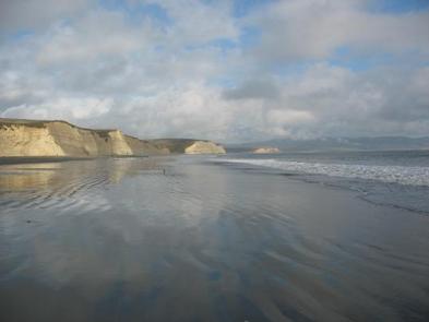
From its thunderous ocean breakers crashing against rocky headlands and expansive sand beaches to its open grasslands, brushy hillsides and forested ridges, Point Reyes offers visitors over 1000 species of plants and animals to discover. Bordered by the San Andreas Fault, home to several cultures over thousands of years, the Seashore preserves a tapestry of stories and interactions of people. Point Reyes awaits your exploration.
Five campgrounds/loops are available for reservations – four hike-in/bike-in campground/loops and one boat-in loop along Tomales Bay. There is NO car or RV camping at Point Reyes National Seashore
For more information, visit the Back Country Camping page on the Point Reyes National Seashore website.
Recreation
Activities include hiking, limited bike riding along the borders of the Philip Burton Wilderness, bird watching, and beach walking. In the winter season whale watching and northern elephant seal populations may be viewed (though not in the backpacking or boat-in areas).
Facilities
Camping facilities at Point Reyes National Seahsore include four hike-in/bike-in-only campgrounds in the southern area of the park and twenty boat-in-only campsites on Tomales Bay. Camping is allowed only in designated campgrounds and sites. Dispersed camping is not allowed. There is NO car or RV camping at Point Reyes National Seashore
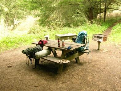
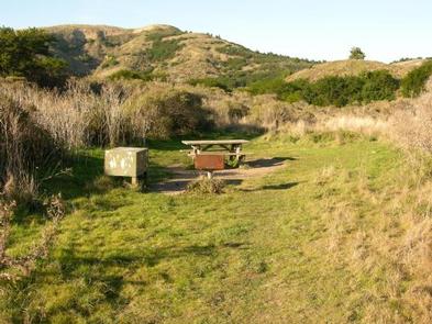
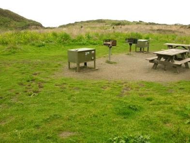
Amenities at the hike-in/bike-in sites included picnic tables, charcoal-only grills, and food storage lockers with centrally located vault toilets and drinking water. No pets permitted. Boat-in sites have no amenities (except for vault toilets on Marshall and Tomales Beaches and picnic tables on Tomales Beach).
Hike-in/Bike-in Campgrounds ( referred to as “loops”, include:
COAST CAMP – Coast Camp is nestled within a small coastal grassy valley with easy access to the beach and tide pools. The beach is within 200 meters (200 yards) of the campground. The shortest approach to Coast Camp is via the 3 km (2 miles) slightly uphill hike on the Laguna and Firelane Trails starting at the Laguna Trailhead just past the hostel. An alternate route following the Coast Trail starting near the hostel offers an easy, flat 4 km (3 miles) route and is open to bicycles. Eleven reservable sites for up to 6 people each and two reservable group sites for up to 25 people each are available. Sites 1 – 7 are in a small semi-protected canyon.
GLEN CAMP – Glen Camp is a quiet and secluded camp deep within a wooded valley protected from ocean breezes. The shortest hike to this camp is a moderate 7 km (5 miles) hike along the Bear Valley and Glen Trails. To access Glen Camp by bicycle, start at the Five Brooks Trailhead, follow the Stewart Trail to the Glen Trail, then north to the Glen Camp Loop, and finish by descending to Glen Camp. This is a strenuous 10 km (6 mile) bike ride. The nearest beach access is a 4 km (3 mile) strenuous one-way hike to the beach at Wildcat Camp. No groups, horses, or pack animals are allowed at Glen Camp. Eleven reservable sites for up to 6 people each are available.
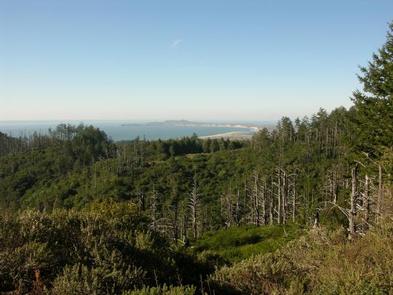
SKY CAMP – Sky Camp is located on the western side of Mt. Wittenberg at an elevation of 310 meters (1025 feet). In clear weather, enjoy sweeping views of Point Reyes, Drakes Bay, and the Pacific Ocean. The easiest and shortest approach is a 2 km (2 miles) moderate uphill hike or bicycle ride from the Sky Trailhead (elevation 250 meters (840 feet)) on Limantour Road. It is a steep 6 km (4 miles) one-way hike down to the beach. Ten reservable sites for up to 6 people each and one reservable group site for up to 25 people each are available.
WILDCAT CAMP – Wildcat Camp is located in an open meadow on a bluff overlooking the ocean with a short walk to the beach and a 3 km (2.0 miles) round-trip walk to Alamere Falls. It is a 10 km (6 mile) hike from Bear Valley or a 9 km (6 miles) hike on the Coast Trail from Palomarin with access to Bass Lake. The only bicycle route is via a strenuous 11 km (7 miles) ride along the Stewart Trail from the Five Brooks Trailhead. One reservable site for up to 6 people, three reservable sites for up to 4 people, and three reservable group sites for up to 25 people each are available.
Boat-in Campground:
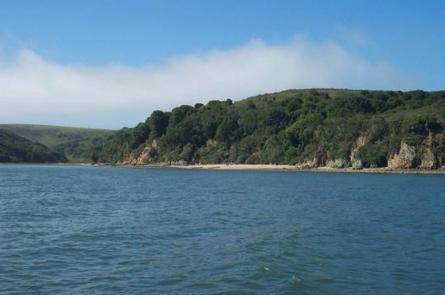
TOMALES BAY – Tomales Bay boat-in camping is allowed on west-side National Park beaches north of Tomales Bay State Park’s Indian Beach. These beaches are tidally influenced and generally are small sandy coves backed against steep cliffs. Campers on Tomales Bay beaches must arrive by boat and may not hike, bike, or ride horses to the beaches. Beaches are not assigned; campers choose available beaches on a first-come, first-served basis after launching. Overnight parking for boat-in campers is availabe at the Tomales Bay Resort and at the Miller Boat Launch and is othewise prohibited within Point Reyes National Seashore and Tomales Bay State Park. The beaches are primitive and without facilities with the exception of vault toilets at Marshall and Tomales Beaches and two picnic tables at Tomales Beach. Unless using the vault toilets at Marshall and Tomales Beaches, boat-in campers must bring portable toilets to remove human waste. In addition, all trash must be removed. Boat-in campers must bring water, racoon-proof food storage, and firewood. Permanent and seasonal closures exisit on some beaches. Check with the Bear Valley Visitor Center for updates. Twenty permits are available each day – nine to parties of 1 to 6 people, eight to parties of 7 to 14 people, and three to parties of 15 to 25 people.
Natural Features
Point Reyes is a peninsula, one and half hours north of San Francisco providing a welcome respite for the surrounding urban area. Wooded hillsides give way to chaparral and grasslands with 150 miles of hiking trails and several beaches.
Nearby Attractions
The Seashore shares the peninsula with Tomales Bay State Park, a day-use area popular for swimming and picnicking.
Charges & Cancellations
There is no peak season at Point Reyes, rates are the same year round. An Individual or Standard site accomodates 1-6 poeple, and are $20 per night. . A group site accomodates up to 25 people ( $40 per night 7-14 people, and $50 per night 15-25 people).

