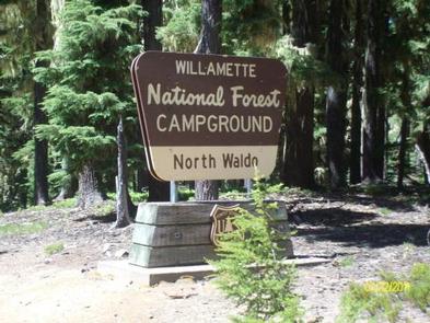
NORTH WALDO, OR Campground Reservation, Info, Images, Map, Directions

NORTH WALDO, Oregon Campground Images, Info & Reservations

Directions

From Oakridge, follow Hwy 58 east for 25 miles to the Waldo Lake Road (FS Road 5897). Follow Waldo Lake Road for 11 miles to FS Road 5898. Follow FS Road 5898 to FS Road 5895. Continue on FS Road 5895 to North Waldo Campground.

Phone

801-226-3564

Activities

BOATING, FISHING, HIKING, DAY USE AREA, SWIMMING

Keywords

Waldo Lake,Waldo

Related Link(s)

Rec Area Info & Images

Oregon State Tourism

Forest Service Concessionaire

Oregon State Road Conditions

Overview

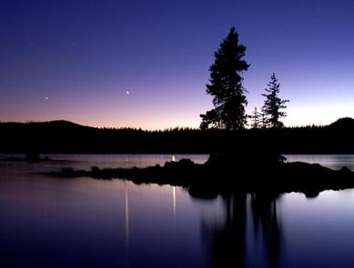
Waldo Lake is one of the largest natural lakes in Oregon. It offers a uniquely peaceful setting on the water and along remote shorelines, surrounded by forests of Douglas fir and mountain hemlock. Recreation in the area is abundant with the lake an ideal location for water activities like sailing, canoeing and swimming.

Recreation

Waldo Lake is circled by the Jim Weaver Loop, 20 miles of trail for hiking and biking. Bikes are allowed on the trails, but not in the nearby Waldo Lake Wilderness. There is also easy access to the Pacific Crest Trail and North Waldo is also a popular starting point for many wilderness trails and lakes, most notably the Rigdon, Wahanna and Torrey Lakes. There is a 1-mile Shoreline Trail between North Waldo Campground and Islet Campground which provides a short and pleasant hike along the lakeshore.

Facilities

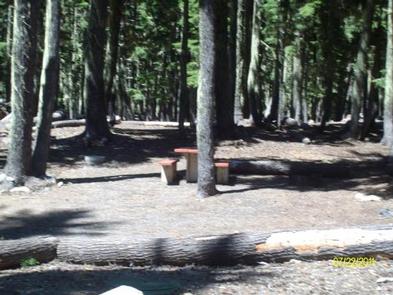
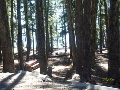
North Waldo is the most popular of the Waldo Lake Campgrounds. There are 58 sites with fire rings and tables, 34 are reservable. The boat launch is somewhat deeper than the others on the lake, which is more accommodating for large sailboats. The drier environment supports fewer mosquitoes, but they are still plentiful in season. This facility is operated by American Land & Leisure. We appreciate hearing from you. Comment cards are available from campground hosts or online at www.americanll.com.

Natural Features

Situated high on the western slopes of the Oregon Cascades at 5,400 feet in elevation, Waldo Lake is one of the purest lakes in Oregon (9.8 square miles with a maximum depth of 427 feet). It has no permanent inlet to bring nutrients into the lake for plant growth. The lack of plant life contributes to its purity, allowing you to see to depths of 120 feet on a calm day.

Reservation

More from CampingHiking.net:

EAGLE GLACIER CABIN, Alaska Campground Images, Info & Reservations

Directions Located 23 miles northwest of Juneau. Access by the Amalga trail, 5.5 miles to the cabin from mile marker 27.3 on the Glacier Highway. The trailhead is on the north end of Eagle River Bridge and follows upstream on north side of Eagle River. The cabin is also accessible

DOVER, Tennessee Campground Images, Info & Reservations

Directions From Nashville, or St.Louis , take I-24 Clarksville, take Exit 8 for TN 237 W. 2.4 Mi., Right onto Warfield Blvd 1.6 Mi. continue onto 101st Airborne PKWY for 6.3 Mi. contine onto TN 347 -PKWY for 4.5 Mi. Turn right onto US 79 S. for 24.2 Mi. Turn

COTTONWOOD CAMPGROUND (WA), Washington Campground Images, Info & Reservations

Directions From Naches, take Highway 410 northeast 22.5 miles to milepost 99.5. Phone 541-338-7869 Activities CAMPING, FISHING, HIKING, WATER SPORTS Keywords CTWD,OKANOGAN – WENATCHEE NF -FS,COTTONWOOD,COTTONWOOD CAMPGROUND Related Link(s) Rec Area Info & Images Washington State Tourism Washington State Road Conditions Forest Service Concessionaire Overview Cottonwood Campground is located along

KNUTSON DAM, Minnesota Campground Images, Info & Reservations

Directions The campground is located 6 miles east of Cass Lake on U.S. Highway 2, and 5 miles north on County Road 10. Phone 218-835-4291 Activities BOATING, CAMPING, FISHING, WATER SPORTS, WILDLIFE VIEWING, SWIMMING SITE Keywords KDam,Knutson Related Link(s) Rec Area Info & Images Minnesota State Road Conditions Minnesota State

WHITE CLOUD, California Campground Images, Info & Reservations

Directions From Nevada City, travel east on Highway 20 for 10 miles. Turn right at the White Cloud Campground sign and then the first right into the campground. From Interstate 80 take exit 161, Highway 20 to Nevada City and drive 26 miles west toward Nevada City. Turn left at

KELLY DAHL, Colorado Campground Images, Info & Reservations

Directions From Denver, go north on Interstate 25 to US Highway 36 west to Boulder. Take Colorado Highway 119 (Canyon Boulevard) west for 22 miles to Nederland. Continue south for 4 miles to the campground. Phone 303-541-2500 Activities CAMPING, HIKING, HORSEBACK RIDING Keywords KELD,KELLY DAHL,ARAPAHO AND ROOSEVELT NF – FS