ASPEN GROUP (INYO), CA Campground Reservation, Info, Images, Map, Directions

ASPEN GROUP (INYO), California Campground Images, Info & Reservations

Listen

Directions

From Bishop, California, take Highway 395 northwest for 25 miles. Turn south at Tom’s Place, and continue driving south for 4 miles onto Rock Creek Road, following signs to the campground.

Phone

760-935-4321

Activities

CAMPING

Keywords

ASPR,INYO NF – FS

Related Link(s)

Rec Area Info & Images

Forest Service Concessionaire

California State Tourism

California State Road Conditions

Overview

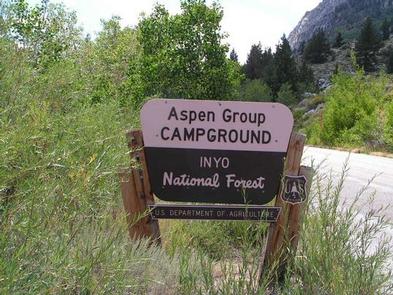
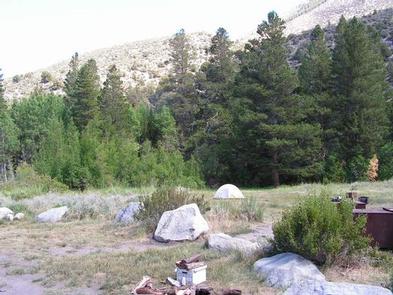
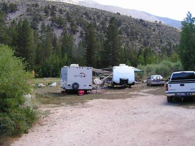
Aspen Group Campground is a secluded, creek side camp in Inyo National Forest between Mammoth Lakes and Bishop, California. The group camping area is primitive and provides spectacular scenery, as well as fishing, hiking, photography and wildlife viewing.

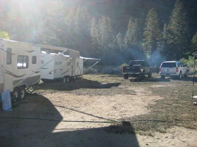
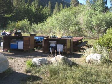
The campground has plenty of wide-open spaces and group picnic areas, making it ideal for large parties and family functions.

Recreation

Rock Creek and other waterways in the eastern Sierra Nevada Mountains are known for their exceptional trout fishing. A catch from the creek may include brook, brown, rainbow and stocked Alpers trout, while anglers may be treated to golden trout in the backcountry.

Hikers can explore the area majestic scenery on trails that meander around high-elevation alpine lakes. Several non-wilderness trails that range from easy to challenging, are a draw for mountain bikers in and around Rock Creek Canyon.

Facilities

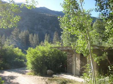
The group camping area can be reserved for up to 25 guests. It provides flush toilets and drinking water, as well as ample space for RVs and tents.

Natural Features

The campground sits in a stand of rustling aspen trees that shimmer golden in fall. Situated at an elevation of 8,100 feet, Aspen offers views of massive peaks to the west and surrounding steep canyons.

The group site is adjacent to the clear, cold and cascading Rock Creek, which originates in the John Muir Wilderness and runs for 22 miles through the bottom of Rock Creek Canyon.

The area is home to abundant wildlife, including black bear, mountain lions, mule deer, pine martin, marmot and many species of fish and birds.

Nearby Attractions

A commercial pack station is within close proximity for horse enthusiasts looking for an outdoor adventure. Several general stores, restaurants, and pay showers are available at nearby resorts.

Reservation

More from CampingHiking.net:

BERLIN FLATS, Idaho Campground Images, Info & Reservations

Listen Directions From Coeur d’Alene, the route is 28 miles east on Interstate 90, then 26 miles north (Kingston exit) on paved Forest Road #9, then 5 miles north from Prichard on paved Forest Road #208, then 9 miles north on Forest Road #412 (paved except 2 miles). Phone 435-245-6521

BEAVER SULPHUR, Oregon Campground Images, Info & Reservations

Listen Directions From Jacksonville, OR, travel south 8 miles on Highway 238 to Ruch, OR, and turn left on to Upper Applegate Road (County Road 859). Continue approximately 8.5 miles and turn left on to Forest Road 20. Continue 3 miles to Beaver-Sulphur Campground, the entrance is on the right.

RED IVES CABIN, Idaho Campground Images, Info & Reservations

Listen Directions From St. Maries, Idaho: Follow paved Forest Highway 50 (St. Joe River Rd) 47 miles to Avery. Continue 29 more miles along FH-50 to the Red Ives Road #218. Turn right (south) on road #218 and travel 10 miles upstream to the Red Ives Ranger Station. The Red

LITTCARR CAMPGROUND, Kentucky Campground Images, Info & Reservations

Listen Directions From I-75, take Exit 38 (SR-192) east to Daniel Boone Parkway to SR-15. Travel SR-15 south to SR-160, turn north and follow for 4 miles. Campground is on the east side of SR-160. Phone 606-642-3052 Activities BOATING, CAMPING, FISHING, HUNTING, DAY USE AREA, SWIMMING SITE Keywords LITT,CARR CREEK

WATERVILLE CAMPGROUND, New Hampshire Campground Images, Info & Reservations

Listen Directions From Highway 93, take exit 28. Follow Highway 49 east for 10 miles, then turn left on Tripoli Road. The campground is 0.25 miles on the left. Phone 603-536-6100 Activities BIKING, BOATING, CAMPING, FISHING, HIKING, HORSEBACK RIDING, WINTER SPORTS, SWIMMING SITE Keywords WATE,WHITE MOUNTAIN NF -FS Related Link(s)

EAST FORK CALIFORNIA, California Campground Images, Info & Reservations

Listen Directions From Bishop or Mammoth Lakes, California, follow U.S. Highway 395 (about 30 miles north of Bishop). Take the Tom’s Place exit and go 6 miles on Rock Creek Road. Phone 760-935-4825 Activities CAMPING, FISHING, HIKING, HORSEBACK RIDING, PICNICKING, WILDLIFE VIEWING Keywords EASF,INYO NF – FS Related Link(s) Rec