
Directions
Travel east of Beaver approximately 10 miles on SR 153, then turn right on to Forest Road 137 for about 5 miles.
Phone
435-438-2436
Activities
CAMPING, FISHING, WILDLIFE VIEWING
Keywords
Middle Kents Lake,Kents Lake,Kent’s Lake
Related Link(s)
Overview
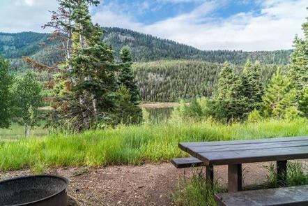
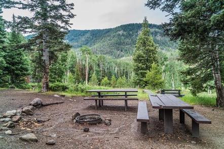
Kents Lake Campground has 28 single family campsites and two multiple family campsites. It is situated in a beautiful forested setting at an elevation of 8,800 feet.
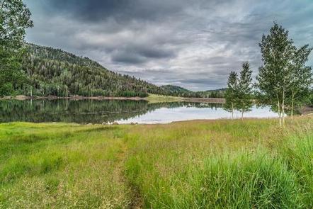
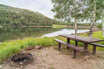
The campground is located adjacent to Kents Lake, which is approximately 50 acres in size and suitable for small fishing boats and canoes. Kents Lake is stocked with a variety of trout, all catchable from shore or boat.
Recreation
Anglers can fish for brown, brook and rainbow trout in Kents Lake from the shore or small non-motorized boat.
Trailheads to the Piute ATV trail are close by, but there is no direct access from the campground.
Facilities
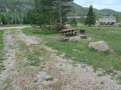
Kents Lake Campground has 28 single family campsites and 2 multiple family campsites. Sites vary from back-in to pull-through sites and will accomodate trailers from 24 to 60 feet long. All units have grills and/or fire rings and picnic tables. Drinking water is available throughout the campground. There are two vault toilets in the campground.
There are no hook ups available. The nearest dump station is located in Beaver.
Natural Features
The Fishlake National Forest in central Utah features majestic stands of aspen encircling open mountain meadows that are lush with a diverse community of forbs and grasses. Elk, deer, black bear, cougar and moose can be found on the Forest, as well as wild turkey and mountain goats.
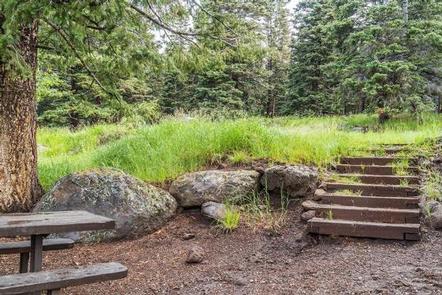
The campground is mainly in an aspen stand with a mix of conifers. The trees provide a range of shade depending on location. Some areas are lighter or heavier shade, depending on site. The majority are well-shaded.