
Directions
Begin at ramp onto Gene Snyder Freeway KY-841W toward I-65, traveling 6.5 miles. Take I-65/Louisville/Nashville, Exit Number 10, onto I-65 S toward Nashville/Elizabethtown, traveling 34 miles. Take US-31W/KY-62/Wendell H Ford Western Kentucky Parkway/Hodgenville/Paducah, Exit Number 91, toward Paducah/Elizabethtown/Owensboro/Western Kentucky Parkway W, traveling 29.6 miles. Take KY-259/Leitchfield/Brownsville, Exit Number 107, traveling .3 miles. Turn right onto S Main Street/KY-259, traveling .9 miles. Take 3rd exit from roundabout Courthouse Square onto W Main Street/KY-54, traveling 10.9 miles. Turn right onto Falls of Rough Road/KY-79, traveling 4.6 miles. Turn right onto Cave Creek Road KY-736, traveling 1.8 miles. End at 1543 Cave Creek Road, Falls of Rough, KY. Distance is approximately 90 miles with an approximate travel time of 1.5 hours.
Phone
270-879-4304
Activities
BOATING, CAMPING, FISHING
Keywords
CAVK,Rough River Lake.,ROUGH RIVER LAKE
Related Link(s)
Kentucky State Road Conditions
Overview
Cave Creek Campground is located on the shore of Rough River Lake in south central Kentucky.
The 5,100-acre lake is a hometown paradise for visitors who love the outdoors, and more than two million visitors camp, picnic, fish, swim, boat and relax on the lake shore each year.
Recreation
A wide variety of recreational activities and facilities are provided at the lake, including ample opportunities for boating and fishing.
The most sought after fish are bass, crappie and catfish, and bass tournaments occur at the lake throughout the year.
Additionally, pontoon, johnboat and jet ski rentals are available at the nearby marinas.
Facilities
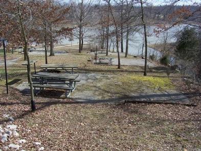
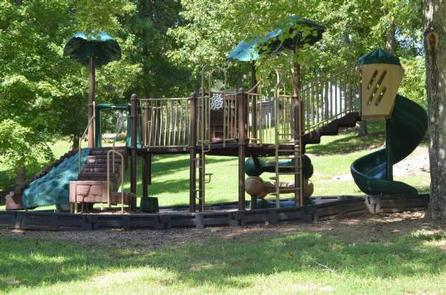
Cave Creek Campground offers 65 campsites, 36 of which have electric hookups. The facility also provides a dump station, playground, boat ramp, drinking water, a shower house, disc golf course, basketball court, and fishing pier.
Natural Features
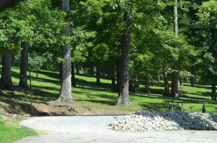
The rolling, forested hills of rural south central Kentucky offer an extraordinary setting for those who visit the lake. Rough River Lake provides views of ancient sandstone, shale and limestone cliffs.
An abundance of water in the area, both surface and underground, has carved through limestone to create a myriad of sinks and caverns.
The lake itself is home to numerous species of wildlife, including migratory songbirds and waterfowl.
Nearby Attractions
This historic Green Farm is adjacent to the lake. It consists of about 3,000 acres, a large ancestral home, an old water-powered mill, and a golf course.
Mammoth Cave National Park, which boasts the longest cave system in the world with more than 240 miles of mapped passageways, is about a one-hour drive away.
Other nearby attractions also include the historic Holt House in Hardinsburg, the Jack Thomas House in Leitchfield, and the new Aquatic Center in Leitchfield.
Charges & Cancellations
Once a reservation has been created, there will be a $10 fee to cancel your reservation, change sites, or change dates. Cancellations made the date before you are scheduled to arrive through the day after your arrival date will also be charged the first night’s use fee. No-show’s are charged a $20 fee plus the first night’s use fee. If your reservaiton is for onliy 1 night, and you have been charged the first night’s use fee, there is no $10 or $20 service fee charged.