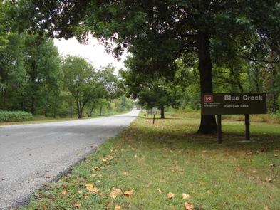
BLUE CREEK, OK Campground Reservation, Info, Images, Map, Directions

BLUE CREEK, Oklahoma Campground Images, Info & Reservations

Directions

From Tulsa, OK, take U.S. Highway 169 north for 23 miles to Highway 88. Turn right and continue for nearly 6 miles. Turn right onto Edgewater Road, then left on Spencer Creek Road. After about a mile turn left onto Blue Creek Road and continue into the campground.

Phone

918-341-4244

Activities

BOATING, CAMPING, FISHING, HIKING, VISITOR CENTER, WATER SPORTS, SWIMMING SITE

Keywords

BLCR,OOLOGAH LAKE,OOLOGAH LAKE

Related Link(s)

Rec Area Info & Images

Oklahoma State Tourism

Oklahoma State Road Conditions

Overview

Blue Creek is located on Oologah Lake in northeast Oklahoma, about 45 miles from Tulsa. The lake provides an ideal getaway for fishing, boating, picnicking and camping. Prevailing winds make Oologah one of the most popular lakes in the area for sailing.

Recreation

Oologah Lake is a prime location for boating, sailing, water skiing and swimming. Several recreation areas with boat ramps and docks are scattered around the lake.

Fishing is a popular pastime. Black bass, crappie, paddlefish, channel and blue catfish, walleye and hybrid striped bass are the primary sport species found in the lake. Young anglers love the Kid’s Sun, Fun and Fishing Derby Day held annually in June.

The Will Rogers Country Centennial Trail stretches 18 miles from Blue Creek Park to the Spillway. This scenic path winds around the east side of the shore and is open to hikers and horseback riders.

The forested hills of the Oologah Wildlife Management Area provide excellent hunting opportunities, with nearly 13,000 acres open to the public.
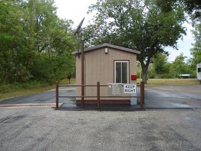
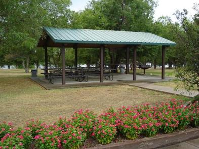
Facilities

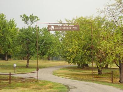
The campground offers spacious campsites with electric hookups. A group day-use picnic shelter with electric is also available and can accommodate up to 100 guests. The campground also includes a loop of equestrian sites.

Natural Features

Oologah Lake sits on the Verdigris River with a surface area of nearly 30,000 acres. Over 200 miles of shoreline are dominated by old-growth post oak and blackjack oak forests, which provide habitat for a variety of wildlife and birds, including deer, turkey, rabbits, quail, squirrels, ducks, geese and doves.

Nearby Attractions

Dog Iron Ranch, the birthplace of Will Rogers, is nearby. The ranch is a living history museum featuring Rogers’ two-story post-Civil War birth home, educational programs, picnic areas and a 400-acre pasture on the lake shore with Texas Longhorn cattle and other livestock. The ranch is open year-round.

Reservation

More from CampingHiking.net:

JESS JUDY, West Virginia Campground Images, Info & Reservations

Directions Follow 28/55 from Petersburg, WV, for 8 miles. Turn left onto Smoke Hole Road, Route 28/11, and travel for 13 miles to County Route 2. Turn left onto Smoke Hole Road, County Route 2, and follow for approximately 2 miles. Jess Judy Campground will be on the right. Phone

STILLHOUSE, Texas Campground Images, Info & Reservations

Directions From Interstate 35 in Belton, Texas take State Highway 190 west to the Simmons Road exit. Exit and turn left under 190 onto Simmons Road. Proceed about three miles to the park. Phone 254-939-6741 Activities BOATING, CAMPING, FISHING, SWIMMING SITE Keywords STIL,STILLHOUSE HOLLOW PARK,STILLHOUSE HOLLOW Related Link(s) Rec Area

COTTONWOOD (TX), Texas Campground Images, Info & Reservations

Directions From Interstate 10, take State Highway 385 south to Fort Stockton and into Marathon. From Marathon, drive 40 miles south on State Highway 385 to the north entrance of Big Bend National Park. Drive straight for 26 miles to Park Headquarters at Panther Junction. Turn right at the intersection

SINKHOLE CAMPGROUND, Arizona Campground Images, Info & Reservations

Directions Located on Willow Springs Lake Road approximately 1/2 mile off of Highway 260. Phone 928-535-9859 Activities CAMPING Keywords Related Link(s) Rec Area Info & Images Arizona State Road Conditions Arizona State Tourism Overview Located in the ponderosa pine forest, this campground is within walking distance of Willow Springs Lake

HOLIDAY, Georgia Campground Images, Info & Reservations

Directions From LaGrange, Georgia, take State Highway 109 west for 7 miles. After crossing the First Lake Bridge, continue another mile and turn left onto Thompson Road. At the next intersection, bear left and follow signs to the park. This county road leads directly into the campground. Phone 706-884-6818 Activities

DOLL MT. CAMPGROUND, Georgia Campground Images, Info & Reservations

Directions From Atlanta, take I-75 north to Exit 293, then Highway 411 north to Highway 136. Turn right on Highway 136 and follow to Highway 382. Turn left on Highway 382 and look for signs to the campground– access road is directly across from the volunteer fire station. Physical address