
Directions
From Centerville, IA, travel 2.5 miles north on HWY 5, then go 4 miles northwest on J-29, then 0.1 mile north on J5T to the park entrance.
Phone
FOR CAMPGROUND INQUIRIES DURING MAY-SEPTEMBER PLEASE CALL 641-647-2079. DURING CLOSED SEASON OCTOBER-APRIL PLEASE CALL 641-647-2464
Activities
BIKING, BOATING, CAMPING, FISHING, HIKING, PICNICKING, WILDLIFE VIEWING, FISH HATCHERY, DAY USE AREA, SWIMMING SITE, INFORMATION SITE, SWIMMING, KAYAKING, CANOEING, WATER ACCESS, SAILING
Keywords
ISLA,RATHBUN LAKE,ISLAND VIEW RATHBUN LAKE,RATHBUN LAKE
Related Link(s)
Overview
Island View Park is located on beautiful Rathbun Lake, just nine miles northwest of Centerville, Iowa and 8 miles southwest of Moravia.
Recreation
The 11,000-acre lake provides a variety of fishing opportunities for any angler: Crappie, channel catfish, walleye and largemouth bass are most common.
The prevailing winds on Rathbun Lake, also known as Iowa’s Ocean, make it one of the best sailing lakes in Iowa.
Facilities
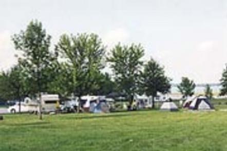
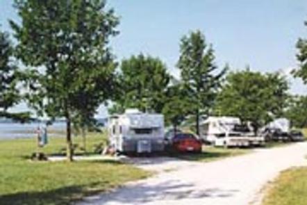
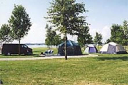
This large campground offers 187 family sites and one group site, all with electric hookups. Three group picnic sites are also available.
Amenities include flush and pit toilets, showers, drinking water and a dump station. A boat ramp, dock, marina, playgrounds, and horseshoe pit are all on-site.
Natural Features
Rathbun Lake is situated in the gently rolling hills of the Chariton River Valley in southeast Iowa. The campground consists of open grassy areas dotted with trees.
Bald eagles, white-tailed deer, Canada geese, wild turkey and other wildlife can be found at Rathbun Lake.
Nearby Attractions
The Rathbun Fish Hatchery is nearby, offering self-guided tours Monday through Friday year-round. Hundreds of thousands of catfish and walleye are produced here each year.
Southern Iowa’s only Off Highway Vehicle Park is just 20 minutes from the campground. It is located on the south bank of the South Fork Chariton River and encompasses nearly 125 acres in an abandoned rock quarry.