WHITETAIL YURT, MT Campground Reservation, Info, Images, Map, Directions

WHITETAIL YURT, Montana Campground Images, Info & Reservations

Listen

Directions

From Troy, Montana, follow Highway 2 west for 9.5 miles to Yaak Highway 508. Follow Yaak Highway 508 for 24 miles to Whitetail Campground. The yurt is in site 9.

Phone

406-295-4693

Activities

CAMPING, HUNTING

Keywords

Whitetail Campground Yurt

Related Link(s)

Rec Area Info & Images

Montana State Tourism

Montana State Road Conditions

Overview

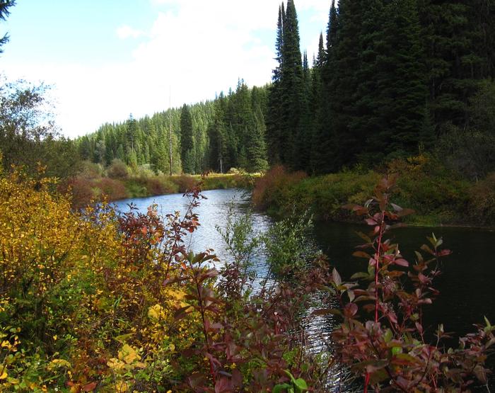
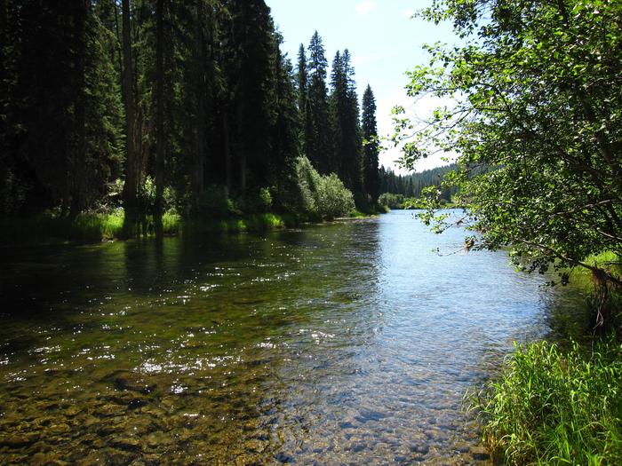
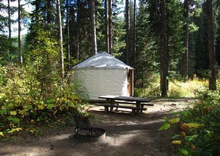
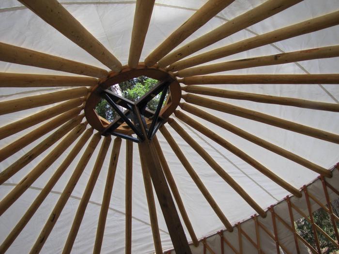
The Whitetail Yurt is nestled among the pine trees along the Yaak River within Whitetail Campground. Enjoy the comforts of a domed tent with a locking door, windows and wooden floor in this 16′ yurt.

Recreation

Opportunities abound from this location. Hiking, fishing, floating, hunting, scenic and historical driving tours are just some of the activities to be enjoyed.

Facilities

This rustic yurt sleeps three with floor room for a couple more. The provided bunk bed with mattresses has a twin as the top bunk and a full-size bed as the bottom bunk. There is also a table and four chairs.

A vault toilet, firewood and potable water are available within the campground.

Guests must bring cooking, cleaning and sleeping supplies. There is no heat source supplied. Guests are expected to pack out all trash and clean the yurt before leaving.

Natural Features

The yurt is situated adjacent to the Yaak River at an elevation of 2,918 feet within the Salish Mountain Range of the Rocky Mountains in the Kootenai National Forest. Yaak River and its many tributaries provide habitat for a variety of trout and big game animals. The Yaak Valley has been an important route through history as a trail for the Kootenai Indians, early prospectors and loggers.

Nearby Attractions

The town of Yaak is located approximately 5.3 miles northeast where you can grab a bite to eat or attend a community event.

Reservation

More from CampingHiking.net:

GERLE CREEK, California Campground Images, Info & Reservations

Listen Directions From Placerville, drive 21 miles east on Highway 50 to the Icehouse Road turnoff. Turn left and go 28 miles north. Take the left fork 3 miles to the campground. Phone 831-245-6891 Activities CAMPING, FISHING, HIKING, SWIMMING SITE Keywords GERL,ELDORADO NF – FS Related Link(s) Rec Area Info

Pioneer Ford Campground, Oregon Campground Images, Info & Reservations

Listen Directions From Sisters, OR: Travel 9.6 miles northwest on Highway 20, then 12.6 miles north on Forest Road 14. Phone 541-323-1746 Activities CAMPING Keywords Related Link(s) Rec Area Info & Images Oregon State Road Conditions Oregon State Tourism Overview Pioneer Ford is one of the most popular of the

RED DIAMOND CAMPGROUND, Oregon Campground Images, Info & Reservations

Listen Directions From Blue River, OR, travel 4 miles east on Highway 126 to Aufderheide Drive (Forest Service Road 19). Turn right and proceed south on Aufderheide Drive, taking the Y and climbing to the top of Cougar Reservoir. Continue south on Aufderheide Drive for 13 miles to Red Diamond

Plymouth Park, Washington Campground Images, Info & Reservations

Listen Directions From Kennewick, Washington take US-395 South or 23 Miles to Exit 131. Merge onto State Route 14 West and continue for 1 mile. Turn south onto Plymouth Road and continue for 1 mile. Follow the curve to Christie Road. The campground is the first left and the day

COBB RIDGE, Missouri Campground Images, Info & Reservations

Listen Directions From Chadwick, Missouri, take Highway 125 south about 2 miles, then turn right onto Highway H and continue past Camp Ridge day-use area, turning right onto Lookout Road (the first portion of lookout road is paved – if you get to the gravel you have gone to far)