LOST RAPIDS, OK Campground Reservation, Info, Images, Map, Directions

LOST RAPIDS, Oklahoma Campground Images, Info & Reservations

Directions

From Broken Bow, OK, take Highway 3 west 22 miles to the park entrance. Turn south at the sign and follow the access road.

Phone

580-876-3720

Activities

BOATING, CAMPING, FISHING, PICNICKING, CANOEING

Keywords

LOSR,PINE CREEK LAKE,PINE CREEK LAKE

Related Link(s)

Rec Area Info & Images

Oklahoma State Tourism

Oklahoma State Road Conditions

Overview

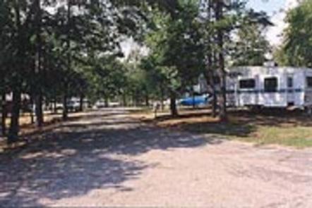
Lost Rapids Campground is located on the eastern shores of Pine Creek Lake. This pleasant campground is popular with campers who enjoy birding, fishing and wildlife photography.

Recreation

Visitors enjoy fishing, boating and picnicking. Common fish include crappie, white bass, largemouth bass, channel catfish, flathead catfish and various types of sunfish.

Facilities

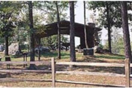
Lost Rapids offers several campsites, half of which have electric hookups. A group campsite that also has 4 electric hookups. Other amenities include flush toilets, drinking water and a boat ramp.

Natural Features

Pine Creek Lake, fed by the Little River, boasts 3,750 acres with 74 miles of shoreline. The lake is in southeastern Oklahoma at the edge of the Ouachita Mountains.

Nearby Attractions

Beavers Bend and Raymond Gary State Parks are within driving distance. Also, the historic ruins of Fort Towson, a confederate command post that was built in 1824, are interesting as well.

Reservation

More from CampingHiking.net:

WEST POINT CABIN, Alaska Campground Images, Info & Reservations

Directions The West Point Cabin is located near the mouth of Portage Bay on Kupreanof Island. It is situated west of West Point, just around the point from Fredrick Sound. It is 18 miles by float plane or 24 miles by boat from Petersburg. The cabin can be found on

CANAL, Kentucky Campground Images, Info & Reservations

Directions From Interstate I-24, take Grand Rivers Exit 31. Drive south on Highway 453 for approximately 4 miles. Turn left onto J.H. O’Bryan Avenue for .1 miles. Turn right onto Canal Campground Road for .5 miles. Phone 270-362-4840 Activities CAMPING, FISHING, DAY USE AREA, SWIMMING SITE Keywords CANA,LAKE BARKLEY,BARKLEY LOCK

CASCADE, Montana Campground Images, Info & Reservations

Directions From U.S. Highway 212, go to the south end of Red Lodge. Turn west onto West Fork Rock Creek Road (Forest Road 2071) and travel 11 miles west. The campground is on the left. Phone 406-587-9054 Activities BIKING, BOATING, FISHING, HIKING, WILDLIFE VIEWING, KAYAKING, CANOEING Keywords CASCADE,CASCADE CAMPGROUND,CASD,CUSTER NF

CLEAR CREEK GROUP (AZ), Arizona Campground Images, Info & Reservations

Directions From Interstate 17, take Exit 287 for AZ-260 toward Cottonwood/Payson/89-A. Turn right onto AZ-260 and follow for approximately 8 miles to the campsite. Phone 928-204-0028 Activities CAMPING, BIRDING Keywords CLEG,OAK CREEK CANYON,COCONINO NF – FS Related Link(s) Rec Area Info & Images Arizona State Tourism Forest Service Concessionaire Arizona