

Directions
From Ozawkie, Kansas, travel 1.5 miles east on KS-92 and follow signs to the campground.
Phone
785-876-3146
Activities
BIKING, BOATING, CAMPING, FISHING, HIKING
Keywords
OLDT,PERRY LAKE,PERRY LAKE
Related Link(s)
Overview
DUE TO FLOODING DAMAGES, OLD TOWN PARK WILL BE PARTIALLY CLOSED. PLEASE CHECK BACK FOR UPDATES.
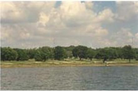
Old Town Campground is situated near the north end of Perry Lake. The campground is popular with those who enjoy fishing and peaceful, quiet camping.
CAMPGROUND GATE POLICY–Park entrance gates will be closed from 10pm-6am Friday/Saturday nights and the entirety of holiday weekends. An exit lane is provided with one way traffic only. No late entrance will be allowed and only Park Staff or Emergency Personnel will be permitted through the gate after 10pm.
Recreation
Perry lake has a reputation for being one of the best sailing lakes in the region; however, boaters of all types will enjoy the many opportunities offered here, whether it’s sailing, power boating or canoeing. Perry Lake offers excellent fishing: White crappie, flathead catfish, walleye, white bass, channel catfish and sauger are in abundance throughout the lake. In addition to the vast lake, the area has approximately 27,000 acres of public land dedicated to wildlife management: turkey, deer, quail, pheasant, rabbit, squirrel, duck and geese are all found on these federal lands.
Facilities
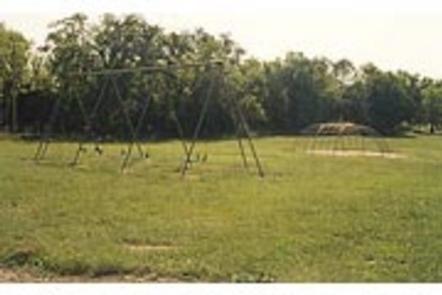
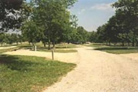
Old Town Campground features grassy, wide-open spaces along the shoreline. The non-electric sites are located in these areas, and additional electric sites are located in a shady loop, set back from the lake. There are 62 total campsites available, approximately half of which are primitive sites. A large reserveable group picnic shelter and playground make the area ideal for large parties or family functions.
Natural Features
Perry Lake Dam was completed in 1969 to help with flood control for the Missouri and Mississippi Rivers. Today, the lake boasts 159 miles of shoreline and 12,000 surface acres of water, creating countless recreational activities for visitors, and earning it the nickname “paradise on the plains.” The campground is surrounded by the lake on two sides, making it ideal for those looking for easy access to the water.
Nearby Attractions
For hikers, the nearby 29-mile Perry Lake loop trail offers a range of terrain and difficulty from easy, gentle slopes in the south to rugged, varying elevation changes in the north. Perry Lake is also a short drive from Lawrence, Topeka, and Kansas City–each offering their own array of unique shopping, dining, and attractions.