Plymouth Park, WA Campground Reservation, Info, Images, Map, Directions

Plymouth Park, Washington Campground Images, Info & Reservations

Directions

From Kennewick, Washington take US-395 South or 23 Miles to Exit 131. Merge onto State Route 14 West and continue for 1 mile. Turn south onto Plymouth Road and continue for 1 mile. Follow the curve to Christie Road. The campground is the first left and the day use area is the second left.

Phone

541-739-1135

Activities

BOATING, CAMPING, FISHING, WILDLIFE VIEWING, DAY USE AREA, SWIMMING SITE, KAYAKING, STAR GAZING, BIRDING, WATER ACCESS, TUBING

Keywords

PLYM,JOHN DAY LOCK & DAM,PLYMOUTH,PLYMOUTH PARK,Plymouth Park,Plymouth

Related Link(s)

Rec Area Info & Images

Washington State Road Conditions

Washington State Tourism

Overview

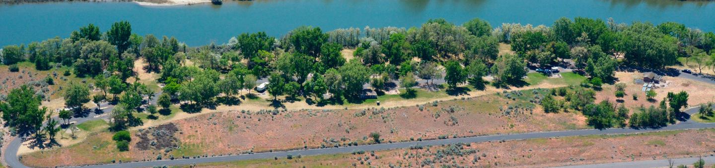
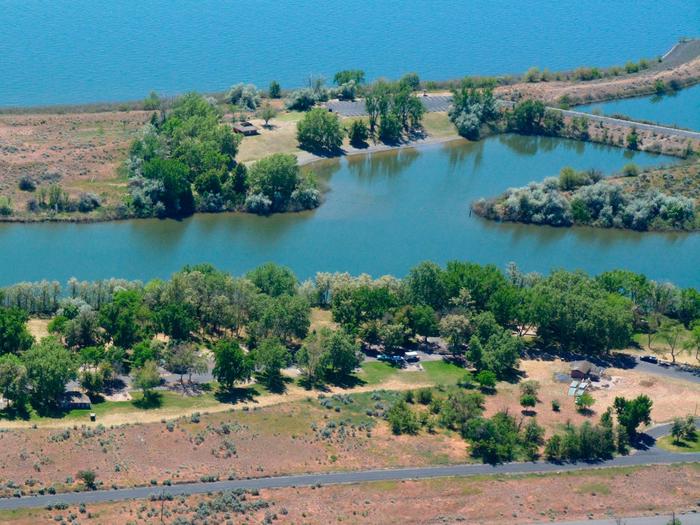
Plymouth Campground is located by the small town of Plymouth, Washington. The day use area and boat launch are on a small island on Lake Umatilla on the Columbia River.

Popular activities in the area include fishing, swimming, boating, water skiing and hunting.

Recreation

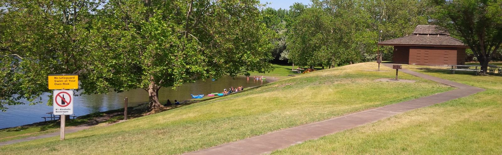
Visitors enjoy boating, water sports and swimming in the river.

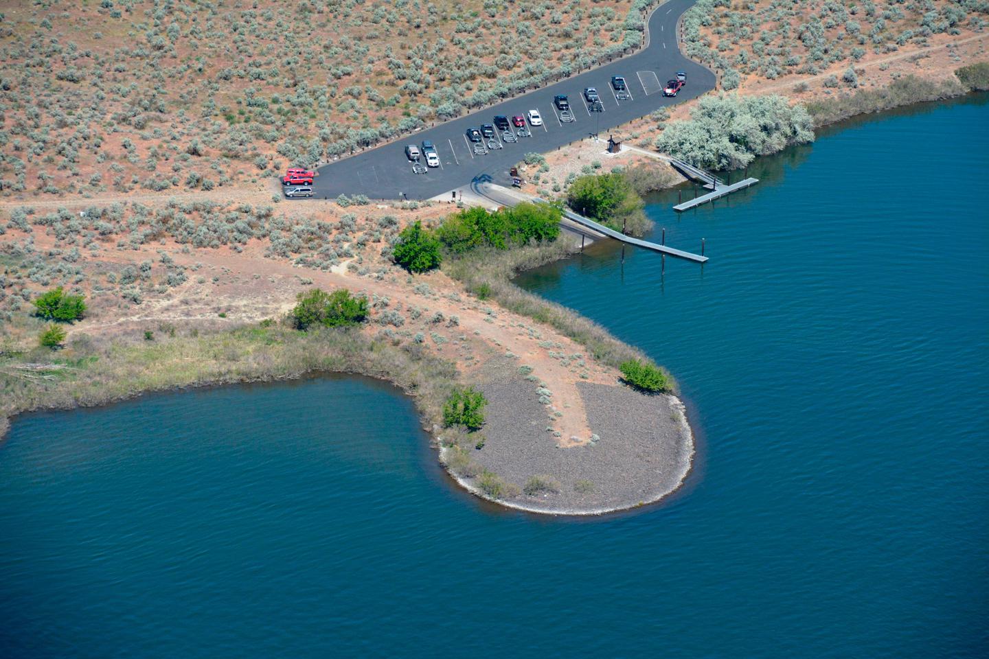
Anglers fish for Chinook, steelhead, walleye, sturgeon, and shad. The boat ramp is located at the day use area for convenient river access.

Facilities

The campground offers 32 sites with electric hookups. Amenities include flush and pit toilets, showers, drinking water, a dump station and playground.

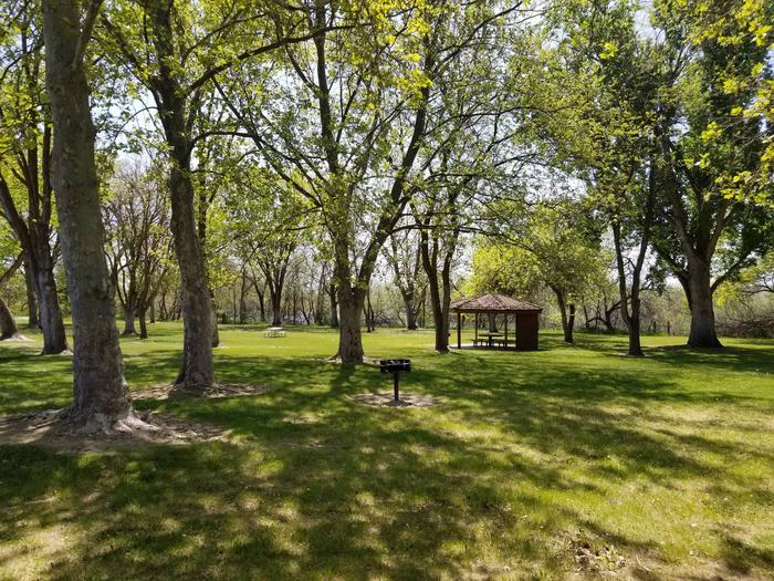
The day use area has a swim beach, boat ramp, flush toliets, vault toliet and courtesy dock.

Natural Features

The park is situated in a high desert environment on an island on the Columbia River. The island is covered with tall sage and Russian Olive trees, but shade is limited.

Wildlife is abundant in the area, and mule deer, waterfowl and raptors are commonly seen.

Nearby Attractions

McNary Dam and Visitor Center and Lake Wallula are two miles upstream from the campground. The lake offers additional opportunities for boating, swimming and fishing.

Reservation

More from CampingHiking.net:

BELTON LAKEVIEW PARK, Texas Campground Images, Info & Reservations

Directions From Interstate 35 in Belton, Texas take exit onto Road 317 (North Main Street). Turn left onto Farm-to-Market Road 439 (Lake Road), and travel west about four miles to the park. Phone 254-939-2461 Activities BOATING, CAMPING, FISHING, PICNICKING Keywords BELT,OVERLOOK PAVILION (BELTON LK),BELTON GROUP USE AREA,FRANKS PAVILION,BELTON PARK,BELTON LAKE

CRESCENT CREEK CAMPGROUND, Oregon Campground Images, Info & Reservations

Directions From Crescent, OR: Travel 8.7 miles west on County Road 61/Crescent Cut-off Road. Phone 541-323-1746 Activities CAMPING Keywords Related Link(s) Rec Area Info & Images Oregon State Road Conditions Oregon State Tourism Overview Crescent Creek is a small campground that is somewhat isolated from other campgrounds in the area.

MAMMOTH CABIN, Utah Campground Images, Info & Reservations

Directions From Fairview, Utah, for 8.5 miles proceed east on Utah Highway 31. Then turn east (left) to Utah highway 264 for .2 miles, then turn left (north) through the paved parking lot to the gravel road, then right (FS road 0124 downhill). You will pass the Gooseberry Campground sign,

POOLE KNOBS, Tennessee Campground Images, Info & Reservations

Directions From downtown Nashville, TN, take I-40 east to I-24 east. After 15 miles take exit 66B and turn right onto Sam Ridley Parkway. Turn right onto Highway 41 north, and after about 1.5 miles turn right onto Fergus Road. Make another right onto Jones Mill Road and follow the

DORIS CREEK CAMPGROUND, Montana Campground Images, Info & Reservations

Directions Turn off U.S. Highway 2 at milepost 144 and follow the West Side Hungry Horse Reservoir (Forest Road #895) across the Hungry Horse Dam. The campground is 3 miles south of the Dam. The road is paved to the campground. Phone 406-752-7924 FOR RESERVATIONS CALL: 1-877-444-6777 Activities BOATING, CAMPING,

SHOSHONE PARK KITCHEN, Idaho Campground Images, Info & Reservations

Directions From Mullan, drive east on Friday Ave, which turns into Larson Road. Total trip is about 3 miles. Look for signs to Shoshone Park. The West Kitchen is the first shelter when entering the park. Phone 208-783-2363 Activities BIKING, CAMPING, FISH HATCHERY Keywords SHOS,IDAHO PANHANDLE NF – FS Related