


Directions
From Espanola, NM, travel 30 miles north on US Highway 84. Turn west on to State Highway 96 and continue 1 mile to the Riana Campground entrance.
Phone
505-685-4371
Activities
BIKING, BOATING, CAMPING, FISHING, HIKING
Keywords
RIAN,ABIQUE RIANA,ABIQ,ABIQUE,RIANA,RAYANNA,ABIQ RIANA,ABIQUIU DAM
Related Link(s)
New Mexico State Road Conditions
Overview
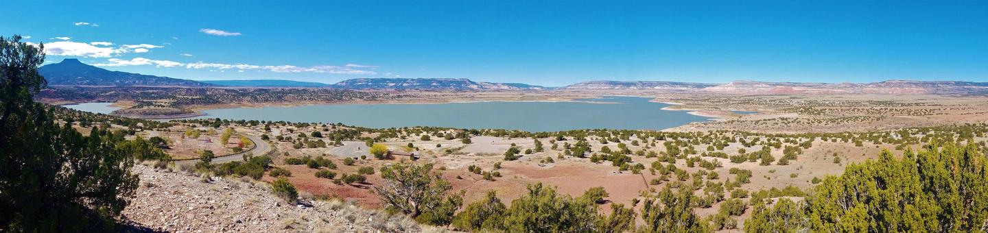
Riana Campground is located on a 150 ft. bluff overlooking the scenic Abiquiu Lake in northern New Mexico, just one hour northwest of charming Santa Fe. The lake sits at an elevation of 6,400 feet on the Rio Chama, a tributary of the legendary Rio Grande.
Recreation
Abiquiu Lake offers many opportunities for outdoor recreation. The fishing here is some of the finest in northern New Mexico.
Visitors enjoy boating, water skiing, and hiking. Lake shore access for boat launching is 1 mile from the campground.
Facilities
Riana Campground hosts 52 campsites, 13 of which have electric and water hookups. Flush toilets, showers, and drinking water are provided, as are picnic shelters, grills, lantern posts, and tent pads. A playground and dump station are located on-site.
Natural Features
Fragrant Pinion pine, juniper, and sage cover the campsite, providing a distinct smell of northern New Mexico, but offering limited shade. Colorful rock formations surround the park.
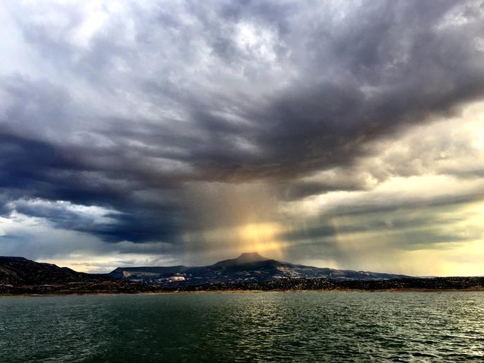
Visitors are awarded a panoramic view of the narrow mesa, Cerro Pedernal, locally known as "Pedernal." Famous American painter, Georgia O’Keefe, had her ashes scattered over its top.
Nearby Attractions
Northern New Mexico is full of beauty and history. The educational and historical Ghost Ranch is about 10 minutes from the park.
The Georgia O’Keeffe Museum, San Pedro Wilderness, Cumbres Toltec Railroad, Chaco Canyon, and Bandelier National Monument are all nearby.
The ski-town of Taos is just over an hour away, and colorful Santa Fe is an hour southeast, both with restaurants, shops, and museums.