
Directions
From Burlington, Kansas, take US 75 north for about 3.5 miles, then turn west onto Embankment Road and continue for 1.5 miles and follow signs to park entrance.
Phone
620-364-8613
Activities
BIKING, CAMPING, FISHING, HIKING, HUNTING
Keywords
RIEA,JOHN REDMOND RESERVOIR,JOHN REDMOND RESERVOIR
Related Link(s)
Overview
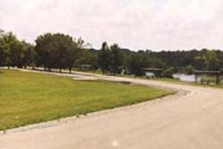
Riverside East Campground is located on the east bank of the Neosho River in the hills of Kansas.
This 168-acre park is part of the John Redmond Reservoir and offers countless water sports and activities for outdoor enthusiasts.
Recreation
John Redmond Reservoir, around 30,000 acres total, provides excellent opportunities for fishing and hunting. White crappie, white bass, channel catfish, flathead catfish and various sunfish species can be found in abundance. Several trails wind through the hills and along the shore. The Otter Creek ATV area is located at the west end of the dam and provides 140 acres of trails for dirt bikes and ATVs. The area is open from sunrise to sunset. The Hickory Creek Trail is a multi-use trail for the hiker, horseback rider and mountain biker, providing 12 miles of scenic trail, forging through the creek at several crossing locations.
Facilities
Riverside East Campground features 42 reservable campsites, along with two large picnic shelters that make the area ideal for large parties or family functions.
Natural Features
John Redmond Reservoir sits in the broad Neosho River Valley. The rolling hills afford the visitor an opportunity to see acres of agriculture and grassland, with vast fields of wheat and corn.
Large areas of grasses including bluestem, Indian grass and switch grass can be seen from the rolling hilltops. The lower areas provided a wooded cover of elm, black walnut, hickory, ash, hackberry, cottonwood and cedar.
Nearby Attractions
The nearby town of Burlington, Kansas, provides gas, grocery and hospital services.