SHAWNEE BEND, MO Campground Reservation, Info, Images, Map, Directions

SHAWNEE BEND, Missouri Campground Images, Info & Reservations

Directions

From Highway 7, travel north on the Dam Access Road for 3 miles and follow signs into the park.

Phone

660-438-7317

Activities

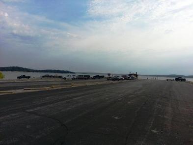
BOATING, CAMPING, FISHING, SWIMMING SITE

Keywords

SHAW,TRUMAN LAKE,HARRY S TRUMAN

Related Link(s)

Rec Area Info & Images

Missouri State Tourism

Missouri State Road Conditions

Overview

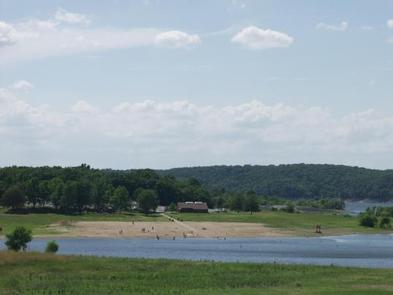
Shawnee Bend Park sits on the shores of Harry S. Truman Lake in the hills of western Missouri.

Visitors enjoy fishing, hunting, swimming and boating.

Click here for the Harry S. Truman Lake virtual tour.

Recreation

Shawnee Bend is an excellent fishing location. Anglers find crappie, largemouth bass and blue and flathead catfish. Truman Lake is also a popular destination for tournament fishermen.

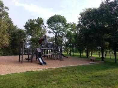
A playground and sandy beach make the area perfect for families.

Facilities

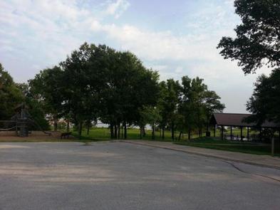
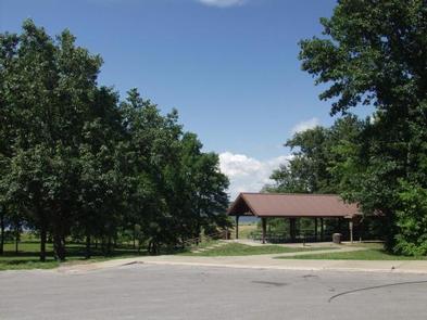
This year-round day-use area offers a large group picnic shelter. Amenities include flush and pit toilets and drinking water.

Natural Features

Truman Lake lies among rolling hills and rocky bluffs. Dense hardwood forests studded with mature pine trees cover the area.

Wildlife is abundant in and around the park. Whitetail deer, turkey, hummingbirds, hawks and ospreys are commonly seen. Bald eagles can be viewed during the winter months.

Nearby Attractions

The 950 miles of shoreline around Truman Lake provide plentiful opportunities for fun in the outdoors. Many parks surround the lake, including Harry S. Truman State Park.

The Harry S. Truman Visitor Center sits atop Kaysinger Bluff and provides a spectacular view of the dam and reservoir. Exhibits provide information about the rich history of the Osage River Valley from pre-civilization to modern day. Waterfowl, bald eagles and turkey vultures are commonly seen from the observation deck.

Reservation

More from CampingHiking.net:

WARRIOR CREEK, North Carolina Campground Images, Info & Reservations

Directions From Winston-Salem, North Carolina, take Highway 421 North (approximately 55 miles) to Exit 286B, turn left onto Highway 268 and continue for approximately 8 miles. Turn right immediately after crossing the bridge and follow signs to the campground. From Charlotte, North Carolina, take I-77 North (approximately 60 miles) before

BLIND PASS CABIN, Alaska Campground Images, Info & Reservations

Directions The cabin is located approximately 40 air miles north of Ketchikan on the northwest shore of Hassler Island, across from Black Island. Accessible by float plane or by boat. Mooring buoy in front of cabin is first-come, first-serve. Refer to USGS topographic map, Ketchikan D-5, and check local tide

HALFWAY FLAT CAMPGROUND, Washington Campground Images, Info & Reservations

Directions From Naches, Washington, follow Highway 410 for approximately 30 miles west to Forest Road 1709. Turn left on Forest Road 1709, cross the bridge then turn left on Forest Road 1704 follow the road approximately 1 mile. Campground is located on the left. From Enumclaw depart WA-164/Griffin Ave toward

PAULSON BAY CABIN, Alaska Campground Images, Info & Reservations

Directions To access the cabin by float plane: it is 40 minutes from Anchorage and 60 minutes from Cordova. By boat, the trip is 18 miles from Whittier. Note: the Bay is not obvious because the mouth is partially obscured by five small islands. Beware of submerged rock ledges between

ANTELOPE, Idaho Campground Images, Info & Reservations

Directions From Horseshoe Bend, Idaho, take State Highway 52 for 9 miles, then turn right on Sweet/Ola Highway and travel 16 miles to Ola. From Ola, continue 10 miles northeast on FS Rd 618, then make a right on FS Rd 626 and follow it for 7 miles. Make a