Chowchilla Recreation Area Day Use, CA Campground Reservation, Info, Images, Map, Directions

Chowchilla Recreation Area Day Use, California Campground Images, Info & Reservations

Directions

50 miles north of Fresno, CA. Take Highway 99 north to Ave 17 east, follow to Road 26 north to Avenue 26 east to Road 29 north. Turn left on Road 29 and travel 8 miles to the park entrance. Follow the signs into the campground.

Phone

559-689-3255

Activities

BIKING, FISHING, HIKING, SWIMMING SITE

Keywords

CHOW,EASTMAN LAKE DAY USE AREA,EASTMAN LAKE,BUCHANAN DAM,EASTMAN LAKE

Related Link(s)

Rec Area Info & Images

California State Road Conditions

California State Tourism

Overview

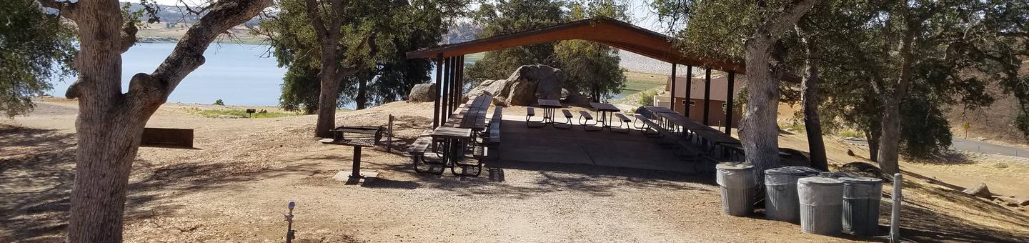
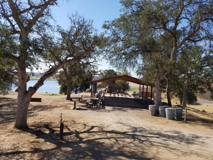
Chowchilla Recreation Day Use Area is located at the beautiful Eastman Lake, surrounded by rugged oak-covered hills. Visitors take advantage of this scenic setting for fishing, boating and hiking. Abundant wildlife in the area includes bobcats, Golden eagles, hawks, Wood ducks and Bald eagles.

Recreation

With warm summers and mild winters, visitors can take advantage of a range of activities including eight miles of trails available for hikers, mountain bikers or horseback riders.

Eastman is the first lake designated by the California Department of Fish and Game as a Trophy Bass Fishery. Crappie, trout and catfish are also popular catches.

Facilities

The picnic shelter can be reserved on a day to day basis only. Camping overnight is not allowed. The picnic shelter holds up to 100 people. A playground, horseshoe pits, and flush toilets are also available for use.

Natural Features

Nestled in the foothills of the Sierra Nevada Range, Eastman Lake boasts spectacular views of the surrounding mountains. The 1,780 surface-acre lake is fed by the Chowchilla River, a tributary of the San Joaquin River.

Nearby Attractions

The visitor center is an ideal stopping place to learn about the natural and cultural history of the area.

Reservation

More from CampingHiking.net:

Creek Pasture Group Site, Utah Campground Images, Info & Reservations

Directions Turn west off US 191 onto Highway 211 and travel approximately 27 miles. The turn off to the campground is on the north side of the highway. It is located approximately 7.5 miles southeast of the Canyonlands National Park visitor’s center and 14.5 miles northwest of Newspaper Rock. The

GREENS LAKE, Utah Campground Images, Info & Reservations

Directions Located on Forest Road 095/Red Canyon Road off Highway 44, approximately 40 miles north of Vernal, Utah. Phone 435-784-3445 Activities BIKING, BOATING, CAMPING, FISHING, HIKING, WILDLIFE VIEWING, BIRDING Keywords GRLK,RED CANYON COMPLEX,FLAMING GORGE,ASHLEY NF – FS,Flaming Gorge National Recreation Area Related Link(s) Rec Area Info & Images Utah State

COW MEADOW CAMPGROUND, Oregon Campground Images, Info & Reservations

Directions From Bend, OR: Travel about 45 miles south on Cascade Lakes Highway (46), 0.5 mile east on Forest Road 40, then 2 miles south on Forest Road 4000-790. Phone 541-323-1746 Activities CAMPING Keywords Related Link(s) Rec Area Info & Images Oregon State Tourism Oregon State Road Conditions Overview Cow

SOUTH SANDUSKY CAMPGROUND, Illinois Campground Images, Info & Reservations

Directions From I-57 take exit 71 and turn west onto Route 14. After 3 miles turn right on Rend City Road, then continue for 6 miles to the campground entrance on the right. Phone 618-724-2493 Activities BIKING, CAMPING, INTERPRETIVE PROGRAMS, FISHING, HIKING, WILDLIFE VIEWING, SWIMMING SITE, STAR GAZING Keywords SSAN,REND

OWEN CREEK, Wyoming Campground Images, Info & Reservations

Directions From Dayton, Wyoming: Travel 27 miles on U.S. Highway 14 west, turn left (south) at Burgess Junction and continue on Hwy 14 for 5 miles until you reach Forest Road 236. Take a right on Forest Road 236 and continue about .2 miles to the campground. Phone 406-587-9054 Activities

FIREFIGHTERS CAMPGROUND, Utah Campground Images, Info & Reservations

Directions From Vernal, Utah, take U.S. 191 north about 41 miles. From Manila, Utah, take Highway 44 for 28 miles. Turn left on U.S. 191 and travel approximately 3 miles north. From Rock Springs, Wyoming, take I-80 west toward Green River about 6 miles to the junction with U.S. 191/Flaming