MOOSE CREEK GROUP SITE, MONTANA Campground Reservation, Info, Images, Map, Directions

MOOSE CREEK GROUP SITE, Montana Campground Images, Info & Reservations

Directions

From Bozeman, travel south on Highway 191 for 32 miles to the turnoff, a quarter-mile south of the main Moose Creek Flat Campground. Turn left onto a gravel road that leads 200 yards to the group site.

From West Yellowstone, take Highway 191 north for 57 miles. The group area is on the east side of the highway across from the campground.

Phone

(406)646-1012

Activities

CAMPING, WILDLIFE VIEWING, PHOTOGRAPHY

Keywords

MCGS,GALLATIN NF – FS

Related Link(s)

Rec Area Info & Images

Forest Service Concessionaire

Montana State Road Conditions

Montana State Tourism

Overview

Moose Creek Group Site is located in the scenic Gallatin Canyon on the Bozeman Ranger District of the Gallatin National Forest of Montana. It is 32 miles south of Bozeman.

The surrounding area offers many outdoor recreational opportunities, including fishing, rafting, hiking and viewing local wildlife.

Recreation

Great opportunities for hiking, fishing, scenic driving and wildlife viewing are available around the campground. Anglers cast for rainbow, brown, brook and cutthroat trout, whitefish and Arctic grayling on the Gallatin River. Rafting and kayaking are popular activities as well.

Many trails can be found in Gallatin Canyon. The Swan Creek Trail begins at nearby Swan Creek Campground. Golden Trout Lakes Trail begins about 15 minutes away up Portal Creek Road, three miles south of the campground.

Facilities

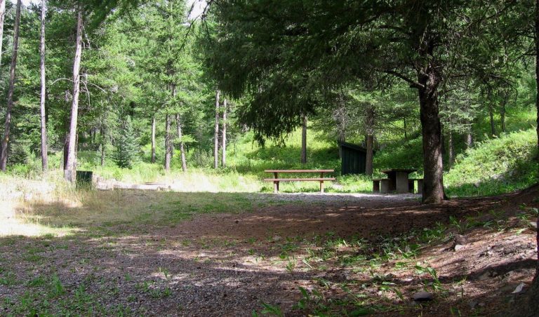
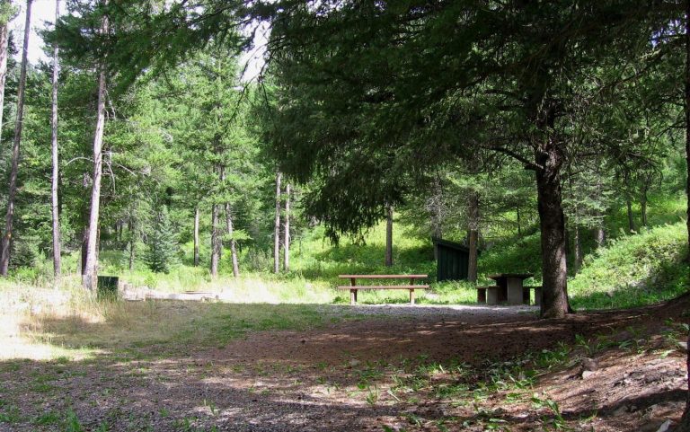
Moose Creek is available for group picnicking or camping and can accommodate up to 90 people. Picnic tables and campfire rings are provided, as are vault toilets. Drinking water and trash collection are not available at the campground.

Natural Features

The group site sits next to the Gallatin River and Moose Creek, just off Highway 191, at an elevation of 5,700 feet. The site is partly surrounded by pine and fir trees.

A variety of wildlife makes its home in this scenic canyon. Visitors can often glimpse bald eagles, bighorn sheep, moose, elk, mountain goats, deer and coyotes. Black and grizzly bears also live in the canyon.

Reservation

More from CampingHiking.net:

TYEE PAVILION, Oregon Campground Images, Info & Reservations

Directions From Sutherlin, travel west on Highway 138 for 12 miles. Turn left at the Bullock Bridge, cross over the bridge and immediately turn right onto County Road 57 (Bullock Road). Travel .5 miles to Tyee. Campground is on the right. Phone 541-440-4930 Activities CAMPING, FISHING, SWIMMING SITE Keywords TYPA

MIDDLE MEADOWS, California Campground Images, Info & Reservations

Directions From Sacramento, California, take Interstate 80 east to Auburn. Take the Elm Street exit and turn left at the stoplight. Follow Highway 49 down the canyon, across the American River, to Cool. Turn onto Highway 193 towards Georgetown. Turn left at the stop sign, then continue 22 miles to

LOST CREEK GROUP, California Campground Images, Info & Reservations

Directions From Redding, California drive 48 miles east on State Highway 44 to State Highway 89. Turn right into Lassen Volcanic National Park and continue five miles south to Lost Creek Group Campground. It is 1/8-mile south of Crags Campground. Phone 530 595-6121 Activities BOATING, HISTORIC & CULTURAL SITE, CAMPING,

WARM SPRINGS REC AREA, California Campground Images, Info & Reservations

Directions Take Highway 101 to Healdsburg and exit on Dry Creek Road. Travel west another 11 miles to park boundary. Watch the road signs and make a left turn across from the visitor center to reach the Warm Springs Recreation Area. Phone 707-431-4533 Activities CAMPING Keywords WASP,LAKE SONOMA,LAKE SONOMA,Warm Springs

MIDWAY, Texas Campground Images, Info & Reservations

Directions From I-35, take the exit for Hwy 6 N toward Meridian (330B) for about 5 miles. Immediately before crossing the lake, exit right at Midway Park Exit. At the exit, drive under the bridge and the park is a quarter-mile down the east-bound service road. Phone 254-756-5359 Activities BOATING,

SAVENAC WEST COTTAGE, Montana Campground Images, Info & Reservations

Directions From Missoula, Montana, travel west on Interstate 90 for 90 miles to Exit 16 for Haugan. At the stop sign turn right. At the frontage road turn right and take the first left, crossing the cattle guard. Signs are onsite to follow. Maps are available online or for purchase