BLACK LAKE, WI Campground Reservation, Info, Images, Map, Directions

BLACK LAKE, Wisconsin Campground Images, Info & Reservations

Directions

From Hayward, Wisconsin, take Highway B east for about 23 miles. Turn left on Barker Lake Road, which turns into Forest Service Road 172, and continue for a total of 8 miles. Turn left onto Forest Service Road 173 and drive less than a mile to the paved campground road.

Phone

(715) 634-4821 OR (715) 264-2511

Activities

CAMPING, FISHING

Keywords

BLAK,CHEQUAMEGON-NICOLET NF – FS

Related Link(s)

Rec Area Info & Images

Overview

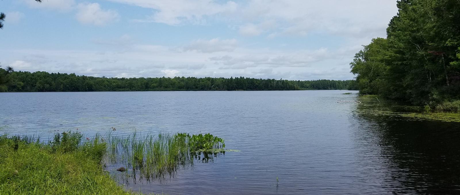
Black Lake is highly ranked as a family-favorite campground. It is spread out along the eastern shores of its namesake, Black Lake. The calm waters beckon to adventurers, offering fishing, boating, swimming and other recreational activities in the northwestern Wisconsin wilderness.

Recreation

The lake offers plentiful fishing, with musky, walleye, bass and pan fish available in abundance. Kayaking and canoeing are also enjoyed by visitors, as the water is usually peaceful and calm. A variety of wildlife, including elk, deer, loon, fox and others, make their homes in the area and are often spotted by visitors.

Hundreds of miles of off-road vehicle, hiking and mountain biking trails surround the lake. The Black Lake interpretive trail offers a 4-mile, in-depth look at the nature that surrounds the wooded shoreline.

A grassy beach provides ample space to run and play, as well as a spot to relax.

Facilities

The campground offers dozens of waterfront sites for tent and RV camping. Each site is equipped with tables and campfire rings with grills. Accessible vault toilets, drinking water, trash collection and recycling bins are also available.

Natural Features

The campground is located in a birch, pine and spruce forest that stretches along the beautiful 129-acre lake, in the southern part of the Chequamegon National Forest.

Nearby Attractions

Fuel, fishing supplies, firewood and restaurants are within a 15-mile drive of the campground, in the town of Hayward.

Reservation

More from CampingHiking.net:

KINGS CREEK, Utah Campground Images, Info & Reservations

Directions From Panguitch, Utah, travel 7 miles south on Hwy 89 to Scenic Hwy 12. Travel Hwy 12 for 11 miles to East Fork Road. Travel East Fork Road 7 miles to Tropic Reservoir and Kings Creek Campground. Turn immediately after the sign for the campground, and continue .5 miles

DAWSON CABIN, Colorado Campground Images, Info & Reservations

Directions From Buena Vista, Colorado, go about 15 miles north on Highway 24 towards Leadville. Turn left on County Road 390 at Clear Creek Reservoir. Go about 6 miles west on County Road 390, then turn right (north) onto the cabin driveway. The cabin is about 100 yards from the

LONE BRANCH, Tennessee Campground Images, Info & Reservations

Directions From Nashville, TN, take I-40 East to exit 229-B/Golden Bear Gateway. Continue straight on Golden Bear Gateway for approximately 9 miles. Entrance to the recreation area will be on your left just passed Cedar Creek Club. * Golden Bear Gateway turns into Benders Ferry Road at the US-70/Lebanon Road

AMERICAN RIDGE LODGE, Washington Campground Images, Info & Reservations

Directions Please contact the Ranger District at 509-653-1401 prior to your arrival to check any restrictions or conditions, such as fire or road closures, or weather that may affect the quality of your visit. Access to the lodge is through a locked gate. The combination to the gate lock will

DUCK HARBOR CAMPGROUND, Maine Campground Images, Info & Reservations

Directions From the north, take I-95 to Bangor, then I-395 to Brewer, then take Rte. 15 south to Stonington. From the south, take I-95 or I-295 to Augusta, then Rte. 3 to Belfast, then Rte. 15 to Stonington. Phone 207-335-5551 Activities CAMPING Keywords None Related Link(s) Rec Area Info &