DAY LAKE, WI Campground Reservation, Info, Images, Map, Directions

DAY LAKE, Wisconsin Campground Images, Info & Reservations

Directions

From Clam Lake, Wisconsin, travel a mile north on Highway GG.

Phone

(715) 634-4821 OR (715) 264-2511

Activities

BOATING, CAMPING, FISHING, SWIMMING SITE

Keywords

DLAK,CHEQUAMEGON-NICOLET NF – FS

Related Link(s)

Rec Area Info & Images

Overview

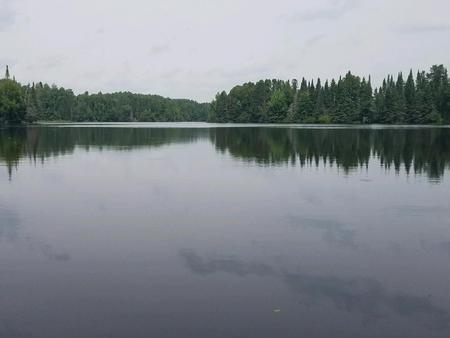
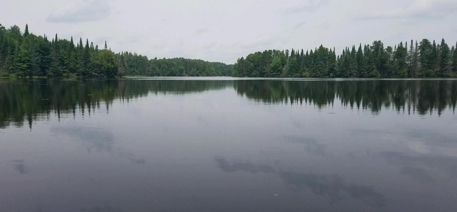
Day Lake Campground is situated in northwestern Wisconsin, not far from the shores of Lake Superior. The spacious and peaceful Day Lake offers a family-friendly campground with swimming beaches, a boat launch and picnic area. Day Lake is a designated off-road vehicle campground, allowing off-road vehicle use to and from the nearby trails.

Recreation

Located in the elk capital of Wisconsin, the Day Lake area has activities for everyone. Miles of off-road vehicle, hiking and mountain biking trails are nearby on the Dead Horse Run Off-road Vehicle (ATV/UTV) Trail. A half-mile interpretive trail can be accessed from the campground.

A boat ramp and picnic area with beach access are located two miles south of the campground, on County Highway M.

The 640-acre lake is a popular destination for anglers, with musky, bass and panfish available in abundance. The area is also ideal for kayaking, canoeing and swimming. Elk, eagles, loons and other wildlife are often spotted in the area.

Facilities

The campground offers dozens of single-family campsites for tent and RV camping. Only the Paper Birch loop has a paved road, while the remainder of roads within the campground are gravel. The parking aprons are grass and dirt.

Each campsite is equipped with tables and campfire rings with grills. Accessible vault toilets and hand pump drinking water are also provided. Trash collection and recycling bins are available at the campground as well.

Natural Features

The Chequamegon-Nicolet National Forest offers 845,000 acres of lush landscape dotted with lakes, rivers and streams. Pine, spruce, maple, aspen and balsam forests, as well as extensive jack pine plantations, make up the vegetation.

Nearby Attractions

A general store, bait shop, firewood vendor, fuel and restaurants are located in Clam Lake, about a mile from the campground. The local community club hosts an annual July 4th fireworks display.

Reservation

More from CampingHiking.net:

GRIZZLY, California Campground Images, Info & Reservations

Directions From Reno, travel north on Highway 395 to Highway 70 and turn west to Portola. From Portola, take County Road 126 north for 7 miles, then County Road 112 to the east side of Lake Davis. Continue approximately 1 mile to the campground, which is on the left. Phone

SOUTH MANITOU GROUP, Michigan Campground Images, Info & Reservations

Directions From Traverse City, Michigan, take M-22 to Sutton’s Bay. Go west on M-204 from Sutton’s Bay towards Leland. Turn north at the junction of M-22 and M-204 to Leland. Take the ferry from Leland to South Manitou Island. Phone 231-326-4700 Activities CAMPING, HIKING, VISITOR CENTER Keywords CG55,Bay,South Manitou Island,Weather

DIFFICULT CAMPGROUND, Colorado Campground Images, Info & Reservations

Directions Take Highway 82 for 5 miles southeast of Aspen, Colorado. Look for USFS Difficult Campground sign on the right, past Mile Marker 45. Phone 970-927-0107 Activities CAMPING, FISHING, HIKING, WILDLIFE VIEWING Keywords DIFF,ASPEN COLORADO,INDEPENDENCE PASS,DIFFICULT CAMPGROUND GRP SIT,WHITE RIVER NF -FS Related Link(s) Rec Area Info & Images Forest

WINDY POINT GROUP (CO), Colorado Campground Images, Info & Reservations

Directions From I-70, take the Silverthorne exit 205. Travel east on Highway 6 approximately 4 miles to Swan Mountain Road. Proceed 2 miles to Swan Mountain Recreation Area. Take dirt road to campground. Phone 970-468-7681 Activities BOATING, CAMPING, FISHING, HIKING, PICNICKING, WILDLIFE VIEWING Keywords WINP,WHITE RIVER NF -FS Related Link(s)

ECHO LAKE, Colorado Campground Images, Info & Reservations

Directions Take I-70 westbound, Idaho Springs exit #240 – Hwy 103. Go south 14 miles to the intersection of Hwy 103 and Hwy 5 (Mt Evans Road). Turn right on Hwy 5 then turn left to enter the campground. Phone 801-226-3564 Activities CAMPING, FISHING, HIKING, WILDLIFE VIEWING, SCENIC DRIVE Keywords

OUTFLOW CAMPING, Pennsylvania Campground Images, Info & Reservations

Directions Route 281 South from points north: continue south through Confluence and over the Casselman & Youghiogheny Rivers. Make an immediate left into the campground. Route 281 North from Route 40: continue north 7 miles past the Youghiogheny River Lake entrance. Make next right into the campground. Route 523 North