YELLOWSTONE GROUP CAMPGROUND, UT Campground Reservation, Info, Images, Map, Directions

YELLOWSTONE GROUP CAMPGROUND, Utah Campground Images, Info & Reservations

Directions

From Duchesne, Utah: Take Highway 87 north to Mountain Home, then travel on Uinta and Ouray Indian Reservation Road to Forest Road 131 to Forest Road 119. FR 119 is rough and rocky in places.

Phone

435-722-5018

Activities

BIKING, CAMPING, FISHING, HIKING, WILDLIFE VIEWING

Keywords

YELL,ASHLEY NF – FS

Related Link(s)

Rec Area Info & Images

Utah State Road Conditions

Utah State Tourism

Overview

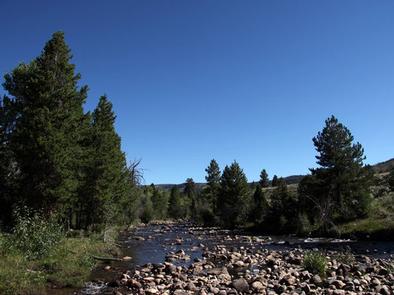
Yellowstone Group Campground lies along its pretty namesake river on the southern slope of the Uinta Mountains, about 40 miles from Duchesne, Utah. Visitors come to the area to enjoy its extensive off-road trail system and great fishing opportunities.

Recreation

The Yellowstone River offers fishing for rainbow, brown, brook and cutthroat trout.

The Yellowstone ATV Trail System is conveniently close, with over 50 miles of trail on the Petty Mountain and Dry Gulch Loops. Hiking and biking are also allowed on these trails.

Facilities

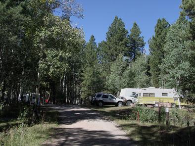
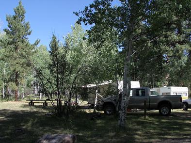
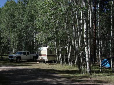
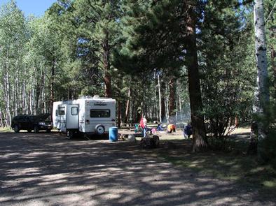
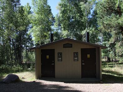
The campground contains one group site with picnic tables and campfire rings. Forty people, four vehicles and four camp trailers/RV units can be accommodated. Vault toilets, drinking water and trash collection are provided. Roads and parking spurs are gravel. Several first come, first served single sites are available as well.

Natural Features

The campground sits on the banks of the Yellowstone River at an elevation of 7700 feet. A forest of aspen, maple and Ponderosa pine covers the area. Wildlife and summer wildflowers are abundant.

Nearby Attractions

Yellowstone Canyon offers beautiful mountain scenery, additional first come, first served campgrounds, a small reservoir and trailheads with access to the High Uintas Wilderness.

Hiking, backpacking and horseback riding are popular in the wilderness area and numerous sparkling lakes provide great backcountry fishing opportunities.

Reservation

More from CampingHiking.net:

LITTLE BEAR GROUP, Utah Campground Images, Info & Reservations

Directions The campground is located 13 miles west of Huntington, Utah, along Highway 31. Phone 435-384-2372 Activities BIKING, CLIMBING, CAMPING, FISHING, HIKING, HUNTING, WILDLIFE VIEWING Keywords LBEA,MANTI-LASAL NF -FS Related Link(s) Rec Area Info & Images Utah State Tourism Utah State Road Conditions Overview Little Bear Group Campground is located

ROARING RIVER PARK, Tennessee Campground Images, Info & Reservations

Directions From I-40, take HWY 53 north through Gainesboro, TN. Turn east on HWY 135 and follow signs into recreation area. Phone (931) 268-2540 Activities FISHING, PICNICKING, WILDLIFE VIEWING, DAY USE AREA, SWIMMING SITE, PHOTOGRAPHY, SWIMMING, MOTOR BOAT, PADDLE BOATING, KAYAKING, WATER ACCESS Keywords RORN,CORDELL HULL LAKE,ROARING RIVER SHELTER,CORDELL HULL

HOLEY MEADOW, California Campground Images, Info & Reservations

Directions From Highway 99, turn east on J22. Travel on J22 through California Hot Springs, then turn left at onto M50. After approximately 10 miles turn left at M107. The entrance to Holey Meadow Campground is on the left about a mile after the turn. Phone 559-539-5230 Activities BIKING, CAMPING,

ACKERMAN CAMPGROUND, California Campground Images, Info & Reservations

Directions From Weaverville, take Highway 3 north for 7 miles. Turn right on Rush Creek Road for 9 miles. Turn left on Trinity Dam Boulevard for 7.5 miles. Phone 530-275-8113 Activities BOATING, CAMPING, FISHING, HIKING, WILDLIFE VIEWING Keywords Lewiston Lake Related Link(s) Rec Area Info & Images California State Road

LAKE THREE, Wisconsin Campground Images, Info & Reservations

Directions 34412 Mineral Lake Rd. (FR 198) From Mellen, Wisconsin; Take County Highway GG west for about 8 miles. Turn right onto Forest Service Road 187/Mineral Lake Road and continue for 3 miles to the intersection with Forest Service Road 198/Pine Stump Corner. Turn right and continue less than a

CROCKER GUARD STATION, California Campground Images, Info & Reservations

Directions From Portola, CA, travel east on Highway 70 for five miles to Beckwourth, CA. Travel north on County Road 111 (Beckwourth-Genesee Road) for six miles. Crocker Guard Station is on the left. Phone 530-832-1076 Activities CAMPING, FISHING, HIKING Keywords Related Link(s) Rec Area Info & Images California State Road