Ashley National Forest
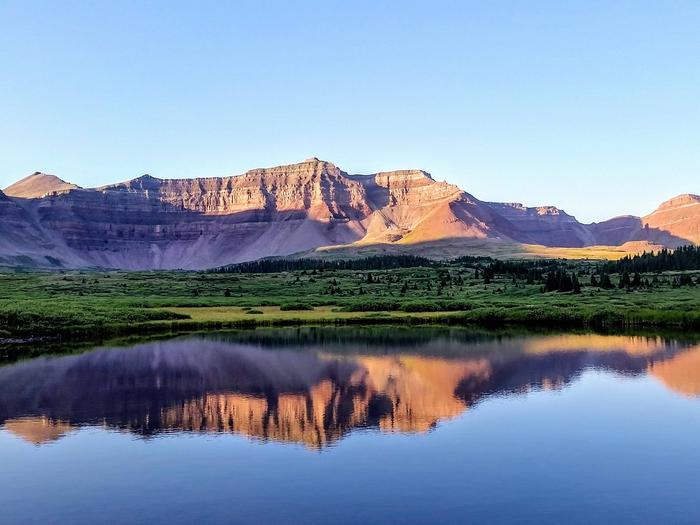
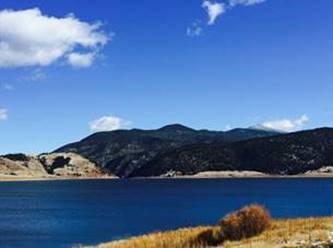
Recreational opportunities abound across 1.3 million acres on the Ashley National Forest! The Ashley National Forest manages 276,175 acres of the High Uintas Wilderness Area offering quiet solitude, as well as access to the highest peak in Utah, Kings Peak. With 1,156 campsites, 8 picnic areas, 1,151 miles of roads and trails for All-Terrain-Vehicles, opportunities for motorized camping and recreation are calling.
The Flaming Gorge National Recreation Area offers many activities including fishing, wildlife viewing, and scenic views of Flaming Gorge to name a few.
Activities
BIKING, BOATING, CAMPING, INTERPRETIVE PROGRAMS, FISHING, HORSEBACK RIDING, OFF HIGHWAY VEHICLE, PICNICKING, VISITOR CENTER, WILDLIFE VIEWING, FIRE LOOKOUTS/CABINS OVERNIGHT, SWIMMING
Ashley National Forest Camping Reservations
Reserve your campsite at these Ashley National Forest camping areas:
ANTELOPE FLAT >> Camping Area
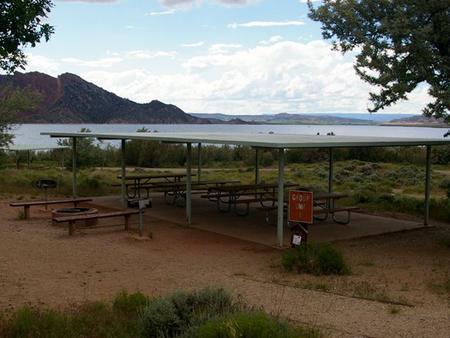 Antelope Flat Campground lies on the shores of the beautiful Flaming Gorge Reservoir at an elevation of 6,000 feet, on the Ashley National Forest within the Flaming Gorge National Recreation Area. Visitors love Antelope Flat for its easy access to boating, water skiing and fishing.
ARCH DAM CAMPGROUND >> Camping Area
 Arch Dam Campground is a popular location for family reunions, church outings and other large gatherings. It is located on the Ashley National Forest within the Flaming Gorge National Recreation Area. Flaming Gorge Dam and the Green River Spillway are less than a mile away. Visitors enjoy boating, water skiing, fishing and swimming.
ASPEN (UT) >> Camping Area
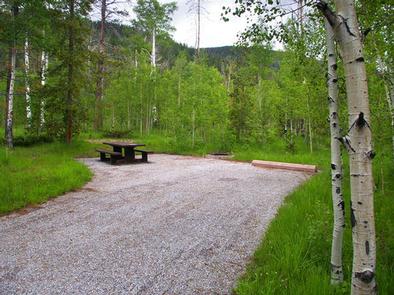
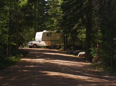 Aspen Campground is nestled in the scenic North Fork Drainage just off Highway 35, about 13 miles from Tabiona, Utah.
The North Fork Drainage lies on the southern slope of the beautiful Uinta Mountains in northeastern Utah. Visitors enjoy fly-fishing and exploring the many local trails.
BROWNE LAKE GROUP SITES >> Camping Area
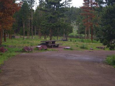 Browne Lake Group Sites are located next to their namesake lake in a high mountain meadow, at an elevation of 8,200 feet. Visitors enjoy fishing, canoeing and exploring miles of hiking and ATV trails. The campground consists of four reservable, accessible group sites that accommodate up to 40 people each. Sites contain picnic tables and campfire circles. Single-family sites are available only a first come, first served basis.
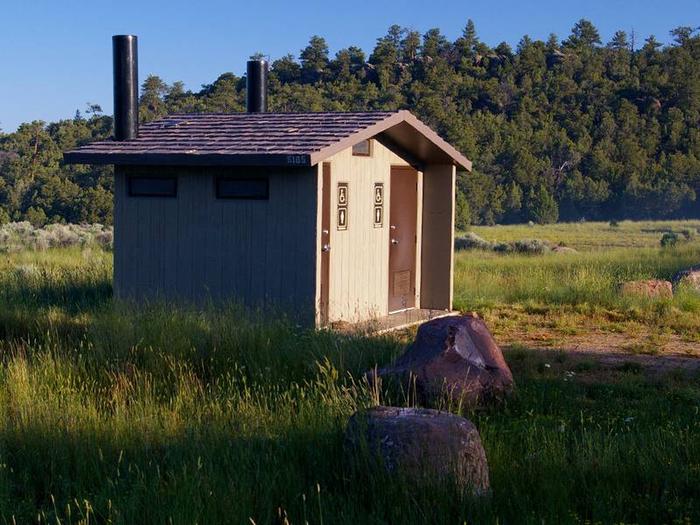
Vault toilets are provided. Roads and parking spurs are dirt. The campground is accessed via a well-maintained dirt road.
BUCKBOARD CROSSING >> Camping Area
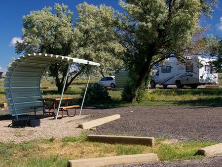 Buckboard Crossing Campground is located on the far northwest shore of Flaming Gorge Reservoir at an elevation of 6,100 feet. Boating, fishing and water skiing are popular activities.
CANYON RIM >> Camping Area
 Canyon Rim Campground is located in a grassy meadow high above Flaming Gorge Reservoir, along Red Canyon Road at an elevation of 7,400 feet. Visitors enjoy exploring the Red Canyon Rim Trail and canoeing and fishing at Greens Lake.
CEDAR SPRINGS CAMPGROUND >> Camping Area
 Cedar Springs Campground is located in the beautiful Flaming Gorge National Recreation Area on the Ashley National Forest at an elevation of 6,100 feet. Flaming Gorge Reservoir and Cedar Springs Marina are less than a mile from the campground. Exciting recreational activities abound, including boating, water skiing and fishing.
COLTON GUARD STATION >> Camping Area
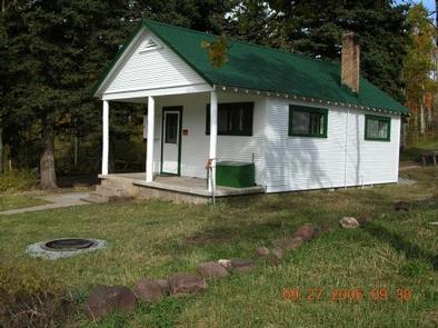
Colton Guard Station is located in the Colton Hollow area, approximately 5 miles west of U.S. Highway 191. It is near Vernal, Utah, in the Ashley National Forest. The Civilian Conservation Corps built the complex in 1933 as part of Franklin D. Roosevelt’s New Deal instituted during the Great Depression. It was a residence for rangers who patrolled the forest on horseback prior to the age of modern vehicles.
The Ashley National Forest Vernal Ranger District has chosen to rent this guard station to the public so that guests can enjoy a RUSTIC experience similar to that of the first rangers. Colton Guard Station is open for reservations all months of the year, except November, April and May.
The cabin can be accessed by vehicle throughout warmer months and during the winter, access is by snowmobile, cross-country ski or snowshoe travel. Guests are responsible for their own travel arrangements and safety, and must bring several of their own amenities.
Call the District Office at (435) 789-1181 three business days prior to a reserved visit to confirm door lock combination. Disrict Office is closed Saturday and Sunday. Lock combination is REQUIRED to enter guard station.
DEER RUN CAMPGROUND >> Camping Area
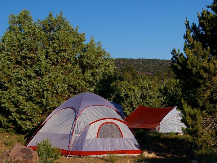 Deer Run Campground is located in the beautiful Flaming Gorge National Recreation Area on the Ashley National Forest at an elevation of 6,200 feet. Flaming Gorge Reservoir is less than a mile below the campground. Exciting recreational activities abound, including boating, water skiing and fishing.
DRIPPING SPRINGS CAMPGROUND (UT) >> Camping Area
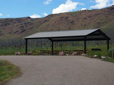 Dripping Springs Campground is situated at an elevation of 6,000 feet in rolling high desert terrain near Flaming Gorge Reservoir. The campground is part of the Flaming Gorge National Recreation Area in the Ashley National Forest. Campers frequent Dripping Springs for its close proximity to the Green River and Little Hole, both of which offer excellent rafting and world-class fishing opportunities.
DUTCH JOHN DRAW CAMPGROUND >> Camping Area
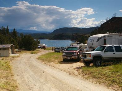 Dutch John Draw Campground is located within a quiet cove on Flaming Gorge Reservoir at an elevation of 6,000 feet. Campers enjoy easy access to boating, water skiing, fishing and swimming. This campground is a group site that can accommodate up to 50 people. Vault toilets and trash collection are provided.
A large picnic shelter with excellent views of the reservoir is located on-site, with picnic tables and a grill. This site is accessed via a well-maintained gravel road; parking spurs within the site are also gravel.
FIREFIGHTERS CAMPGROUND >> Camping Area
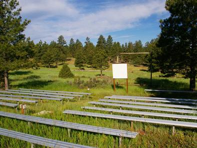 Firefighters Campground is just 3 miles from beautiful Flaming Gorge Reservoir, within the Flaming Gorge National Recreation Area on the Ashley National Forest. The campground serves as a memorial to three firefighters who lost their lives in the 1977 Cart Creek Fire. Visitors enjoy boating, fishing, swimming and hiking.
FIREHOLE CANYON CAMPGROUND >> Camping Area
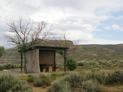 Firehole Canyon Campground is located on the far northeastern shore of Flaming Gorge Reservoir within the Flaming Gorge Recreation Area on the Ashley National Forest. Rock Springs, Wyoming, is just 29 miles away. Boating, fishing and water skiing are popular activities.
GREEN RIVER FLOAT-IN CAMPSITES >> Camping Area
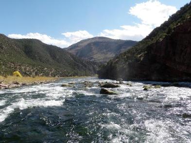 Take a step back in time and traverse the same scenic wonders that explorers such as John Wesley Powell and William Ashley once explored. The Green River provides spectacular fishing and river-running opportunities, as well as unique geology, outlaw history and Native American rock art. So come to navigate the waters and cast a rod in an adventure the whole family can enjoy.
The Green River Float-In Campsites contain 17 sites for river goers to camp along the mighty Green River. Some of these sites can be reached on foot but most of these sites can only be reached by boat.
15. GREENDALE >> Camping Area
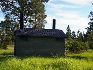 Greendale Campground is located in the beautiful Flaming Gorge National Recreation Area on the Ashley National Forest at an elevation of 6,900 feet. Flaming Gorge Reservoir is nearby, offering exciting recreational activities like boating, fishing and swimming.
GREENS LAKE >> Camping Area
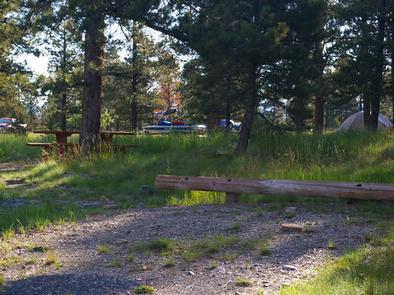 Greens Lake Campground is located next to its scenic namesake along Red Canyon Road at an elevation of 7,400 feet. Visitors enjoy canoeing and fishing on the lake and exploring the Red Canyon Rim Trail. The campground lies on the shore of Greens Lake, about 1 mile from beautiful cliffs overlooking Flaming Gorge Reservoir. Lodgepole and ponderosa pines and aspens dot the campground, providing partial shade. Summer wildflowers are plentiful.
GRIZZLY RIDGE YURT >> Camping Area
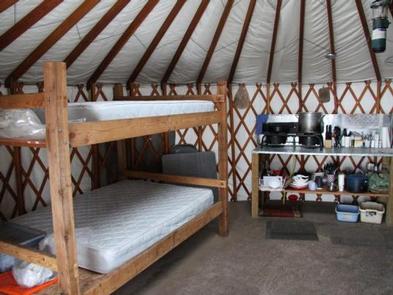
Grizzly Ridge Yurt is located on the Ashley National Forest, approximately 20 air miles north of Vernal, in eastern Utah. It provides year-round primitive lodging for guests. The yurt is open for reservations all months except November, April and May. Hiking, off-roading, skiing and snowshoeing are the most popular activities in the area.
Call the District Office at (435) 789-1181 three business days prior to a reserved visit to confirm door lock combination. Disrict Office is closed Saturday and Sunday. Lock combination is REQUIRED to enter yurt.
HIDEOUT CANYON BOAT-IN CAMPGROUND >> Camping Area
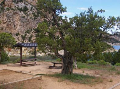 Hideout Canyon Boat-In Campground is located on beautiful Flaming Gorge Reservoir, 2 miles from the nearest road.
This popular campground, which gets its name from a hiding spot used by Butch Cassidy and his gang, is only accessible to visitors who boat or hike-in to the location.
IRON SPRINGS GROUP ASHLEY >> Camping Area
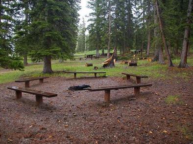 Iron Springs Group Campground is located approximately 5 miles off U.S. Highway 191, along the Red Cloud Loop Scenic Backway at an elevation of 9,200 feet. Campers enjoy exploring local off-road trails. Iron Springs lies at the edge of a grassy meadow bordered by shady pines and aspens. Sagebrush and summer wildflowers dot the meadow. Many small lakes and streams can be found in the vicinity.
JARVIES BOAT IN GROUP >> Camping Area
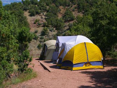 Jarvies Boat-in Group Campground is located on beautiful Flaming Gorge Reservoir in Jarvies Canyon at an elevation of 6,040 feet. The campground is part of the Flaming Gorge Recreation Area on the Ashley National Forest. Campers must boat-in to the facility, and the nearest boat ramps are located at Cedar Springs and Mustang Ridge Marinas, both 20 minutes across the water.
JARVIES FAMILY BOAT IN >> Camping Area
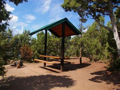 Jarvies Family Boat-In Campground is located on beautiful Flaming Gorge Reservoir in Jarvies Canyon at an elevation of 6,040 feet. Campers must boat-in to the facility, and the nearest boat ramps are located at Cedar Springs and Mustang Ridge Marinas, both 20 minutes across the water.
LODGEPOLE AT FLAMING GORGE >> Camping Area
Lodgepole Campground is settled near beautiful Flaming Gorge Reservoir just 26 miles north of Vernal, UTAH, at an elevation of 8,000 feet. Visitors enjoy exploring local trails and day-tripping to the reservoir, only 10 miles away.
LUCERNE CAMPGROUND >> Camping Area
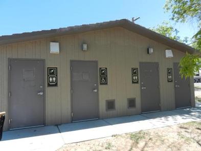 Lucerne Campground is located on the shore of Flaming Gorge Reservoir at an elevation of 6,100 feet. Boating, fishing and water skiing are popular activities. The campground is situated in a high desert landscape with sagebrush and a few scattered trees. Natural shade is minimal. Typical weather ranges from warm days to cool nights.
MINERS GULCH >> Camping Area
 Miners Gulch Campground is located next to Rock Creek in the Rock Creek Drainage at an elevation of 7,500 feet.
The drainage sits on the southern slope of the beautiful Uinta Mountains. Visitors enjoy fishing and exploring the popular Rock Creek Trail.
MOON LAKE CAMPGROUND >> Camping Area
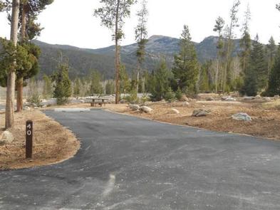 Moon Lake Campground is located on the shores of the scenic two mile long Moon Lake on the southern slope of the 13,000 foot peaked Uinta Mountains. Visitors come to Moon Lake to enjoy cool mountain air, fishing, canoeing and motor- boating, scenic vistas, hiking trails and horse rides.
MOON LAKE GROUP CAMPGROUND >> Camping Area
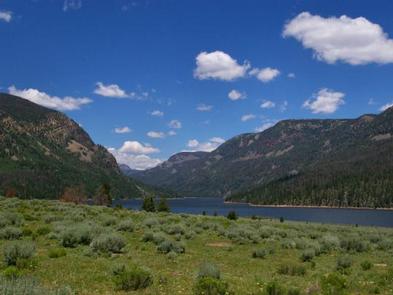 Moon Lake Group Campground is located on the shores of scenic Moon Lake on the southern slope of the Uinta Mountains. Visitors come to Moon Lake for its canoeing and fishing opportunities, abundant trails and scenic beauty.
27. MUSTANG RIDGE CAMPGROUND >> Camping Area
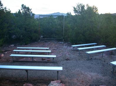 Mustang Ridge Campground is located on a high desert bluff above beautiful Flaming Gorge Reservoir at an elevation of 6,300 feet. The reservoir can be accessed within a half-mile of the campground. Recreational activities abound, including boating, water skiing and fishing.
28. NAVAJO CLIFFS >> Camping Area
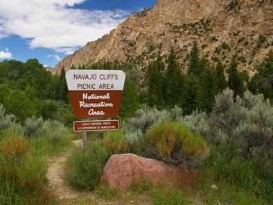 Navajo Cliffs is an ideal group day-use site for weddings, reunions and large gatherings. It’s just 7 miles south of Manila, Utah, along the scenic Sheep Creek Geological Loop at an elevation of 6,200 feet. The site offers beautiful views of unique Navajo Cliffs. Shady trees line the banks of Sheep Creek, which runs through the site. Wildlife is plentiful in the area. Typical weather ranges from warm days to cool nights.
29. PARADISE GUARD STATION >> Camping Area
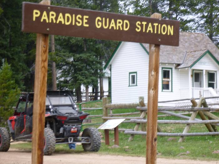 Paradise Guard Station is located on the Ashley National Forest, approximately 25 air miles northwest of Vernal, in eastern Utah. Folklore states the district ranger built the cabin in his spare time in 1922 and it has changed very little since then. In 1929, the Bartlett Sawmill was built just 75 yards south. It burned down in 1940, but some remnants of the old facility still remain.
The Ashley National Forest Vernal Ranger District has chosen to rent this guard station to the public so visitors can enjoy a rustic experience similar to that of the first rangers. Guests enjoy canoeing and fishing on Paradise Park Reservoir, and exploring local hiking, biking and off-road vehicle trails.
30. RED CANYON >> Camping Area
Red Canyon Campground is located in a grassy meadow high above Flaming Gorge Reservoir in northeastern Utah along Red Canyon Road at an elevation of 7,400 feet. Visitors enjoy exploring the Red Canyon Rim Trail and canoeing and fishing at Greens Lake. ( THIS IS NOT THE RED CANYON IN SOUTHERN UTAH-_ THAT ONE IS NOT RESERVABLE.)
31. ROCK CREEK GROUP >> Camping Area
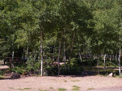 Rock Creek Group Campground is located next to Rock Creek in the Rock Creek Drainage at an elevation of 7200 feet. The drainage sits on the southern slope of the beautiful Uinta Mountains. Visitors enjoy fishing and exploring the popular Rock Creek Trail.
32. SKULL CREEK >> Camping Area
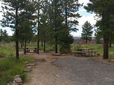
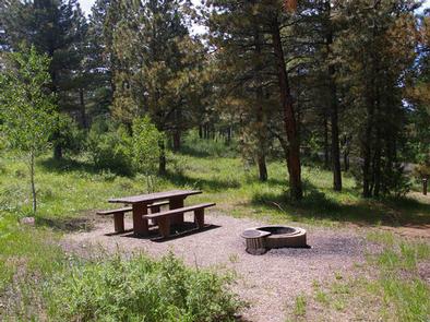 Skull Creek Campground is located about 35 miles north of Vernal, Utah near Flaming Gorge Reservoir. Visitors enjoy hiking and biking on local trails and boating, fishing and swimming on the reservoir. Skull Creek lies in a hillside forested with ponderosa pines and aspens near Flaming Gorge Reservoir at an elevation of 7,400 feet. The campground is partially shaded. Summer wildflowers dot the landscape. The campground contains 17 single-family sites, each equipped with a picnic table and campfire ring. Vault toilets are provided. There is no drinking water available.
33. UINTA RIVER GROUP >> Camping Area
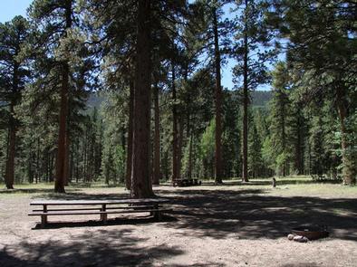 Uinta River Group Campground is located about 25 miles from Roosevelt near the Uinta River at an elevation of 7,600 feet. Visitors come to enjoy the area’s fishing and trail opportunities. The campground lies in an open meadow beneath towering Ponderosa pines. Summer wildflowers and wildlife are abundant. The campground contains one large group site that can accommodate up to 150 people. Several picnic tables and campfire rings with grills are scattered throughout the area.
34. YELLOWSTONE GROUP CAMPGROUND >> Camping Area
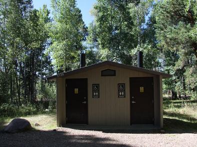 Yellowstone Group Campground lies along its pretty namesake river on the southern slope of the Uinta Mountains, about 40 miles from Duchesne, Utah. Visitors come to the area to enjoy its extensive off-road trail system and great fishing opportunities.
Hiking Trails
Looking for nice hiking areas to take a hike? Choose from these scenic hiking trails:

