Directions
From Cle Elum, Washington, take State Hwy 903 north approximately 19 miles to the end of the paved road. The campground entrance is to the right before the Old Guard Station.
Phone
509-852-1100
Activities
CAMPING, HIKING, HORSEBACK RIDING, PHOTOGRAPHY, HORSE CAMPING, BERRY PICKING, BIRDING
Keywords
CAYH,OKANOGAN – WENATCHEE NF -FS
Related Link(s)
Overview
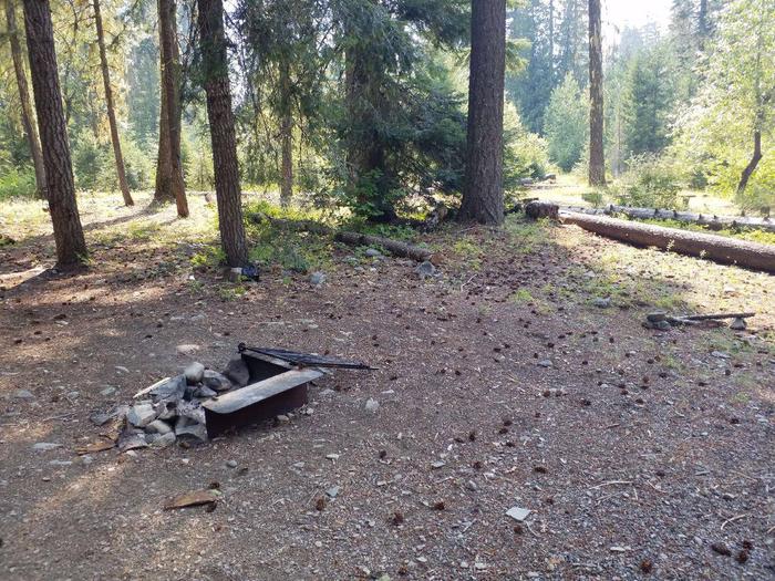
Cayuse Horse Campground sits in the foothills of the Cascade mountains in Okanogan-Wenatchee National Forest. A favorite among horse enthusiasts, the campground is nestled in a mixed-conifer forest. In close proximity to snow-capped peaks, high elevation lakes, scenic rivers and several wilderness areas, this campground offers visitors opportunities to experience both the serene and wild aspects of the area.
Recreation
The Cayuse Horse Camp provides visitors access to a wide variety of trails. Rugged peaks, sparkling lakes and forested area provide the backdrop for many of these rides. Equestrians may want to traverse at least a portion of the spectacular Pacific Crest Trail (PCT), one of America’s premier National Scenic Trails. The PCT showcases some of North America’s most fantastic scenery as it winds its way its way from Mexico to Canada through California, Oregon and Washington. Wilderness passes (available at the trailhead) are required for this trail.
Facilities
This campground is open to stock users only and offers 14 large equestrian sites. There is a single corral for each site, with a maximum of 3 horses per single site and 4 horses per double site. The corrals are not near the campsites, but located in a common area with two water troughs on opposite sides of the corrals. Picnic tables, campfire rings with grills and ample room for parking vehicles and trailers are available at each site. Drinking water is also available, and there is access to vault toilets. This horse camp is open after snow levels recede, and access to trails is available.
Natural Features
Okanogan-Wenatchee National Forest offers stunning scenic views, with high, glaciated alpine peaks, valleys of old growth forest and rugged shrub-steppe country making up the diverse landscape. Elevations range from below 1,000 feet to over 9,000 feet.
Visitors to the area can expect many days of warm, sunny weather in the summer, and winters with clear skies and plenty of snow.
The surrounding undeveloped wilderness, clean streams and diverse forests support an abundance of wildlife, including deer, porcupine, native fish and migratory birds.
Nearby Attractions
Visitors enjoy farmers markets and antique shops in the nearby communities of Roslyn, Cle Elum, and Ellensburg. Popular events in the town of Ellensburg over Labor Day weekend include the Kittitas County Fair and Ellensburg Rodeo.

