Directions
From Denver, go approximately 105 miles to exit 171. Take Highway 24 south through the town of Minturn to the Tigiwon Road/Forest Service Road 707 and turn right. Follow the Tigiwon Road approximately 6 miles to the Community House. Make sure you pick up a free Motor Vehicle Use Map either at the White River National Forest webpage or at the office located in Minturn. This map will direct you to what Forest Service roads are open to motorized travel by the kind of vehicle and time of year.
Phone
970-827-5715
Activities
BIKING, CAMPING, HIKING, HUNTING, WILDLIFE VIEWING
Keywords
TIGI,TIGIWON LODGE,TIGIWON HOUSE,WHITE RIVER NF -FS
Related Link(s)
Colorado State Road Conditions
Overview
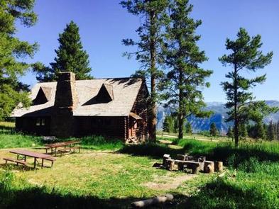
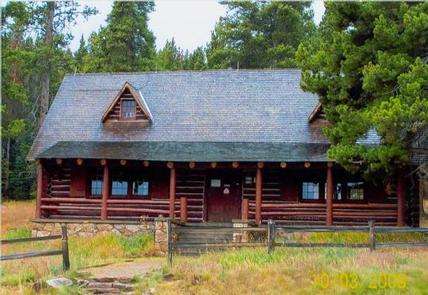
The historic Tigiwon Community house is a large day-use cabin, perfect for family reunions, parties or weddings.
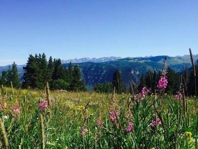
Nestled in a forested setting, this facility has an expansive view of Colorado’s Gore Range.
Recreation
Encompassing a landscape of rivers, mountains, trails, and forest roads, the White River National Forest is one of the top recreation Forests in the nation. The Community House is a few miles below a trailhead which accesses the Holy Cross Wilderness Area. Several trails lead into this special place, please learn about wilderness ethics and regulations before hiking.
Facilities
Tigiwon Community House is a day-use area only. Overnight camping is prohibited.
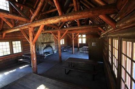
The historic Tigiwon Community house is a relatively large, one room cabin. Amenities both inside and outside the cabin are Accessible. Outside, visitors will have access to four 10-foot picnic tables, two charcoal grills, a fire pit, a horseshoe pit and vault toilets. Inside amenities include four tables, bench seating around the room and a stone fireplace.
Natural Features
In the heart of the Rocky Mountains, the 2.3 million acre White River National Forest is a place of serenity and adventure, boasting eight wilderness areas and ten peaks surpassing 14,000 feet in elevation.
The White River National Forest was established in 1891 as the White River Plateau Timber Reserve, the second such reserve to be named in the United States.
Nearby Attractions
Tigiwon Community House is in the heart of the Vail Valley. It is inbetween the Holy Cross and Eagles Nest Wilderness Areas which abound with hiking trails. The valley floor has mountain bike trail opportunties. The Eagle and Colorado Rivers flow through the valley and offer many floating and fishing opportunities.
Charges & Cancellations
1-50 people = $85
51 -100 people = $135
101-200 people = $185


