WILLOW FLAT CAMPGROUND, UT Campground Reservation, Info, Images, Map, Directions

WILLOW FLAT CAMPGROUND, Utah Campground Images, Info & Reservations

Directions

From Preston, Idaho, head south on U.S. Highway 91 for approximately 3 miles. Turn east on the Cub River Road (Forest Road 406) and travel 3 miles past the Cache National Forest boundary to the intersection of Forest Road 406 and Forest Road 407. Bear right at the intersection, staying on Forest Road 406, and travel over a mile to the campground.

Phone

541-351-1182

Activities

BIKING, CAMPING, FISHING, HIKING, HUNTING, WILDLIFE VIEWING, DAY USE AREA, SWIMMING SITE

Keywords

WILF,CARIBOU-TARGHEE NF – FS

Related Link(s)

Rec Area Info & Images

Idaho State Road Conditions

Idaho State Tourism

Overview

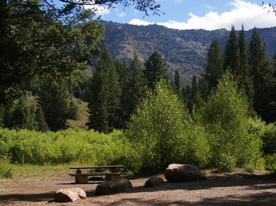
Willow Flat is a popular campground, located on the banks of the Cub River, in southeastern Idaho. It sits in a pretty valley, surrounded by scenic mountain views, at an elevation of 6,300 feet. Visitors enjoy fishing the river and exploring numerous forested trails.

Recreation

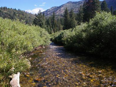
The Cub River provides great fishing for wild cutthroat and hatchery rainbow trout.

Numerous trails begin within the campground, including a 1/2-mile nature trail to Sam Parkinson Spring.

The multi-use Cub River Trail also begins at the campground, offering great hiking, mountain and dirt biking, as well as off-road vehicle and horseback riding. The trail accesses the Highline Trail, the North Fork of St. Charles Creek and the Cub River Guard Station.

Facilities

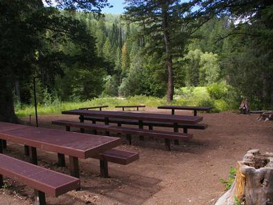
This large campground contains six group campsites than can accommodate 24 to 100 people. Numerous single-family campsites are available at the campground as well.

Some single and group sites have picnic shelters. A few single sites must be accessed via footbridges over the river from the parking spur.

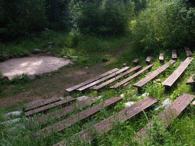
Amenities available at the campground include vault toilets and drinking water. An amphitheater with bleacher seating and a cement platform is located at group site G03. Roads and parking spurs within the campground are gravel.

Natural Features

A mixed forest of pines, spruce and hardwoods provides partial shade and beautiful scenery. The banks of the Cub River are lined with dense stands of willow, a favorite food of local moose. Deer and elk are often seen in the area as well.

Reservation

More from CampingHiking.net:

CLEAR LAKE GROUP SITE, Washington Campground Images, Info & Reservations

Directions From Naches, Washington, follow Highway 12 west for approximately 34 miles to County Road 1200/Tieton Reservoir Road at the west end of Rimrock Lake. Turn south/left on County Road 1200 and follow for about .3 miles to Road 740. Continue for a half-mile, and the reservation site is the

MOON LAKE GROUP CAMPGROUND, Utah Campground Images, Info & Reservations

Directions From Duchesne, Utah, take Highway 87 north to Mountain Home, then travel on county road to Forest Road 131. The campground is about 36 miles from Duchesne. Phone 435-722-5018 Activities BIKING, BOATING, CAMPING, FISHING, HIKING, HORSEBACK RIDING, WILDLIFE VIEWING, SWIMMING SITE Keywords MOON,ASHLEY NF – FS Related Link(s) Rec

TIONESTA REC. AREA CAMPGROUND, Pennsylvania Campground Images, Info & Reservations

Directions From Tionesta, PA: Go 0.5 mile south on SR 36 and follow signs into the campground. Phone 814-755-3512 Activities BOATING, CAMPING, FISHING, HIKING, PICNICKING, WILDLIFE VIEWING, WILDERNESS, ENVIRONMENTAL EDUCATION, PHOTOGRAPHY, RANGER STATION, CANOEING, DISC GOLF, RECREATION PROGRAMS, SCENIC DRIVE Keywords TIONESTA DAM,TIONESTA LAKE,OUTFLOW CAMP LEFT BANK,TIONESTA OUTFLOW CAMPGROUND,TIONESTA CAMPGROUND,TIONESTA

HAWTHORN BLUFF, Oklahoma Campground Images, Info & Reservations

Directions From Tulsa, Oklahoma, take U.S. Highway 169 north for 27 miles to Highway 88. The campground is 2 miles east of the town of Oologah on Highway 88. Phone 918-443-2319 Activities BOATING, CAMPING, FISHING, HIKING, VISITOR CENTER, WATER SPORTS, DAY USE AREA, SWIMMING SITE Keywords HAWT,OOLOGAH LAKE,OOLOGAH LAKE Related

UP UP LOOKOUT, Montana Campground Images, Info & Reservations

Directions West bound on I-90 take the Drexel Exit #25. From Drexel turn back east on I-90 to Ward Creek Exit #26. East bound on I-90 take the Ward Cr Exit #26. Proceed up the Ward Creek Rd #889, travel 3.2 miles. Turn right onto Road #3816 and travel 12.1

BLUE MEADOW, West Virginia Campground Images, Info & Reservations

Directions From White Sulphur Springs, travel 8 miles north on State Route 92. Turn left (west) at Alvon, West Virginia, onto State Route 16. Travel 4 miles to the recreation area. Phone 304-536-2144 Activities CAMPING, FISHING, HIKING, WILDLIFE VIEWING, SWIMMING SITE Keywords BLUM,MONONGAHELA NF -FS Related Link(s) Rec Area Info